
Princeton in Worcester County, Massachusetts — The American Northeast (New England)
Site of Mary Rowlandson’s Release
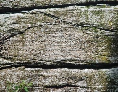
Photographed by Roger W. Sinnott, June 24, 2010
1. Site of Mary Rowlandson’s Release Marker
Topics and series. This historical marker is listed in these topic lists: Colonial Era • Indigenous Peoples and Communities • Wars, US Indian • Women. In addition, it is included in the King Philip's War 1675-1676 series list. A significant historical month for this entry is May 1777.
Location. 42° 30.39′ N, 71° 52.19′ W. Marker is in Princeton, Massachusetts, in Worcester County. It can be reached from Midstate Trail south of Redemption Rock Trail North (Massachusetts Route 140), on the left when traveling south. Marker is not visible from the road, but the rock on which it is carved is (barely). Called Redemption Rock, it is located in the woods to the left of Route 140 when traveling northwest. Touch for map. Marker is at or near this postal address: 268 Redemption Rock Trail N, Princeton MA 01541, United States of America. Touch for directions.

Regionally, this marker is in the Quiet Corner and in Greater
this page online
Other nearby markers. At least 8 other markers are within 6 miles of this marker, measured as the crow flies: Redemption Rock (within shouting distance of this marker); West Village (approx. 3.9 miles away); Patrick Joseph Moran (approx. 4.9 miles away); The Drake Home and the Underground Railroad (approx. 5.6 miles away); In Memory of the Men of Leominster (approx. 5.7 miles away); Site of Second Meeting House (approx. 5.7 miles away); World War ll Vietnam Korean War Memorial (approx. 5.8 miles away); Oliver E. Hazard (approx. 6 miles away). Touch for a list and map of all markers in Princeton.
Regarding Site of Mary Rowlandson’s Release. Mary Rowlandson (c. 1637-1711), wife of Lancaster minister Joseph Rowlandson, had been captured with her three children in early February 1676 by a coalition of Nipmucs, Narragansetts, and Wampanoags during King Philip’s War, one of
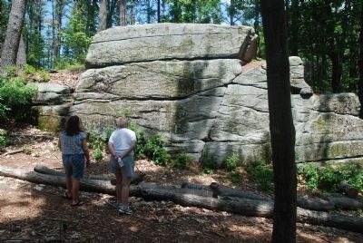
Photographed by Roger W. Sinnott, June 24, 2010
2. Wider View of Rock with Marker
During captivity Mary met several Native American leaders, including the Wampanoag sachem Metacom himself, called King Philip by the English. Finally in May 1676, John Hoar negotiated her release (when King Philip was not around) and escorted her to Boston, where she was reunited with her husband. Some months later two of the couple’s children were also released, the third having died in captivity.
The above details are mainly from King Philip’s War: The History and Legacy of America’s Forgotten Conflict by Eric B. Schultz and Michael J. Tougias (The Countryman Press, Woodstock, VT, 1999).
Related markers. Click here for a list of markers that are related to this marker. To better understand the relationship,
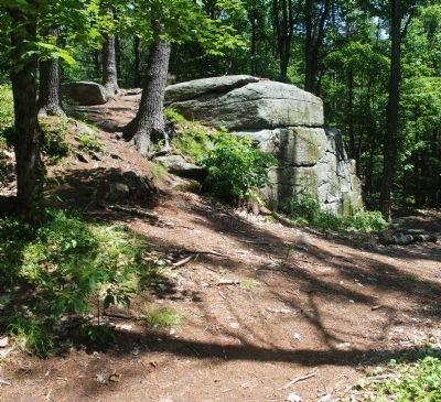
Photographed by Roger W. Sinnott, June 24, 2010
3. Side view of Redemption Rock
Also see . . .
1. More information. Includes additional links about Mary Rowlandson and her book. (Submitted on June 25, 2010, by Roger W. Sinnott of Norwell, Massachusetts.)
2. The Narrative of the Captivity and Restoration of Mrs. Mary Rowlandson.
Whereunto are annexed A Map of her Removes & Biographical & Historical Notes(Submitted on April 26, 2026, by G.W.Bartlett of Hingham, Massachusetts.)
3. Mary (White) Rowlandson Talcott. After her husband died, Mrs. Mary (White) Rowlandson married the widowed Capt. Samuel Talcott on Aug. 6, 1679 in Wethersfield (now Glastonbury), Hartford Co., Connecticut. She had previously been taken prisoner by the Algonquin Indians during King Philip's War, and she wrote "The Sovereignty and the Goodness of God," an account of her capture by the Indians that became one of America's first best sellers. (Submitted on April 26, 2026, by G.W.Bartlett of Hingham, Massachusetts.)
4. James Printer (Wawaus).
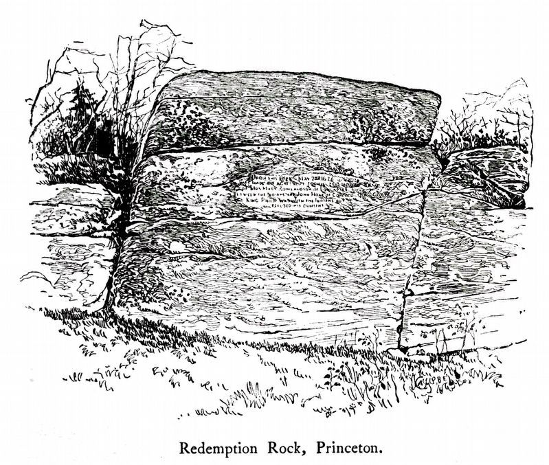
Wawaus, also known as "James Printer", was a Nipmuc leader from Hassanamesit (today Grafton, Massachusetts), who experienced(Submitted on April 26, 2026, by G.W.Bartlett of Hingham, Massachusetts.)the incorporation and marginalization of his people in colonial Massachusetts. He is most commonly known for his work at the first printing press in the American colonies. He helped produce the first Indian Bibles in the Massachusett language (an Algonquin language). He also set the type for books including the famous Narrative of the Captivity and Restoration of Mrs. Mary Rowlandson.Internet Archive4. Redemption Rock, PrincetonFrom The Narrative of the Captivity and Restoration of Mrs. Mary Rowlandson, First Printed in 1682. Reprinted in 1903 by J. Wilson Cambridge and Son.
Credits. This page was last revised on April 27, 2026. It was originally submitted on June 25, 2010, by Roger W. Sinnott of Norwell, Massachusetts. This page has been viewed 1,521 times since then and 48 times this year. Last updated on April 20, 2026, by G.W.Bartlett of Hingham, Massachusetts. Photos: 1, 2, 3. submitted on June 25, 2010, by Roger W. Sinnott of Norwell, Massachusetts. 4. submitted on November 11, 2020, by Allen C. Browne of Silver Spring, Maryland. • Devry Becker Jones was the editor who published this page.
