Anacostia Park in Southeast Washington in Washington, District of Columbia — The American Northeast (Mid-Atlantic)
The Life of a River
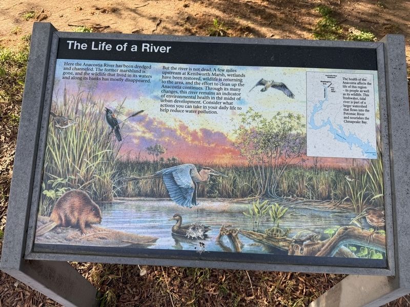
Here the Anacostia River has been dredged and channeled. The former marshland is gone, and the wildlife that lived in its waters and along its banks has mostly disappeared.
But the river is not dead. A few miles upstream at Kenilworth Marsh, wetlands have been restored, wildlife is returning to the area, and the effort to clean up the Anacostia continues. Through its many changes, this river remains an indicator of environmental health in the midst of urban development. Consider what actions you can take in your daily life to help reduce water pollution.
[Caption:]
The health of the Anacostia affects the life of this region — its people as well as its wildlife. This freshwater, tidal river is part of a larger watershed that flows into the Potomac River and nourishes the Chesapeake Bay.
Erected by National Park Service, U.S. Department of the Interior.
Topics. This historical marker is listed in these topic lists: Environment • Indigenous Peoples and Communities • Natural Features • Waterways & Vessels.
Location. 38° 52.724′ N, 76° 58.178′ W.
this page online

Regionally, this marker is in the Washington Metropolitan Area. It is also in the American Northeast, in the Upper South, in the Mid-Atlantic, in the Tidewater, and in the Chesapeake Bay Region. Globally, it is in North America, the Western Hemisphere, the Western World, and the Anglosphere.
Other nearby markers. At least 8 other markers are within walking distance of this marker: The Anacostia River Floodplain (here, next to this marker); Summer in the Parks (about 300 feet away, measured in a direct line); Anacostia Skating Pavilion (about 400 feet away); a different marker also named Anacostia Skating Pavilion (about 400 feet away); Unity in the Community (about 600 feet away); An Upstream Battle (approx. 0.2 miles away); Seafarers Yacht Club (approx.
Additional commentary.
1. About the marker
This sign serves as a historical marker because it shares how the history of human interaction has affected the local environment.
— Submitted April 20, 2026, by Devry Becker Jones of Washington, District of Columbia.
Credits. This page was last revised on April 21, 2026. It was originally submitted on April 20, 2026, by Devry Becker Jones of Washington, District of Columbia. This page has been viewed 11 times since then. Photos: 1, 2. submitted on April 20, 2026, by Devry Becker Jones of Washington, District of Columbia.
