Near Mathews in Mathews County, Virginia — The American South (Mid-Atlantic)
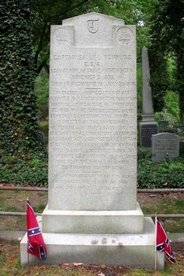
Captain Sally L. Tompkins, C.S.A. Monument
April 25, 2010
1. Captain Sally L. Tompkins, C.S.A. Monument
C.S.A.
Born at Poplar Grove, Mathews Co., VA.
November 9, 1833.
Died at Richmond, VA., July 25, 1916.
In grateful appreciation of her
services in maintaining the Roberston
Hospital at Richmond, VA., from 1861
to 1865, where 1300 soldiers were
tenderly cared for, this memorial
is erected by the Confederate
Veterans, and United Daughters of
the Confederacy. President Jefferson
Davis gave her a commission as Captain
of Cavalry, unassigned, in order that
because of its valuable work in
restoring so many men to the army,
this hospital should be under
Government supervision.
"I was an hungered and ye gave me meat.
I was thirsty and ye gave me drink.
I was sick and ye ministered unto me."
St. Matthew 25 Chapter
Erected by United Daughters of the Confederacy.
Topics and series. This historical marker and monument is listed in these topic lists: Cemeteries & Burial Sites • Science & Medicine • War, US Civil • Women. In addition, it is included in the United Daughters of the Confederacy series list. A significant historical month for this entry is July 1891.
Location. 37° 24.615′ N, 76° 20.119′ W. Marker is near Mathews, Virginia, in Mathews County. It can be reached from Williams Wharf Road (Virginia Route 614) 0.4 miles west of New Point Comfort Highway ( Route 14). This memorial is located in the Christ Church Cemetery. Touch for map. Marker is in this post office area: Mathews VA 23109, United States of America. Touch for directions.

Regionally, this marker and monument is on the Middle Peninsula and in the Hampton Roads Metropolitan Area. It is also in the American South, specifically in the Upper South, in the Tidewater, in the Chesapeake Bay Region, and on the Eastern Seaboard. Globally, it is in the North Atlantic Region, North America,
this page online
Other nearby markers. At least 8 other markers are within 2 miles of this marker, measured as the crow flies: Kingston Parish (within shouting distance of this marker); Tompkins Cottage, circa 1820 (approx. 1.7 miles away); Fort Cricket Hill (approx. 1.8 miles away); Civil War In Mathews County (approx. 1.8 miles away); Mathews County Courthouse Square (approx. 1.8 miles away); Mathews County Confederate Monument (approx. 1.8 miles away); Captain Sally L. Tompkins, C.S.A. (approx. 1.8 miles away); The Old Thomas James Store (approx. 1.8 miles away). Touch for a list and map of all markers in Mathews.
April 25, 2010
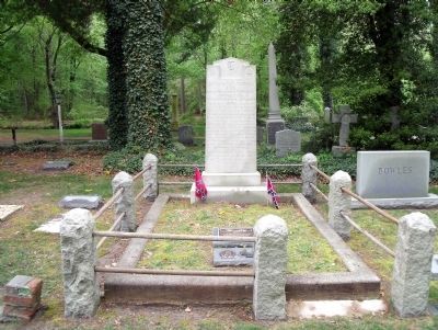
2. Sally L. Tompkins gravesite
April 25, 2010
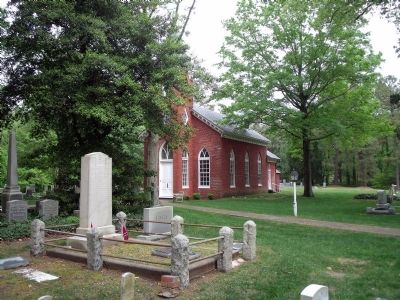
3. Christ Church Cemetery
April 25, 2010
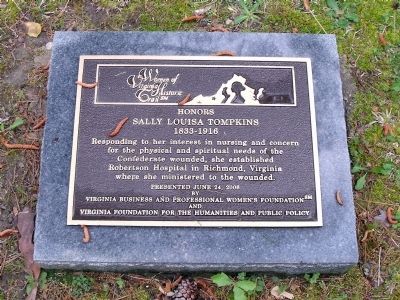
4. Women of Virginia Historic Trail plaque

Photographed by Evan Dwyer, August 29, 2026
5. Women of Virginia Historic Trail plaque
As well as her UDC and iron cross grave markers, set into a granite stone rather than mounted on the tradtitonal ground posts.
Credits. This page was last revised on August 30, 2026. It was originally submitted on April 26, 2010. This page has been viewed 1,928 times since then and 35 times this year. Photos: 1, 2, 3, 4. submitted on April 26, 2010. 5. submitted on August 30, 2026, by Evan Dwyer of Richmond, Virginia.
