Defiance in Defiance County, Ohio — The American Midwest (Great Lakes)
Pontiac Park
Photographed by Dale K. Benington, March 6, 2010
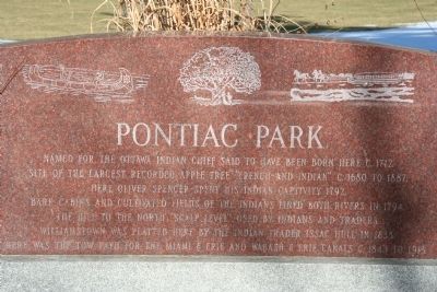
1. Pontiac Park Marker
Topics. This historical marker is listed in these topic lists: Indigenous Peoples and Communities • Wars, US Indian • Waterways & Vessels. A significant historical year for this entry is 1712.
Location. 41° 17.363′ N, 84° 21.507′ W. Marker is in Defiance, Ohio, in Defiance County. It is on East River Road (Ohio Route 424) 0.1 miles east of North Clinton Street, on the right when traveling east. Touch for map. Marker is in this post office area: Defiance OH 43512, United States of America. Touch for directions.

Regionally, this marker is in the Black Swamp and in the Till Plains. It is also in the American Midwest
this page online
Other nearby markers. At least 8 other markers are within walking distance of this marker: You Are On The Buckeye Trail (a few steps from this marker); Defiance Rotary Club 75th Anniversary (a few steps from this marker); Bark Cabin Home of Coohcooche (about 400 feet away, measured in a direct line); French Indian Apple Tree (about 400 feet away); Pontiac Birthplace (about 400 feet away); Defiance Native (about 400 feet away); General Anthony Wayne (about 600 feet away); a different marker also named You Are On The Buckeye Trail (about 600 feet away). Touch for a list and map of all markers in Defiance.
Photographed by Dale K. Benington, March 6, 2010
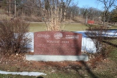
2. Pontiac Park Marker
View looking northeast with historical marker in the foreground and State Route 424 and Pontiac Park can be seen in the background.
Photographed by Dale K. Benington, March 6, 2010
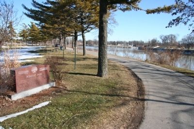
3. Pontiac Park Marker
View looking southeast of the historical marker in the foreground and the Maumee River in the right background.
Credits. This page was last revised on June 16, 2016. It was originally submitted on May 2, 2010, by Dale K. Benington of Toledo, Ohio. This page has been viewed 1,540 times since then and 50 times this year. Photos: 1, 2, 3. submitted on May 2, 2010, by Dale K. Benington of Toledo, Ohio.
