Near Fairfax in Fairfax County, Virginia — The American South (Mid-Atlantic)
Archaeology helps us protect the stories of our past.
Photographed by Devry Becker Jones (CC0), July 14, 2026
1. Archaeology helps us protect the stories of our past. Marker
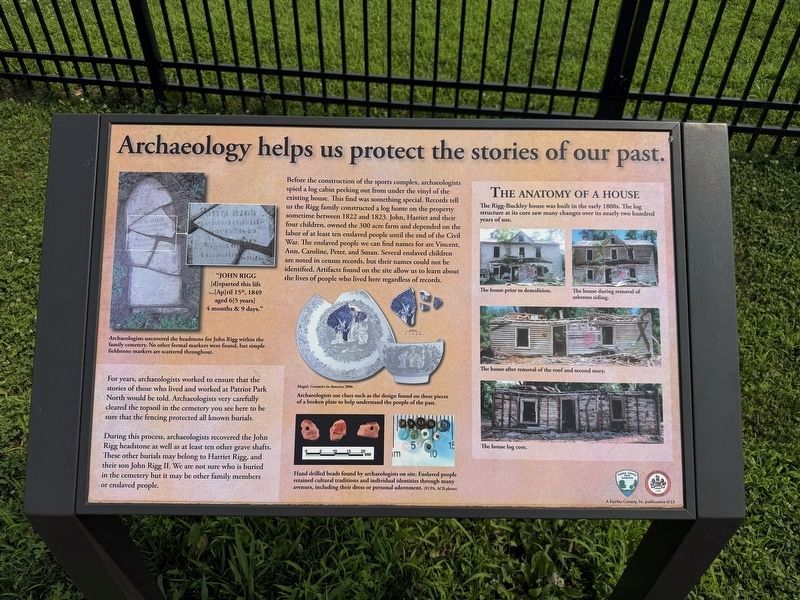
Before the construction of the sports complex, archaeologists spied a log cabin peeking out from under the vinyl of the existing house. This find was something special. Recrds tell us the Riggs family constructed a log home on the property sometime between 1822 and 1823. John, Harriet and their four children, owned the 300 acre farm and depended on the labor of at least ten enslaved people until the end of the Civil War. The enslaved people we can find names for are Vincent, Ann, Caroline, Peter, and Susan. Several enslaved children are noted in census records, but their names could not be identified. Artifacts found on the site allow us to learn about the lives of people who lived here regardless of recors.
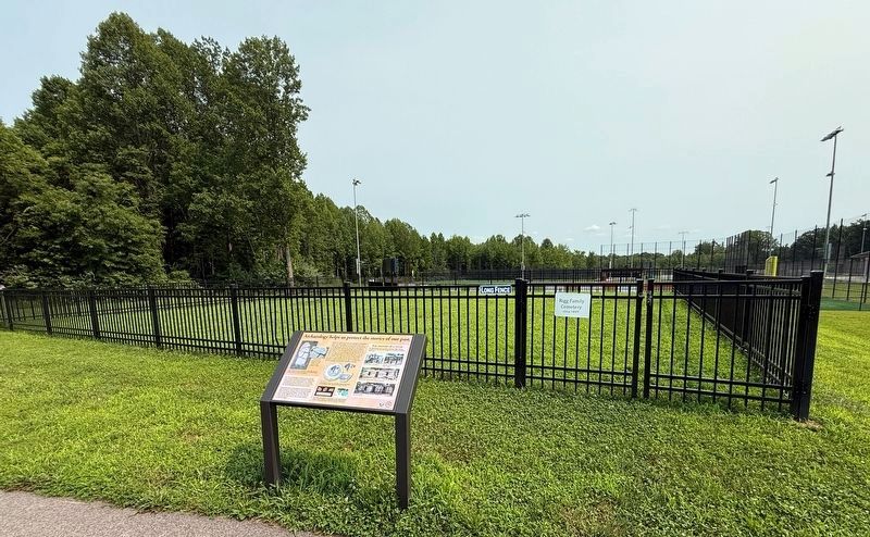
For years, archaeologists worked to ensure that the stories of those who lived and worked at Patriot Park North would be told. Archaeologists very carefully cleared the topsoil in the cemetery you see here to be sure that the fencing protected all known burials.
During this process, archaeologists recovered the John Rigg headstone as well as at least ten other grave shafts. These other burials may belong to
this page online
[Captions:]
"John Rigg
[d]eparted this life
…[Ap]ril 15th, 1849
aged 6[5 years]
4 months & 9 days."
Arcahaeologists uncovered the headstone for John Rigg within the family cemetery. No other formal markers were found, but simple fieldstone markers are scattered throughout.
Archaeologists use clues such as the design found on these pieces of a broken plate to help understand the poeple of the past.
Hand drilled beads found by archaeologists on site. Enslaved people retained cultural traditions and individual identities through many avenues, including their dress or personal adornment. (FCPA, ACP photo)
The house prior to demolition. • The house during removal of asbestos siding. • The house after removal of the roof and second story.
The house log core.
Erected 2023 by Fairfax County Park Authority.
Photographed by Devry Becker Jones (CC0), July 14, 2026
2. Archaeology helps us protect the stories of our past. Marker
Topics. This historical marker is listed in these topic lists: Agriculture • Anthropology & Archaeology • Cemeteries & Burial Sites • Settlements & Settlers. A significant historical year for this entry is 1822.
Location. 38° 49.801′ N, 77° 22.492′ W. Marker is near Fairfax, Virginia, in Fairfax County. It can be reached from Willow Springs School Road 0.3 miles north of Braddock Road (Virginia Route 620), on the right when traveling north. Touch for map. Marker is at or near this postal address: 5425 Willow Springs School Rd, Fairfax VA 22030, United States of America. Touch for directions.

Regionally, this marker is in the Washington Metropolitan Area and in Northern Virginia. It is also in the American South, specifically in the Upper South, in the Mid-Atlantic, and on the Eastern Seaboard. Globally, it is in the North Atlantic Region, North America, the Western Hemisphere, the Western World, and the Anglosphere. Historically, it finds itself in what was once the territory of the Mississippian Culture, one of the original Thirteen Colonies, one of the Confederate States of America, and the Antebellum South.
Other nearby markers. At least 8 other markers are within 3 miles of this marker, measured as the crow flies: Bull Run Battlefields (approx. 1½ miles away); Fairfax Nike Missile Site (approx. 1.8 miles away); War Dogs (approx. 1.8 miles away); General Colin L. Powell, Advocate for Youth Initiatives (approx. 2.1 miles away); Reid-Ballard House (approx. 2.2 miles away); Manassas Gap Railroad (approx. 2.3 miles away); Old Dominion Stone Company Millstone (approx. 2.4 miles away); Ox Hill Battlefield Park & Interpretive Trail (approx. 2.4 miles away). Touch for a list and map of all markers in Fairfax.
Additional keywords. enslaved labor
Credits. This page was last revised on July 14, 2026. It was originally submitted on July 14, 2026, by Devry Becker Jones of Washington, District of Columbia. This page has been viewed 25 times since then. Photos: 1, 2. submitted on July 14, 2026, by Devry Becker Jones of Washington, District of Columbia.
