Tiverton in Newport County, Rhode Island — The American Northeast (New England)
Weetamoo
Beloved Woman of Pocasset
Photographed by G.W.Bartlett, July 26, 2026
1. Weetamoo Marker
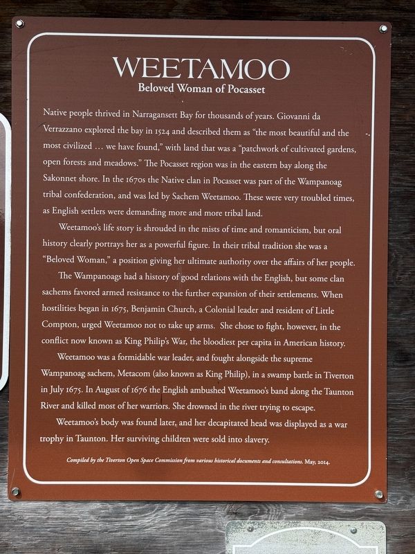
Native people thrived in Narragansett Bay for thousands of years. Giovanni da Verrazzano explored the bay in 1524 and described them as "the most beautiful and the most civilized... we have found," with land that was a "patchwork of cultivated gardens, open forests and meadows." The Pocasset region was in the eastern bay along the Sakonnet shore. In the 1670s the Native clan in Pocasset was part of the Wampanoag tribal confederation, and was led by Sachem Weetamoo. These were very troubled times, as English settlers were demanding more and more tribal land.
Weetamoo's life story is shrouded in the mists of time and romanticism, but oral history clearly portrays her as a powerful figure. In their tribal tradition she was a "Beloved Woman," a position giving her ultimate authority over the affairs of her people.
The Wampanoags had a history of good relations with the English, but some clan sachems favored armed resistance to the further expansion of their settlements. When hostilities began in 1675, Benjamin Church, a Colonial leader and resident of Little Compton, urged Weetamoo not to take up arms. She chose to
this page online
Weetamoo was a formidable war leader, and fought alongside the supreme Wampanoag sachem, Metacom (also known as King Philip), in a swamp battle in Tiverton in July 1675. In August of 1676 the English ambushed Weetamoo's band along the Taunton River and killed most of her warriors. She drowned in the river trying to escape.
Weetamoo's body was found later, and her decapitated head was displayed as a war trophy in Taunton. Her surviving children were sold into slavery.
Compiled by the Tiverton Open Space Commission from various historical documents and consultations. May, 2014.
Erected 2014 by Tiverton Open Space Commission.
Topics and series. This historical marker is listed in these topic lists: Colonial Era • Indigenous Peoples and Communities • Wars, US Indian • Women. In addition, it is included in the King Philip's War 1675-1676 series list. A significant historical month for this entry is May 2014.
Location. 41° 34.395′ N, 71° 10.652′ W. Marker is in Tiverton, Rhode Island, in Newport County. It can
Photographed by G.W.Bartlett, July 26, 2026
2. Weetamoo Marker

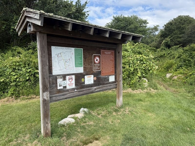
Regionally, this marker is on Narragansett Bay. It is also in the American Northeast, in New England, and on the Eastern Seaboard. Globally, it is in the North Atlantic Region, North America, the Western Hemisphere, the Western World, and the Anglosphere. Historically, it finds itself in what was once one of the original Thirteen Colonies.
Other nearby markers. At least 8 other markers are within 4 miles of this marker, measured as the crow flies: Chace-Cory House (approx. half a mile away); Rhode Island Red (approx. 2.9 miles away); Take a Walk on Your Land (approx. 3.1 miles away); Holt’s Trail (approx. 3.9 miles away); Fort Barton (approx. 3.9 miles away); General Lafayette (approx. 3.9 miles away); Fort Barton Redoubt (approx. 3.9 miles away); a different marker also named Fort Barton (approx. 3.9 miles away). Touch for a list and map
Photographed by G.W.Bartlett, July 26, 2026
3. Weetamoo Marker
Also see . . .
1. Weetamoo (Wikipedia).
Weetamoo was born in the Mattapoiset village of the Pokanoket or around the Taunton River [Swansea, Massachusetts today]. Her father was Corbitant and he was Sachem of the Pocasset from c. 1618 to 1630. She had a younger sister named Wootonekanuske and no brothers. From an early age, Weetamoo was exposed to the diplomatic duties of her father and ended up adopting his views regarding the colonists.(Submitted on July 26, 2026, by G.W.Bartlett of Hingham, Massachusetts.)
2. Weetamoo Woods Trail Map - Explore RI.
A complete trail map of Weetamoo Woods and Pardon Gray Preserve is available on-line at Explore RI.org.(Submitted on July 26, 2026, by G.W.Bartlett of Hingham, Massachusetts.)
3. Sunksqua of Pocassett “Tatpanum” Namumpum Weetamoo - Find-a-Grave.
She was born circa 1635. According to Sonneborn, Liz (2007). A to Z of American Indian Women. New York: Infobase Publishing. p. 268. "she was born in the Mattapoiset village of the Pokanoket or at Rhode Island's Taunton River area" Per Ellen, Snodgrass, Mary (2018). American(Submitted on July 26, 2026, by G.W.Bartlett of Hingham, Massachusetts.)colonial women and their art : a chronological encyclopedia. Lanham, Maryland. "She was known as a bead worker/quiller and dancer." Her father was Corbitant, sachem of the Pocasset tribe in present-day North Tiverton, Rhode Island, (c. 1618–1630).Photographed by G.W.Bartlett, July 26, 20264. Weetamoo Woods Roadside Signage
4. The Narrative and the Restoration of Mrs. Mary Rowlandson, pg. 53 (Internet Archive).
Quanopin, Mrs. Rowlandson’s purchaser, was a Narraganset and the grandnephew of Canonicus. His oldest squaw was Onux; his second, whom Mrs. Rowlandson served as maid, was Weetamoo, Queen of Pocasset and sister-in-law of Philip; being the sister of his wife and also the widow of his brother Alexander, alias Wamsutta, Quanopin was her third husband.(Submitted on July 27, 2026, by G.W.Bartlett of Hingham, Massachusetts.)
Photographed by G.W.Bartlett, July 26, 2026
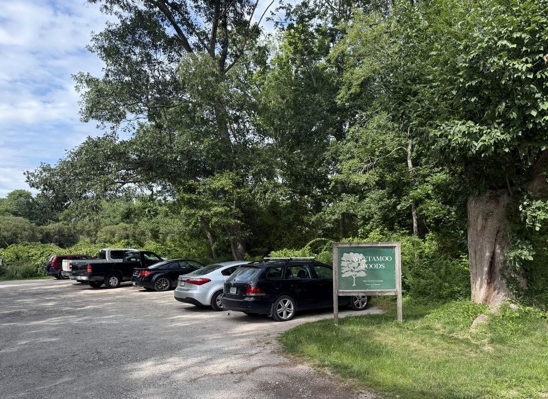
5. Weetamoo Woods Parking Area
Public Parking Area at East Road Entrance to Weetamoo Woods in Tiverton.
Credits. This page was last revised on September 24, 2026. It was originally submitted on July 26, 2026, by G.W.Bartlett of Hingham, Massachusetts. This page has been viewed 18 times since then. Photos: 1, 2, 3, 4, 5. submitted on July 26, 2026, by G.W.Bartlett of Hingham, Massachusetts. • Michael Herrick was the editor who published this page.
