Little Compton in Newport County, Rhode Island — The American Northeast (New England)
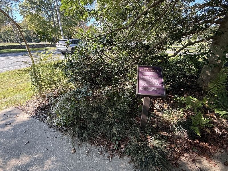
Ancient Connections
Roads and waterways connected Sakonnet to vast social and trade networks.
| — | Awashonks Garden | — |

Photographed by G.W.Bartlett, July 26, 2026
1. Ancient Connections Marker
To your left is an ancient road that follows a ridge left by a retreating glacier about 13,000 years ago.Together with local waterways, this road connected the Sakonnets to 68 other Wampanoag villages to the north and east, and to other Native nations beyond. In recent years people have found Sakonnet belongings, made of stone or copper, that were brought here thousands of years ago along trade routes stretching as far as Pennsylvania and the Great Lakes. The English renamed this ancient route the Great West Road.
To the west of the road the Sakonnets had agricultural fields and meadows running down to the Sakonnet River. To the east of the road were their carefully managed woodlands.
Erected 2025 by Little Compton Historical Society.
Topics and series. This historical marker is listed in these topic lists: Agriculture • Anthropology & Archaeology • Indigenous Peoples and Communities • Roads & Vehicles. In addition, it is included in the Rhode Island, Little Compton Historical Society series list.
Location. 41° 29.583′ N, 71° 11.091′ W. Marker
this page online

Regionally, this marker is on Narragansett Bay. It is also in the American Northeast, in New England, and on the Eastern Seaboard. Globally, it is in the North Atlantic Region, North America, the Western Hemisphere, the Western World, and the Anglosphere. Historically, it finds itself in what was once one of the original Thirteen Colonies.
Other nearby markers. At least 8 other markers are within walking distance of this marker: Stone Walls (a few steps from this marker); Mishoon (a few steps from this marker); Squant (a few steps from this marker); Wilbor House (a few steps from this marker); 13,000 Years (a few steps from this marker); Attuck: Sentinal of the Land (a few steps from this marker); Distrust for the Newcomers (a few steps from this marker); The Sakonnet Diaspora / Native Neighbors / The Last 350 Years / The Next 350 Years
Also see . . . On the Indian Trail, Literally - Southborough Historical Society.
In preparation for expanding the Native American presence at the Museum, I’ve been reading a wonderful book "Indian New England before the Mayflower" and I came across a very interesting map: “A compilation of certain recorded northern New England Indian trails and villages of the 17th and 18th centuries.” Something about this looked really familiar, so using one of the online map overlay services, I decided to place the Indian trail map over the modern road grid in Massachusetts, Connecticut and Rhode Island. Wow!(Submitted on July 29, 2026, by G.W.Bartlett of Hingham, Massachusetts.)

Photographed by G.W.Bartlett, July 26, 2026
3. West Main Road
Photo of West Main Road from the east side of the road looking west towards the Sakonnet River.

Photographed by G.W.Bartlett, July 26, 2026
4. Awashonks Garden Entrance
Awashonks Garden entrance is behind the Wilbor House on the Little Compton Historical Society grounds.
Credits. This page was last revised on September 27, 2026. It was originally submitted on July 29, 2026, by G.W.Bartlett of Hingham, Massachusetts. This page has been viewed 18 times since then. Photos: 1. submitted on July 29, 2026, by G.W.Bartlett of Hingham, Massachusetts. 2. submitted on September 27, 2026, by Devry Becker Jones of Washington, District of Columbia. 3, 4. submitted on July 29, 2026, by G.W.Bartlett of Hingham, Massachusetts. • Andrew Ruppenstein was the editor who published this page.
