Frazee in Becker County, Minnesota — The American Midwest (Upper Plains)
Along the Northern (Laurentian) Divide
| — | Lake Country Scenic Byway | — |
Photographed by Cosmos Mariner, August 30, 2022
1. Along the Northern (Laurentian) Divide Marker
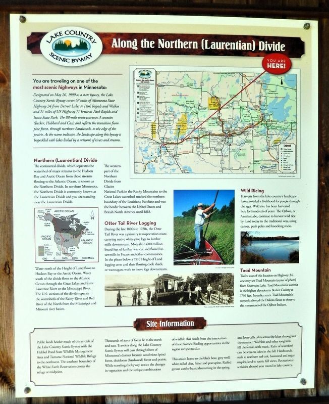
You are traveling on one of the most scenic highways in Minnesota:
Designated on May 26, 1999 as a state byway, the Lake Country Scenic Byway covers 67 miles of Minnesota State Highway 34 from Detroit Lakes to Park Rapids and Walker and 21 miles of US Highway 71 between Park Rapids and Itasca State Park. The 88-mile route traverses 3 counties (Becker, Hubbard and Cass) and reflects the transition from pine forest, through northern hardwoods, to the edge of the prairie. As the name indicates, the landscape along this byway is bespeckled with lakes linked by a network of rivers and streams.
Northern (Laurentian) Divide
The continental divide, which separates the watershed of major streams to the Hudson Bay and Arctic Ocean from those streams flowing to the Atlantic Ocean, is known as the Northern Divide. In northern Minnesota, the Northern Divide is commonly known as the Laurentian Divide and you are standing near the Laurentian Divide.
Water north of the Height of Land flows to Hudson Bay or the Arctic Ocean. Water south of the divide flows to the Atlantic Ocean through the Great Lakes and Saint Lawrence River or the Mississippi
this page online
The western part of the Northern Divide from Glacier National Park in the Rocky Mountains to the Great Lakes watershed marked the northern boundary of the Louisiana Purchase and was the border between the United States and British North America until 1818.
Otter Tail River Logging
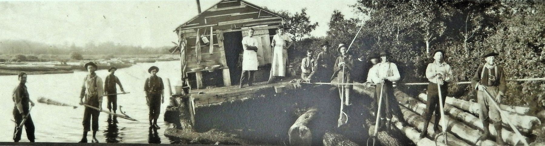
During the late 1800s to 1920s, the Otter Tail River was a primary transportation route, carrying native white pine logs to lumber mills downstream. More than 600 million board feet of lumber was cut and floated to sawmills in Frazee and other communities. In the photo below a 1910 Height of Land logging crew and their floating cook shack, or wannagan, work to move logs downstream.
Wild Ricing
Harvests from the lake country's landscape have provided a livelihood for people through the ages. Wild rice has been harvested here for hundreds of years. The Ojibwe, or Anishinaabe, continue to harvest wild rice by hand today in the traditional way, using canoes, push poles and knocking sticks.
Toad Mountain
To the
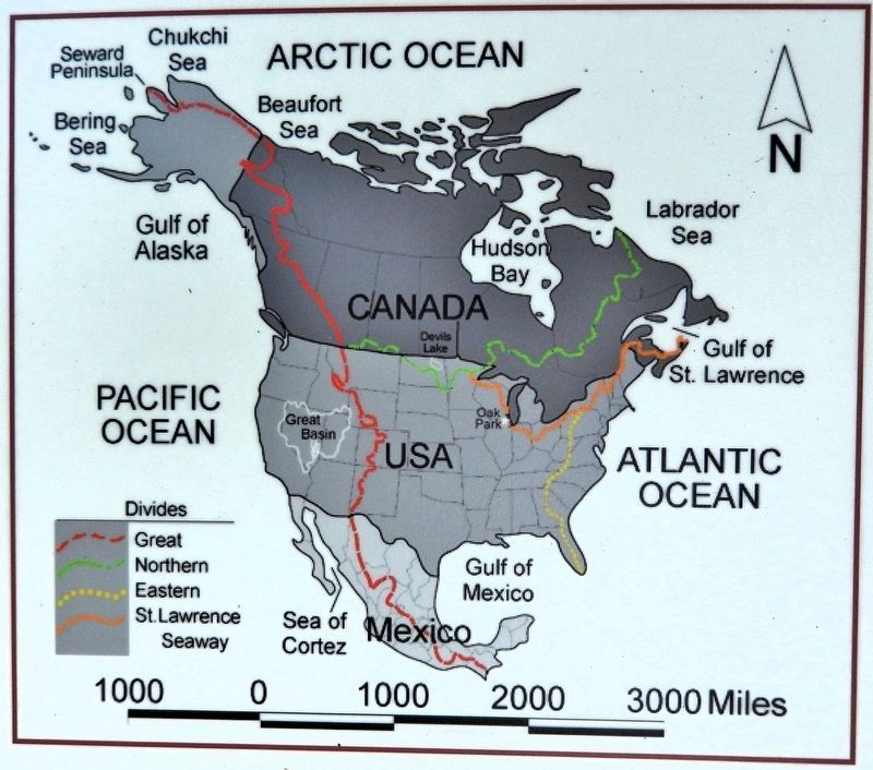
2. Marker detail: Map of North American Divides
Site Information
Public lands border much of this stretch of the Lake Country Scenic Byway with the Hubbel Pond State Wildlife Management Area and Tamarac National Wildlife Refuge to the northwest. The southern boundary of the White Earth Reservation crosses the refuge at midpoint.
Thousands of acres of forest lie to the north and east. Travelers along the Lake Country Scenic Byway will pass through three of Minnesota's distinct biomes: coniferous (pine) forest, deciduous (hardwood) forest and prairie. While traveling the byway, notice the changes in vegetation and the unique combinations of wildlife that result from the intersection of these biomes. Birding opportunities in the region are spectacular.
This area is home to the black bear, grey wolf, white-tailed deer, fisher and porcupine. Ruffed grouse can be heard drumming in the spring and loon
Becker County Historical Society, /
3. Marker detail: 1910 Height of Land Logging Crew
Topics. This historical marker is listed in these topic lists: Agriculture • Indigenous Peoples and Communities • Roads & Vehicles • Waterways & Vessels. A significant historical date for this entry is May 26, 1999.
Location. 46° 50.688′ N, 95° 37.431′ W. Marker is in Frazee, Minnesota, in Becker County. It is on Lake Country Scenic Byway (State Highway 34) 0.1 miles east of County Road 120, on the right when traveling east. The marker is on the east side of the Height of Land Town Hall driveway. Touch for map. Marker is at or near this postal address: 37083 Minnesota Highway 34, Frazee MN 56544, United States of America. Touch for directions.

Regionally, this marker is in the American Midwest and in the Corn Belt. Globally, it is in North America, the Western Hemisphere, the Western World, and the Anglosphere. Historically,
Photographed by Cosmos Mariner, August 30, 2022
4. Along the Northern (Laurentian) Divide Marker
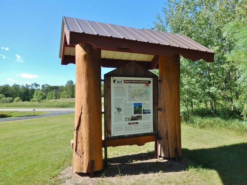
This marker spans the south side of the interpretive kiosk near the Height of Land Town Hall driveway. Minnesota Highway 34 crosses in the background.
Other nearby markers. At least 6 other markers are within 13 miles of this marker, measured as the crow flies: Height of Land (here, next to this marker); Old Indian Trail (approx. 6.6 miles away); The Woods Trail (approx. 9.3 miles away); The Lakes of Minnesota (approx. 9.3 miles away); Detroit Lakes — A City with a Past (approx. 9.3 miles away); Old Government Road (approx. 12.4 miles away).
Also see . . . Wild Rice and the Ojibwe (Minnesota Historical Society).
(Creator: Jessica Milgroom) Excerpt: Ojibwe people arrived in present-day Minnesota in the 1600s after a long migration from the east coast of the United States that lasted many centuries. Together with their Anishinaabe kin, the Potawatomi and Odawa, they followed a vision that told them to search for their homeland in a place “where the food floats on water.” Before contact with Europeans and as late as the early twentieth century, Ojibwe people depended on wild rice as a crucial part of their diet, together with berries, fish, meat, vegetables, and maple sugar. They moved their camps throughout the year, depending on the activities of seasonal food gathering. In autumn, families moved to a location close to a lake with a promising stand of wild rice and stayed there for the duration of the season. Men hunted and fished while women harvested rice, preparing food for their families to eat throughout the following winter, spring, and summer.(Submitted on August 28, 2026, by Cosmos Mariner of Cape Canaveral, Florida.)
Credits. This page was last revised on August 28, 2026. It was originally submitted on August 27, 2026, by Cosmos Mariner of Cape Canaveral, Florida. This page has been viewed 22 times since then. Photos: 1, 2, 3, 4. submitted on August 28, 2026, by Cosmos Mariner of Cape Canaveral, Florida.
