Volusia in Volusia County, Florida — The American South (South Atlantic)
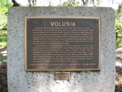
Volusia
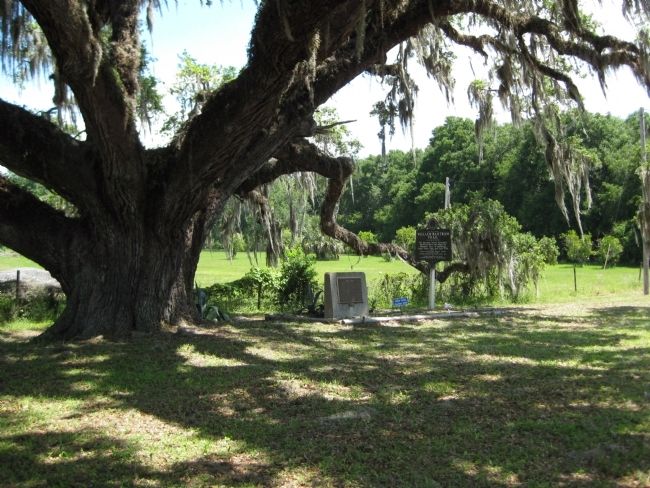
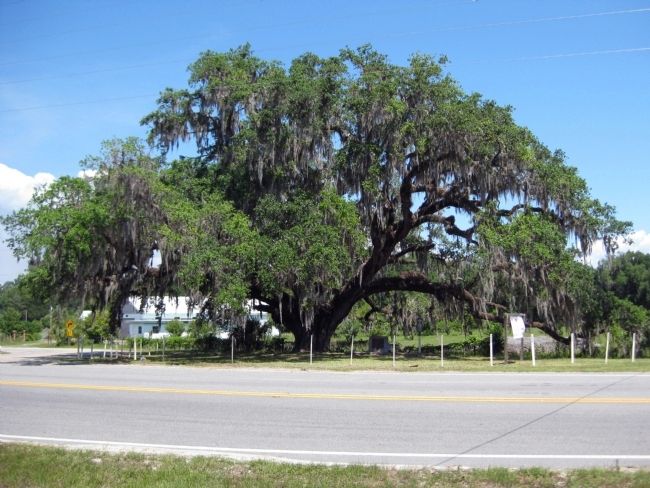
This majestic oak marks the center of many historic sites: to the southwest, the fort and mission San Salvador de Macaya (1667); to the south, Spalding's "Upper Store" (1763), which became Panton, Leslie Indian Trading House (1776). Also in the vicinity during the Creek-Seminole Indian War period (1835-1858) were Forts Volusia, Call, Barnwell, and Columbia. Volusia Military Cemetery adjoined this site and the Methodist Episcopal Church was built in 1845 within Ft. Call's enclosure.
Erected 1978 by Volusia County Historical Commission.
Topics. This historical marker is listed in these topic lists: Cemeteries & Burial Sites • Churches & Religion • Colonial Era • Forts and Castles • Native Americans • Settlements & Settlers • Wars, US Indian. A significant historical year for this entry is 1815.
Location. 29° 10.128′ N, 81° 31.245′ W. Marker is in Volusia, Florida, in Volusia County. Marker is at the intersection of State Road 40 and Alice Drive, on the right on State Road 40. Marker is located on the northeast corner where Alice Drive intersects Florida State Road 40, just east of the Astor Bridge. Touch for map. Marker is in this post office area: Astor FL 32102, United States of America. Touch for directions.
Other nearby markers. At least 8 other markers are within 6 miles of this marker, measured as the crow flies. William Bartram Trail (here, next to this marker); Astor: "The Jewel of the St. Johns River" (approx. ¼ mile away); Fort Butler (approx. half a mile away); Quarter's House (approx. 5.9 miles away); Lewis Log Cabin (approx. 5.9 miles away); Convict Cage Wagon (approx. 5.9 miles away); Midway Methodist Church (approx. 5.9 miles away); Huntington Post Office (approx. 5.9 miles away).
More about this marker. Marker is situated under the "Volusia Oak", on its eastern side in a plot maintained by the Astor Area Garden Club. It stands beside a marker for the William Bartram Trail.
Regarding Volusia. The "Volusia Township" is today an unincorporated community which is commonly associated with the neighboring community of Astor, across the river in Lake County, and site of the nearest post office.
Volusia Township
was one of the settings used by Marjorie Kinnan Rawlings in her Pulitzer Prize winning novel The Yearling. The book's 1946 film adaptation starring Gregory Peck, Jane Wyman, and Claude Jarman, Jr., was nominated for eight Academy Awards and won three.
Additional keywords. Astor, Yearling, Marjorie Kinnan Rawlings
Credits. This page was last revised on August 19, 2017. It was originally submitted on May 31, 2010, by Glenn Sheffield of Tampa, Florida. This page has been viewed 1,796 times since then and 77 times this year. Photos: 1, 2, 3. submitted on May 31, 2010, by Glenn Sheffield of Tampa, Florida. • Bill Pfingsten was the editor who published this page.


