Macon in Bibb County, Georgia — The American South (South Atlantic)
Funeral Mound of the Mississippians
Archeological Evidence Reveals Past
| — | Ocmulgee National Monument | — |
Photographed by Benjamin Rubin, October 25, 2026
1. Funeral Mound of the Mississippians Marker
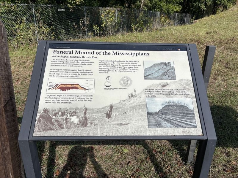
This mound was the burial place for the village leaders and important people. Over 100 burials were discovered within the mound, as well as log tombs and other structures at different levels.
Archeological evidence suggests that this mound was built in seven stages. A structure was built on top of each stage, probably to prepare the dead for burial and the accompanying ceremonies.
The present height is at the third stage. At the seventh and final stage of construction, it is estimated that the mound may have measured as much as 280 feet long, 100 feet wide and 25 feet high.
Significant artifacts found during the archeological investigations of the 1930s uncovered a part of a human figure effigy and the remnant (reconstructed) of a necklace called a gorget. These suggest that a high-ranking person was buried here. The sketches here highlight what the original pieces may have looked like.
Before the park was established, the Central of Georgia Railroad destroyed a portion of the northeast corner of the mound during its construction in the 1870s.
(caption) Sketch and model sculpture by Marty Haythorn, a local Georgia artist.
Erected by National
this page online
Topics. This historical marker is listed in these topic lists: Anthropology & Archaeology • Cemeteries & Burial Sites • Indigenous Peoples and Communities • Parks & Recreational Areas.
Location. 32° 50.379′ N, 83° 36.678′ W. Marker is in Macon, Georgia, in Bibb County. It is on Ocmulgee National Park Road 1½ miles south of Emery Highway (Georgia Route 129). Touch for map. Marker is at or near this postal address: 169 Ocmulgee National Park Rd, Macon GA 31217, United States of America. Touch for directions.

Regionally, this marker is in the Piedmont. It is also in the American South and specifically in the Deep South. Globally, it is in North America, the Western Hemisphere, the Western World, and the Anglosphere. Historically, it finds itself in what was once the territory of the Mississippian Culture, one of the original Thirteen Colonies, one of the Confederate States of America, and the Antebellum South.
Other nearby markers. At least 8 other markers are within walking distance of this marker: Muscogee (Creek) 1600-1826 (approx. ¼ mile away); Trading with the British 1690-1715 (approx. ¼ mile away); Paleo Indian Period 15000 B.C.E. - 8000 B.C.E. (approx. ¼ mile away); Mississippian Period 900 - 1600 (approx. ¼ mile away); The Great Temple Mound and Town Site (approx. ¼ mile away); The "Iron Horse" devastates the mounds (approx. 0.4 miles away); Cornfield Mound and Prehistoric Trenches (approx. 0.4 miles away); Ocmulgee's Earth Lodge - America's Oldest Ceremonial Lodge (approx. 0.4 miles away). Touch for a list and map of all markers in Macon.
Also see . . . Ocmulgee Mounds National Historical Park. National Park Service (Submitted on October 26, 2026.)
Credits. This page was last revised on October 26, 2026. It was originally submitted on October 25, 2026, by Benjamin Rubin of Columbia, South Carolina. This page has been viewed 12 times since then. Photo 1. submitted on October 25, 2026, by Benjamin Rubin of Columbia, South Carolina. • Bernard Fisher was the editor who published this page.
