White Rock in Los Alamos County, New Mexico — The American Mountains (Southwest)
Plants
Bandelier National Monument
| — | National Park Service, U.S. Department of the Interior | — |
Photographed by Benjamin Rubin, October 16, 2026
1. Plants Marker
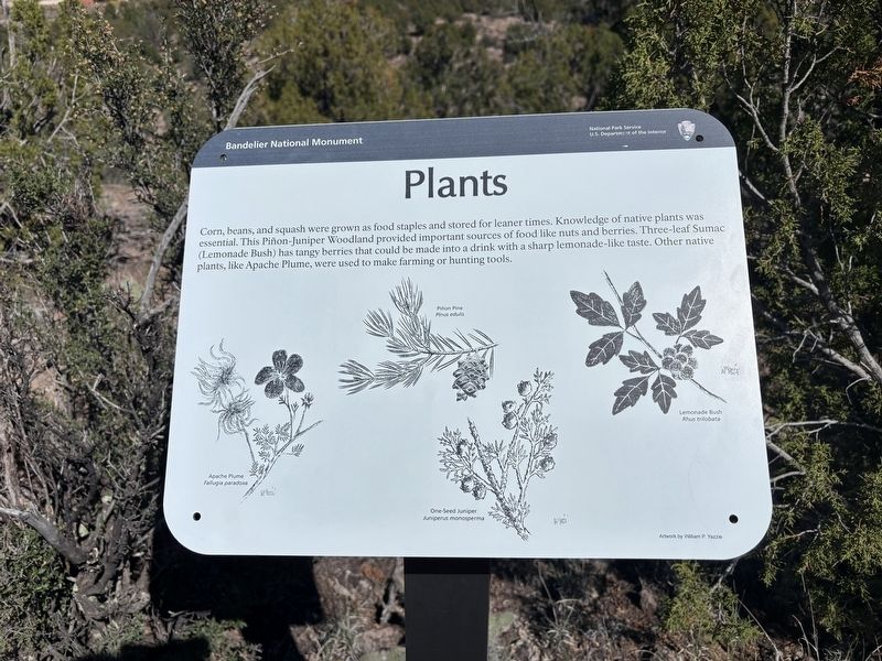
Corn, beans, and squash were grown as food staples and stored for leaner times. Knowledge of native plants was essential. This Piñon-Juniper Woodland provided important sources of food like nuts and berries. Three-leaf Sumac (Lemonade Bush) has tangy berries that could be made into a drink with a sharp lemonade-like taste. Other native plants, like Apache Plume, were used to make farming or hunting tools.
Erected by National Park Service, U.S. Department of the Interior.
Topics. This historical marker is listed in these topic lists: Agriculture • Anthropology & Archaeology • Indigenous Peoples and Communities • Parks & Recreational Areas.
Location. 35° 47.248′ N, 106° 16.718′ W. Marker is in White Rock, New Mexico, in Los Alamos County. It can be reached from Coopers Hawk Road north of Stock Trail, on the right when traveling west. Touch for map. Marker is at or near this postal address: 500 Coopers Hawk Rd, White Rock NM 87547, United States of America. Touch for directions.

Regionally, this marker is in Northern New Mexico. It is also in the
this page online
Other nearby markers. At least 8 other markers are within 7 miles of this marker, measured as the crow flies: The Role of Fire (about 500 feet away, measured in a direct line); Sacred Spaces (about 600 feet away); Houses (approx. 0.2 miles away); Tyuonyi Overlook (approx. 0.2 miles away); A Living Legacy (approx. 0.6 miles away); A Lasting Legacy (approx. 0.6 miles away); Los Alamos (approx. 6.3 miles away); Los Alamos Project Main Gate Park (approx. 6.3 miles away). Touch for a list and map of all markers in White Rock.
Credits. This page was last revised on November 9, 2026. It was originally submitted on November 6, 2026, by Benjamin Rubin of Columbia, South Carolina. This page has been viewed 6 times since then. Photo 1. submitted on November 6, 2026, by Benjamin Rubin of Columbia, South Carolina. • Devry Becker Jones was the editor who published this page.
