Port Tobacco in Charles County, Maryland — The American Northeast (Mid-Atlantic)
Port Tobacco: A Maryland Mosaic
Photographed by Evan Dwyer, October 31, 2026
1. Port Tobacco: A Maryland Mosaic Marker
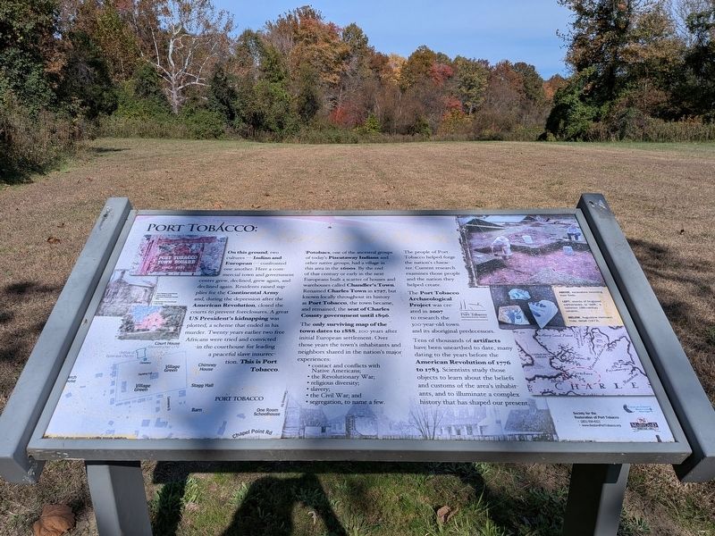
Potobacs, one of the ancestral groups of today's Piscataway Indians and other native groups, had a village in this area in the 1600s. By the end of that century or early in the next Europeans built a scatter of houses and warehouses called Chandler's Town. Renamed Charles Town in 1727, but known locally throughout its history as Port Tobacco, the town became, and remained, the seat of Charles County government until 1896.
The only surviving map of the town dates to 1888, 200 years after initial European settlement. Over those years the town's inhabitants and neighbors shared
this page online
• contact and conflicts with Native Americans;
• the Revolutionary War;
• religious diversity;
• slavery;
• the Civil War; and
• segregation, to name a few.
The people of Port Tobacco helped forge the nation's character. Current research examines those people and the nation they helped create.
The Port Tobacco Archaeological Project was created in 2007 to research the 300-year-old town and its aboriginal predecessors.
Tens of thousands of artifacts have been unearthed to date, many dating to the years before the American Revolution of 1776 to 1783. Scientists study those objects to learn about the beliefs and customs of the area's inhabitants, and to illuminate a complex history that has shaped our present.
Image Captions:
Port Tobacco Courthouse, south wing (1915), Columbia Historical Society Files.
Yellow symbols above represent surviving historic buildings.
Above, excavators recording their finds.
Left, sherds of tin-glazed earthenware, or 'delft,' a common 18th-century ceramic.
Below, Augustine Hermann map, detail (1673).
Left, Commerce Street in front of Padgett House (1900)
Society for the Restoration of Port Tobacco
•
Photographed by Evan Dwyer, October 31, 2026
2. Port Tobacco: A Maryland Mosaic Marker
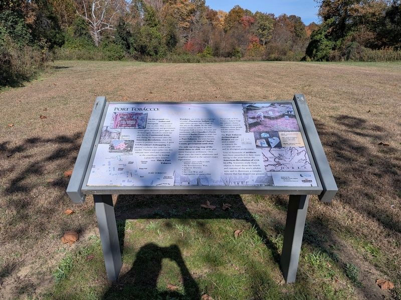
Wider context view. The historic area is beyond this clearing and the tree line, off to the right out of sight. This wide, flat area was part of the town of Port Tobacco and once hosted dozens of buildings. The river is off to the left, silted into wetlands and also not visible from here.
• www.RestorePortTobacco.org
Erected by Charles County Maryland, Maryland Heritage Area, The Port Tobacco Archaeological Project.
Topics. This historical marker is listed in these topic lists: Anthropology & Archaeology • Colonial Era • Indigenous Peoples and Communities • War, US Civil. A significant historical year for this entry is 1727.
Location. 38° 30.596′ N, 77° 1.309′ W. Marker is in Port Tobacco, Maryland, in Charles County. It can be reached from Warehouse Landing Road 0.2 miles west of Chapel Point Road, on the right when traveling south. Marker is at the southwest end of the Port Tobacco historic area, where the Port Tobacco River Park trails begin. Touch for map. Marker is at or near this postal address: 8430 Commerce St, Port Tobacco MD 20677, United States of America. Touch for directions.

Regionally, this marker is in the Washington Metropolitan Area and in Southern Maryland. It is also in the American South, specifically in the Upper South, in the Mid-Atlantic, in the Tidewater, and on the Eastern Seaboard. Globally, it is in the North Atlantic Region, North America, the Western
Photographed by Evan Dwyer, October 31, 2026
3. Archaeological Dig Site
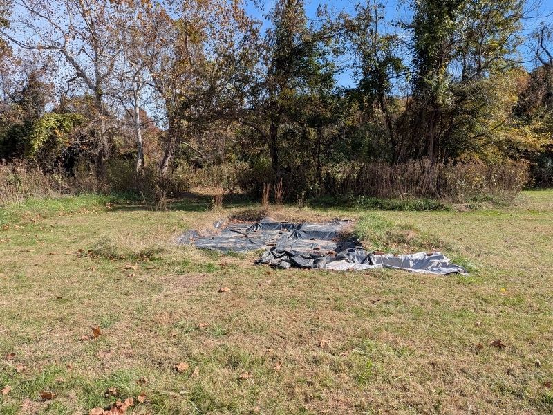
Just 145' northeast of the marker, this dig is uncovering the remains of the Swann Oyster House.
Other nearby markers. At least 8 other markers are within walking distance of this marker: The Port Tobacco Jail (about 400 feet away, measured in a direct line); John Wilkes Booth (about 600 feet away); Revolutionary War Patriots (about 600 feet away); On to Yorktown (about 700 feet away); Port Tobacco: Conspiracy & the Plot to Assassinate President Lincoln (about 700 feet away); Port Tobacco (about 700 feet away); a different marker also named Port Tobacco: A Maryland Mosaic (about 700 feet away); Port Tobacco: Commerce (about 700 feet away). Touch for a list and map of all markers in Port Tobacco.
Related marker. Click here for another marker that is related to this marker. The linked marker is a duplicate on the other side of the walking trail.
Also see . . . Port Tobacco Historic District - Maryland Historical Trust. Entry includes the National Register nomination for the district as a whole. (Submitted on November 9, 2026, by Evan Dwyer of Richmond, Virginia.)
Photographed by Evan Dwyer, October 31, 2026
4. Burch House
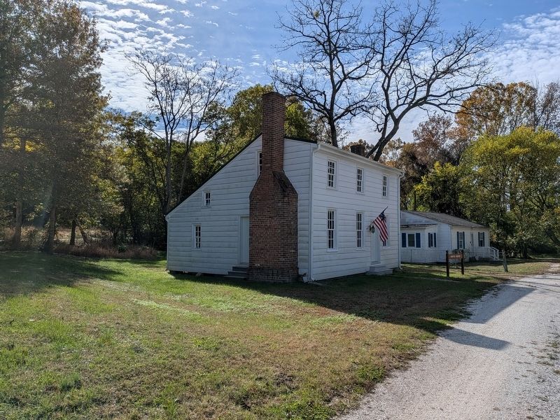
The Burch House, the oldest structure still standing in Port Tobacco, now serves as the headquarters and offices of The Port Tobacco Archaeological Project. It sits 575' east of the marker.
Photographed by Evan Dwyer, October 31, 2026
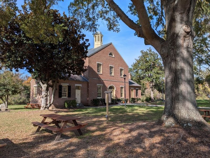
5. Port Tobacco Courthouse
The south wing, nearest, is original. The rest of the structure is a 1970 reconstruction on the same footprint, though the floor in the center section's foyer is of original brick from the 1819 structure.
Credits. This page was last revised on November 9, 2026. It was originally submitted on November 9, 2026, by Evan Dwyer of Richmond, Virginia. This page has been viewed 5 times since then. Photos: 1, 2, 3, 4, 5. submitted on November 9, 2026, by Evan Dwyer of Richmond, Virginia.
