Madison in Dane County, Wisconsin — The American Midwest (Great Lakes)
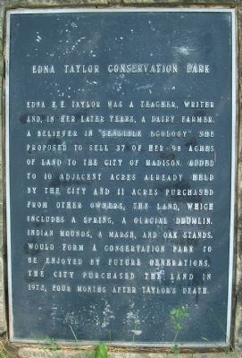
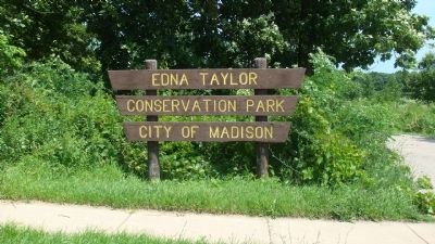
Edna Taylor Conservation Park
Topics. This historical marker is listed in these topic lists: Agriculture • Arts, Letters, Music • Education • Environment • Parks & Recreational Areas • Women. A significant historical year for this entry is 1972.
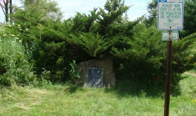
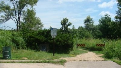
Location. 43° 3.109′ N, 89° 19.011′ W. Marker is in Madison, Wisconsin, in Dane County. Marker can be reached from the intersection of Femrite Drive and Edna Taylor Parkway, on the left when traveling east. The marker is in the parking lot of the Edna Taylor Conservation Park. Touch for map. Marker is in this post office area: Madison WI 53716, United States of America. Touch for directions.
Other nearby markers. At least 8 other markers are within 2 miles of this marker, measured as the crow flies. Roselawn Tower of Memories (approx. 0.2 miles away); George Nichols Home - Circa 1878 (approx. 0.9 miles away); The Outlet Mound (approx. 0.9 miles away); Black Bridge (approx. one mile away); Bungalowen (approx. 1.1 miles away); Paunack Park (approx. 1.2 miles away); Nathaniel Dean Farmhouse (approx. 1.2 miles away); Dean House / Nathaniel Dean (approx. 1.2 miles away). Touch for a list and map of all markers in Madison.
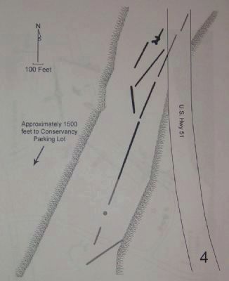
Regarding Edna Taylor Conservation Park. According to the Madison Landmarks Commission, which designated the mound area of the park as a landmark (no. 92), "Six linear mounds and one panther effigy [dated 700-1200 A.D.] are located on a high glacial drumlin along the eastern side of the Edna Taylor Conservancy. Originally another linear mound followed the hill crest to the north of the existing group and a conical mound and another very long linear mound extended to the south.
Wisconsin has the highest concentration of effigy mounds in the United States and the Madison area has one of the highest concentration of effigy mounds remaining. Most mounds were lost to 19th century agricultural practices and city development. The mound builders were farmers who also engaged in hunting and gathering. They lived in small villages and migrated from one to another based on the seasonal availability of natural resources. The mounds often, but not always, have burials associated with them, but their exact purpose is not entirely understood. Mounds tend to have been built in places with beautiful views of the surrounding countryside. The mounds are considered sacred by modern Native Americans and should be treated with respect."
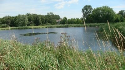
According to a 1996 survey by Robert A. Birmingham and Katherine H. Rankin entitled "Native American Mounds in Madison and Dane County," "Six linear mounds and one panther effigy associated with the Late Woodland Stage are located on a high glacial drumlin. Early settlers remember this area as a hill completely covered with woods except that the mounds had no trees on them. Surrounding the drumlin was open countryside with marsh and open water to the south (the small marsh in the conservancy is a remnant of this once much larger wetland). On the northwest slope of the drumlin are three linear mounds and a well preserved panther effigy. Three very long linears follow the crest of the hill. They have been somewhat shortened at both ends by farming and highway construction. Originally a linear mound followed the hill crest to the north of the existing group, and other mounds extended southwest along the hill. Most of the southern mounds were destroyed by farming and residential development. The
entire group once stretched for nearly a mile.
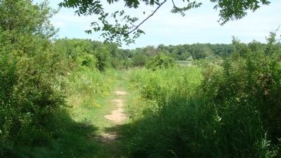
"To reach the mounds, start from the Edna Taylor Conservancy parking lot off Femrite Drive and walk north along the main path for about 1500 feet. The linear mounds extend along the side of the path and the panther effigy is to the right of the path near the north end of the mound group. The other linear mounds can be seen in the sledding area."
Credits. This page was last revised on June 3, 2021. It was originally submitted on July 20, 2010, by William J. Toman of Green Lake, Wisconsin. This page has been viewed 1,665 times since then and 25 times this year. Photos: 1, 2, 3, 4, 5, 6. submitted on July 20, 2010, by William J. Toman of Green Lake, Wisconsin. 7. submitted on July 23, 2010, by William J. Toman of Green Lake, Wisconsin. • Bill Pfingsten was the editor who published this page.
