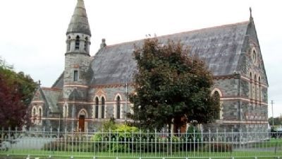
Culmullen in County Meath, Leinster, Ireland — Mid-East (and Dublin)
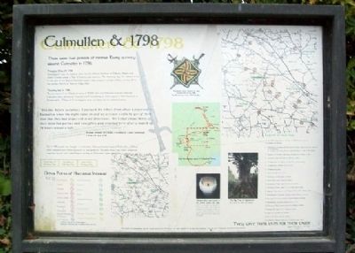
Culmullen & 1798
They Gave Their Lives For Their Cause
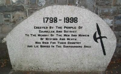
Culmullen and District
to the memory of the Men and Women
of Wexford and Meath
who died for their Country
and lie buried in the surrounding area
There were two periods of intense
Rising activity around Culmullen in 1798
Thursday May 24, 1798
Dunshaughlin was the rallying point for the United Irishmen of Meath, Dublin and North Kildare where a Tree of Liberty was planted. The following day, the rebels moved to one side of the Bog of Culmullen where they camped overnight before moving off to the decisive Battle of Tara on May 26th.
Thursday July 12, 1798
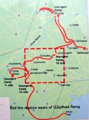
The remnants of the Wexford army of 4,000 men and followers marched through Culmullen after defeats at Clonard and Knockderry on their way to a final dispersal at Ballyboughill. Many of the stragglers were cut down by the pursuing army.
"The day before yesterday, I pursued the rebels from about Longwood to Kulmullen when the night came on and no account could be got of them than that they had dispersed in all directions. We killed about thirty of their detached parties and stragglers and returned here after a march of 14 hours witout a halt."
Extract of letter of Colonel J. Gordon to Lord Castlereagh
(Trim 14th July 1798)
Up to 100 people are thought to have been killed and buried around Culmullen. Others were capured and either executed or transported. Reports show that three prisoners captured by the then Lord Fingal's cavalry at Kulmullen were named as:
Darby Byrne 18
5'8" Brown hair
John Byrne 21
5'10" Black hair
James Lacey
5'5" Brown hair
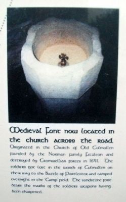
Medieval Font now located in the church across the road.
Originated in the Church of Old Culmullen founded by the Norman family Fitzleon and destroyed by Cromwellian forces in 1641. The soldiers got lost in the woods of Culmullen on their way to the Battle of Portlester and camped overnight in the 'Camp' field. The sandstone font bears the marks of the soldiers weapons having been sharpened.
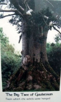
The Big Tree of Gaulstown
From which the rebels were hanged
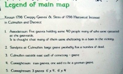
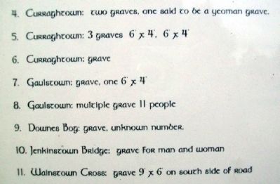
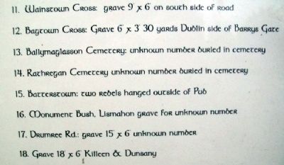
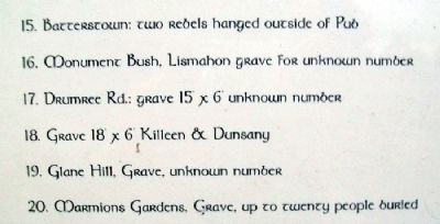
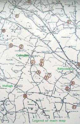
Legend of main map
Known 1798 Croppy Graves & Sites of 1798 Historical Interest in Culmullen and District
[see photos for Legend numbers]
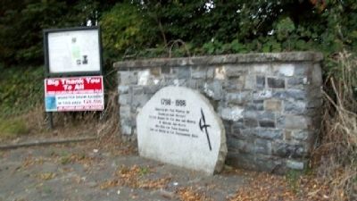
Monument, Grave Markers & Sign
Erected 12th of July 1998
The Bicentenary of the 1798 Rebellion
Erected 1998 by the People of Culmullen, Batterstown and District.
Topics. This historical marker is listed in these topic lists: Cemeteries & Burial Sites • Civil Rights • Heroes • Military • Notable Events • Patriots & Patriotism • Political Subdivisions • Settlements & Settlers • Wars, Non-US. A significant historical year for this entry is 1798.
Location. 53° 29.451′ N, 6° 36.382′ W. Marker is in Culmullen, Leinster, in County Meath. Marker is at the intersection of Road 126 and Pelletstown Road, on the left when traveling north on Road 126. Memorial is west across the street from the c.1877 St. Martin of Tours Culmullen Parish Church. Touch for map. Touch for directions.
Other nearby markers. At least 8 other markers are within 16 kilometers of this marker, measured as the crow flies. Welcome to Tara of the Kings (approx. 10.1 kilometers away); Bective Abbey / Mainistir Bheigtí (approx. 12 kilometers away); Caisleán mhagh nuadhad / Geraldine Castle (approx. 12.3 kilometers away); St. Mary's Church (Anglican) (approx. 12.3 kilometers away); James, Duke of Leinster (approx. 12.3 kilometers away); St. Mary's Church of Ireland East Window (approx. 12.3 kilometers away); Newtowntrim Cathedral / Ardeaglais an Bhaile Nua (approx. 13.1 kilometers away); The Wonderful Barn (approx. 16.1 kilometers away).
Also see . . .
1. Excerpt from Memoirs of Joseph Holt. (Submitted on July 21, 2010.)
2. History of the Diocese of Meath. Has mention of the 1798 Rising. (Submitted on July 21, 2010.)
Credits. This page was last revised on October 12, 2021. It was originally submitted on July 20, 2010, by William Fischer, Jr. of Scranton, Pennsylvania. This page has been viewed 2,134 times since then and 36 times this year. Photos: 1, 2, 3, 4, 5, 6, 7, 8, 9, 10, 11, 12, 13. submitted on July 21, 2010, by William Fischer, Jr. of Scranton, Pennsylvania.
