McFarland in Dane County, Wisconsin — The American Midwest (Great Lakes)
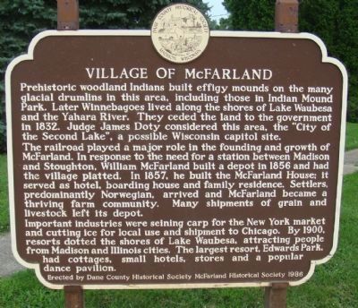
Village of McFarland
The railroad played a major role in the founding and growth of McFarland. In response to the need for a station between Madison and Stoughton, William McFarland built a depot in 1856 and had the village platted. In 1857, he built McFarland House; it served as hotel, boarding house and family residence. Settlers, predominantly Norwegian, arrived and McFarland became a thriving farm community. Many shipments of grain and livestock left its depot.
Important industries were seining carp for the New York market and cutting ice for local use and shipment to Chicago. By 1900, resorts dotted the shores of Lake Waubesa, attracting people from Madison and Illinois cities. The largest resort, Edwards Park, had cottages, small hotels, stores and a popular dance pavilion.
Erected 1986 by Dane County Historical Society and McFarland Historical Society. (Marker Number 22.)
Topics and series. This historical marker is listed in these topic lists: Agriculture • Industry & Commerce • Native Americans • Parks & Recreational Areas • Railroads & Streetcars • Roads & Vehicles • Settlements & Settlers. In addition, it is included in the Wisconsin, Dane County Historical Society series list. A significant historical year for this entry is 1832.
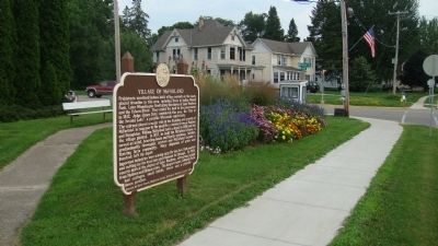
Location. 43° 0.76′ N, 89° 17.373′ W. Marker is in McFarland, Wisconsin, in Dane County. Marker is at the intersection of Main Street (County Road MN) and Bashford Street, on the left when traveling south on Main Street. The marker is across Main Street from and faces Arnold Larson Park. Touch for map. Marker is in this post office area: Mc Farland WI 53558, United States of America. Touch for directions.
Other nearby markers. At least 8 other markers are within 3 miles of this marker, measured as the crow flies. Stephen Moulton Babcock (approx. 0.8 miles away); Drohman Farm (approx. 2.1 miles away); Fish Camp Launch (approx. 2.4 miles away); Working at Fish Camp (approx. 2.4 miles away); How to catch 30,000 carp (approx. 2.4 miles away); All about nets (approx. 2.4 miles away); Too many carp (approx. 2.4 miles away); Carp for sale (approx. 2˝ miles away). Touch for a list and map of all markers in McFarland.
Credits. This page was last revised on December 30, 2019. It was originally submitted on July 29, 2010, by William J. Toman of Green Lake, Wisconsin. This page has been viewed 1,044 times since then and 70 times this year. Photos: 1, 2. submitted on July 29, 2010, by William J. Toman of Green Lake, Wisconsin. • Craig Swain was the editor who published this page.

