South Deerfield in Franklin County, Massachusetts — The American Northeast (New England)
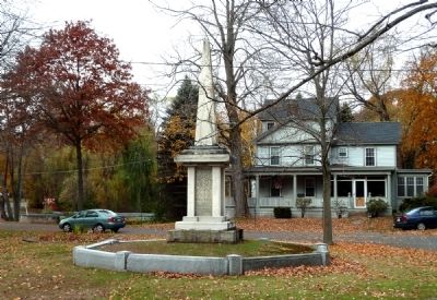
Bloody Brook Monument
1838
—
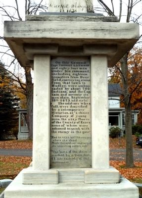
On this Ground Capt. Thomas Lathrop and eighty four men under his command, including eighteen teamsters from Deer field, conveying stores from that town to Hadley, were ambuscaded by about 700 Indians, and the Captain and seventy six men slain, September 18th 1675. (old style)
The soldiers who fell, were described by a contemporary Historian, as “a choice Company of young men, the very flower of the County of Essex none of whom were ashamed to speak with the enemy in the gate.”
“And Sanguinetto tells you where the dead
Made the earth wet and turned the unwilling waters red.”
“The Same of the slain is marked by a Stone slab, 21 rods southerly of this monument.”
Erected 1838.
Topics. This historical marker and monument is listed in these topic lists: Colonial Era • Native Americans • Wars, US Indian • Waterways & Vessels. A significant historical date for this entry is September 18, 1987.
Location. 42° 28.986′ N, 72° 36.221′ W. Marker is in South Deerfield, Massachusetts, in Franklin County. Marker is on North Main Street, on the right when traveling north. Touch for map. Marker is in this post office area: South Deerfield MA 01373, United States of America. Touch for directions.
Other nearby markers. At least 8 other markers are within 5 miles of this marker, measured as the crow flies. Bloody Brook Stone Slab (about 400 feet away, measured in a direct line); SGT. Gregory Allen Belanger (approx. 3.1 miles away); Old Deerfield (approx. 4.1 miles away); Memorial Hall (approx. 4.2 miles away); Godfrey Nims (approx. 4.2 miles away); Benjamin Barrett (approx. 4.2 miles away); Wells-Thorn House (approx. 4.2 miles away); Lucy Terry Prince / Caesar (approx. 4.2 miles away).
More about this monument. The marker sits on a large grassy island on the east side of North Main Street just north of its intersection with Pleasant Street.
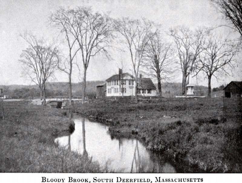
Regarding Bloody Brook Monument. In their 1999 book King Philip’s War, Eric B. Schultz and Michael J. note: “Deerfield was a tempting target for the Indians because of its poor defenses and excellent fall harvest.” Accordingly, Massachusetts Bay leaders decided to evacuate Deerfield and sent troops under Capt. Lathrop to lead the teamsters out. Their wagons were carrying foodstuffs to be distributed throughout the Connecticut River valley during the coming winter. They got as far as present-day South Deerfield when the Nipmuc sachem Muttawmp and his warriors launched their attack.
[Note: The two lines of poetry (next-to-last paragraph of the inscription) are from Lord Byron’s Childe Harold’s Pilgrimage and refer to the Battle of Lake Trasimeno in 217 BC. It was one of the bloodiest battles of the Second Punic War, in which Hannibal’s Carthaginian troops “came down from the heights” to ambush and massacre a Roman army, turning a stream red.]
The cornerstone for this monument was laid in 1835, and it was completed three years later. But the stone slab referred to at the end of the inscription is much older still. (See its link in Other Nearby Markers above.)
Also see . . . A Brief History. Short summary of King Philip’s War. (Submitted on November 4, 2010, by Roger W. Sinnott of Chelmsford, Massachusetts.)
Credits. This page was last revised on November 11, 2020. It was originally submitted on November 4, 2010, by Roger W. Sinnott of Chelmsford, Massachusetts. This page has been viewed 2,215 times since then and 139 times this year. Photos: 1, 2. submitted on November 4, 2010, by Roger W. Sinnott of Chelmsford, Massachusetts. 3. submitted on November 11, 2020, by Allen C. Browne of Silver Spring, Maryland. • Bill Pfingsten was the editor who published this page.


