Niagara Falls in Niagara County, New York — The American Northeast (Mid-Atlantic)
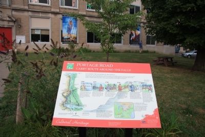
Portage Road
Carry Route Around the Falls
— Cultural Heritage —
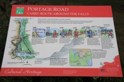
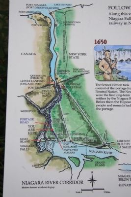
Along this very road Native Americans, explorers, traders, and soldiers passed for centuries to get around the Niagara Falls and Gorge. Merchants cashed in on trade goods, troops fought for safe passage, and the first railway in North American was built to carry goods up and down the Niagara Escarpment.
1650
The Seneca Nation took control of the portage from the Neutral Nation. The Neutrals were the first long-term settlers by the Niagara River. Before them the Hopewell people and nomads had used the portage.
1679
French explorer LaSalle portaged around the falls and built a ship on the bank of the river near Cayuga Creek. The Griffon, in which he explored the upper Great Lakes.
1720
Chabert Joncaire, a French trader, built a trading post at the lower landing near present day Lewiston. The Senecas were employed to carry goods over the portage.
1759
British forces took control of Fort Niagara and the portage. They built a tramway at the escarpment and used carriages to carry the goods over the road to the upper river. The Senecas were no longer employed.
1796
American companies lead by Augustus and Peter Porter, Benjamin Barton, and Joseph Annin leased and managed the portage after the American Revolution, hotels and taverns were built along the route, and the falls began to attract tourists.
1813
British troops seized the route and burned most of the buildings on the American side of the Niagara River during the War of 1812. Americans regained control after the war. The opening of the Erie Canal in 1825 made the portage route obsolete. The route became Portage Road, the street that you drive and walk on today.
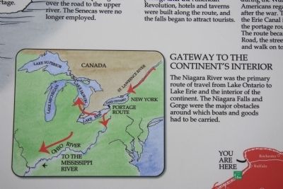
Gateways to the Continents Interior
The Niagara River was the primary route of travel from Lake Ontario to Lake Erie and the interior of the continent. The Niagara Falls and Gorge were the major obstacles around which boats and goods had to be carried.
Niagara Escarpment
The same geologic feature responsible for the falls had to be climbed to get to navigable waters upstream. From the top of the 250' high escarpment, the portage road extended south southeast about 7 miles to the river above the falls.
Erected by Great Lakes Seaway Trail.
Topics and series. This historical marker is listed in these topic lists: Colonial Era • Native Americans
• Roads & Vehicles • Waterways & Vessels. In addition, it is included in the Great Lakes Seaway Trail National Scenic Byway series list. A significant historical year for this entry is 1650.
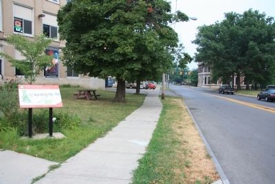
Location. 43° 5.645′ N, 79° 2.871′ W. Marker is in Niagara Falls, New York, in Niagara County. Marker is on Portage Road south of Pine Avenue (U.S. 62), on the right when traveling north. This historic marker is located in the middle of the block, between Pine Avenue and Walnut Avenue, across the street from the Niagara Falls Memorial Medical Center complex (and the public park with memorial statue that is part of the complex). Touch for map. Marker is in this post office area: Niagara Falls NY 14303, United States of America. Touch for directions.
Other nearby markers. At least 8 other markers are within walking distance of this marker. Annie Edson Taylor (approx. 0.2 miles away); Carlisle D. Graham (approx. 0.2 miles away); Oakwood Cemetery (approx. 0.2 miles away); Old Blockhouse (approx. ¼ mile away); The Most Combat Decorated World War II Soldier (approx. half a mile away); In Honor of the Soldiers, Sailors & Marines (approx. half a mile away); The Carnegie Building (approx. half a mile away); Niagara Falls Medal of Honor Memorial (approx. half a mile away). Touch for a list and map of all markers in Niagara Falls.
Credits. This page was last revised on June 16, 2016. It was originally submitted on April 13, 2012, by Dale K. Benington of Toledo, Ohio. This page has been viewed 1,020 times since then and 103 times this year. Photos: 1, 2, 3, 4, 5, 6. submitted on April 13, 2012, by Dale K. Benington of Toledo, Ohio.
