Near Bar Harbor in Hancock County, Maine — The American Northeast (New England)
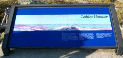
Cadillac Mountain
Photographed by William Fischer, Jr., September 21, 2011
1. Cadillac Mountain Marker
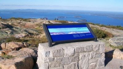
Cadillac Mountin is Acadia National Park's highest elevation and most comprehensive viewpoint. It is also the highest point on the United States Atlantic Coast (1,500 feet/466m). If you stood here alone at dawn you might be the first person in the country to see the sun's first rays.
The mountain is named for Antoine de la Mothe Cadillac, the Frenchman who was granted possession of this island in the late 1600s by King Louis XIV. Later Cadillac founded Detroit, inspiring the name of the prestigous automobile.
In front of you (east) are Frenchman Bay, with its several islands, and Schoodic Peninsula beyond. To your right (south) lie Seal Harbor, the Cranberry Islands, and the open sea.
Erected by National Park Service, U.S. Department of the Interior.
Topics. This historical marker is listed in these topic lists: Colonial Era • Natural Features • Parks & Recreational Areas • Roads & Vehicles.
Location. 44° 21.148′ N, 68° 13.451′ W. Marker is near Bar Harbor, Maine, in Hancock County. It can be reached from Cadillac Summit Road. Marker is near
this page online

Regionally, this marker is on Mount Desert Island and in Downeast Maine. It is also in the American Northeast, in New England, and on the Eastern Seaboard. Globally, it is in the North Atlantic Region, North America, the Great North Woods, the Western Hemisphere, the Western World, and the Anglosphere. Historically, it finds itself in what was once the Viceroyalty of New France and also Acadia.
Other nearby markers. At least 8 other markers are within one mile of this marker, measured as the crow flies: Stephen Tyng Mather (a few steps from this marker); Mountaintop Retreat (within shouting distance of this marker); Saved for Future Generations (within shouting distance of this marker); Picture Perfect? (about 400 feet away, measured in a direct line); Volcanic Landscape Exposed (about 400 feet away); Trustee's Foresight (approx. 0.3 miles away); To the Top! (approx. 0.3 miles away);
Photographed by William Fischer, Jr., September 21, 2011
2. Cadillac Mountain Marker
Also see . . . Acadia National Park. (Submitted on April 14, 2012, by William Fischer, Jr. of Reynoldsburg, Ohio.)
Credits. This page was last revised on February 26, 2026. It was originally submitted on April 14, 2012, by William Fischer, Jr. of Reynoldsburg, Ohio. This page has been viewed 3,022 times since then and 107 times this year. Photos: 1, 2. submitted on April 14, 2012, by William Fischer, Jr. of Reynoldsburg, Ohio.
