Downtown Harrisburg in Dauphin County, Pennsylvania — The American Northeast (Mid-Atlantic)
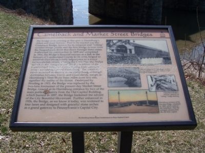
Camelback and Market Street Bridges
Photographed by Beverly Pfingsten, March 15, 2008
1. Camelback and Market Street Bridges Marker
this page online
Top Photo
Late 1800's photo of the Camelback Bridge
Center Left Photo
Unreadable
Center Right Photo
Camelback Bridge's interior captures its "rolling" bridge decking.
Bottom Photo
Harrisburg entrance of the two-lane bridge, completed in 1905, which replaced the Camelback. Note the salvaged columns from the old State Capitol.
Topics and series. This historical marker is listed in these topic lists: Agriculture • Bridges & Viaducts • Industry & Commerce • Landmarks • Notable Events • Roads & Vehicles • War, US Civil. In addition, it is included in the Covered Bridges series list. A significant historical year for this entry is 1809.
Location. 40° 15.512′ N, 76° 53.005′ W. Marker is in Harrisburg, Pennsylvania, in Dauphin County. It is in Downtown Harrisburg. It is at the intersection of Market Street and Front Street on Market Street. Touch for map. Marker is at or near
Photographed by Beverly Pfingsten, March 15, 2008
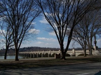
2. Market Street Bridge with Riverfront Park in foreground.

Regionally, this marker is in South-Central Pennsylvania, specifically in Pennsylvania Dutch Country, and in the Susquehanna Valley. It is also in the American Northeast and in the Mid-Atlantic. Globally, it is in North America, the Western Hemisphere, the Western World, and the Anglosphere. Historically, it finds itself in what was once the Haudenosaunee (Iroquois) Confederacy and also one of the original Thirteen Colonies.
Other nearby markers. At least 8 other markers are within walking distance of this marker: Camel Back Bridge (within shouting distance of this marker); Riverfront Park (within shouting distance of this marker); Dauphin County Courthouse (within shouting distance of this marker); Dauphin County (within shouting distance of this marker); Governors’ Row (within shouting distance of this marker); Findlay Executive Mansion (within shouting distance of this marker); Shunk Executive Mansion (about 300 feet away, measured in a direct line); Threatened Invasion of Harrisburg (about 300 feet away). Touch for a list and map of all markers in Harrisburg.
Credits. This page was last revised on June 16, 2016. It was originally submitted on March 18, 2008, by Bill Pfingsten of Bel Air, Maryland. This page has been viewed 2,809 times since then and 70 times this year. Photos: 1, 2. submitted on March 18, 2008, by Bill Pfingsten of Bel Air, Maryland.
