Mackinaw City in Emmet County, Michigan — The American Midwest (Great Lakes)
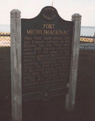
Fort Michilimackinac
Photographed by Richard E. Miller, 2003
1. Fort Michilimackinac Marker
Erected 1958. (Marker Number S0011.)
Topics and series. This historical marker is listed in these topic lists: Colonial Era • Forts and Castles • Indigenous Peoples and Communities • War, French and Indian • Waterways & Vessels. In addition, it is included in the Michigan Historical Commission series list. A significant historical date for this entry is June 2, 1763.
Location. 45° 47.163′ N, 84° 44.082′ W. Marker is in Mackinaw City, Michigan, in Emmet County. It can be reached from Lovingny Street. Marker is at the south end of the Mackinac Bridge, at the edge of Fort Michilimakinac State Park, about 100 feet west of Lovingny Street, and across I-75/MI-339 from the historic Mackinaw City Lighthouse via Huron Avenue.
this page online

Regionally, this marker is in Northern Michigan Lower Peninsula, on the Straits of Mackinac, and in one of the Lake Michigan Shore counties. It is also in the American Midwest. Globally, it is in North America, in the Great North Woods, on the Great Lakes, in the Western Hemisphere, in the Western World, and in the Anglosphere. Historically, it finds itself in what was once the Viceroyalty of New France and also the Northwest Territory.
Other nearby markers. At least 8 other markers are within walking distance of this marker: Using the Land (within shouting distance of this marker); The Anishnaabek (within shouting distance of this marker); Encampment at Pequodenonge (within shouting distance of this marker); Anishnaabek Home (within shouting distance of this marker); The Powder Magazine (within shouting distance of this marker); Canoes (about 500 feet away, measured in a direct line); Fur Trade Routes (about 500 feet
Photographed by Richard E. Miller, 2003
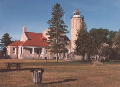
2. Old Mackinac Point Lighthouse (constructed 1892)
about half a mile east of the Fort Michilimackinac marker.
Also see . . .
1. Fort Michilimackinac. Wikipedia entry (Submitted on May 8, 2008, by Richard E. Miller of Oxon Hill, Maryland.)
2. Old Mackinac Point Lighthouse. Mackinac State Historic Parks entry (Submitted on May 8, 2008, by Richard E. Miller of Oxon Hill, Maryland.)
Photographed by Richard E. Miller, 2003
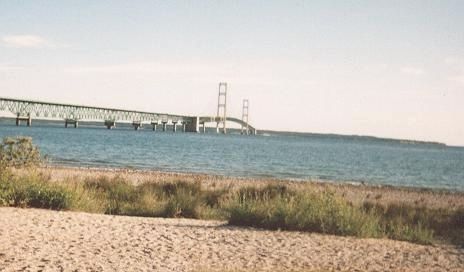
3. Mackinac Bridge
Credits. This page was last revised on February 2, 2021. It was originally submitted on May 8, 2008, by Richard E. Miller of Oxon Hill, Maryland. This page has been viewed 3,245 times since then and 71 times this year. Photos: 1, 2, 3. submitted on May 8, 2008, by Richard E. Miller of Oxon Hill, Maryland. • J. J. Prats was the editor who published this page.
