Montgomery Township near Mercersburg in Franklin County, Pennsylvania — The American Northeast (Mid-Atlantic)
Rev. Steel's Fort
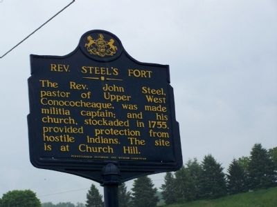
Photographed by Beverly Pfingsten, May 18, 2008
1. Rev. Steel's Fort Marker
Erected 1947 by Pennsylvania Historical and Museum Commission.
Topics and series. This historical marker is listed in these topic lists: Colonial Era • Forts and Castles • Indigenous Peoples and Communities • Religion & Religious Structures • War, French and Indian. In addition, it is included in the Pennsylvania Historical and Museum Commission (PHMC) series list. A significant historical year for this entry is 1755.
Location. 39° 48.246′ N, 77° 52.195′ W. Marker is near Mercersburg, Pennsylvania, in Franklin County. It is in Montgomery Township. It is at the intersection of PA 16 and Findley Road, on the right when traveling west on PA 16. Touch for map. Marker is in this post office area: Mercersburg PA 17236, United States of America. Touch for directions.

Regionally, this marker is in South-Central Pennsylvania. It is also in the American Northeast, in the Mid-Atlantic, in Appalachia, and specifically in
this page online
Other nearby markers. At least 8 other markers are within 3 miles of this marker, measured as the crow flies: To Irwinton Mills (approx. 1.2 miles away); Dr. Hugh Mercer (approx. 1.2 miles away); Mercersburg Veterans Memorial (approx. 2.1 miles away); In Memory of those who gave their Lives in World War I (approx. 2.1 miles away); In Memory of those who gave their lives in World War II (approx. 2.1 miles away); James Buchanan (approx. 2.1 miles away); The 54th Mass. Infantry Regiment, US Colored Troops (approx. 2.2 miles away); Marshall College (approx. 2.3 miles away). Touch for a list and map of all markers in Mercersburg.
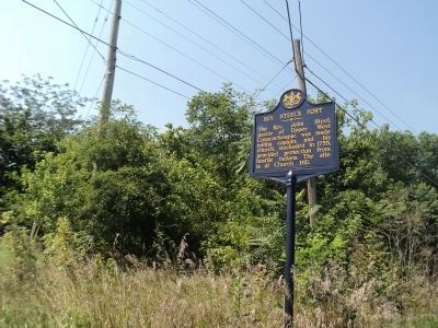
Photographed by Bill Coughlin, August 22, 2012
2. Rev. Steel's Fort Marker
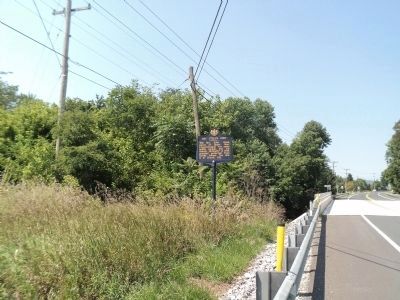
Photographed by Bill Coughlin, August 22, 2012
3. Rev. Steel's Fort Marker
Credits. This page was last revised on February 7, 2023. It was originally submitted on May 30, 2008, by Bill Pfingsten of Bel Air, Maryland. This page has been viewed 2,562 times since then and 115 times this year. Photos: 1. submitted on May 30, 2008, by Bill Pfingsten of Bel Air, Maryland. 2, 3. submitted on August 23, 2012, by Bill Coughlin of Woodland Park, New Jersey.
