Chattanooga in Hamilton County, Tennessee — The American South (East South Central)
Crossing into History
Photographed by Dale K. Benington, August 5, 2014
1. Crossing into History Marker
Trail of Tears
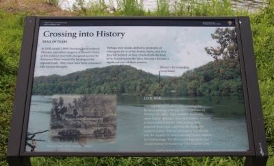
In 1838, nearly 2,000 Cherokee, their enslaved Africans, and others stopped at Brown's Ferry (a few yards to your left) and gazed across the Tennessee River toward the landing on the opposite bank. They must have been consumed with various thoughts.
Perhaps their minds drifted to memories of times gone by or of the homes, farms, and lives they left behind. As they climbed into the boat to be ferried across the river, this place became a significant part of their journey.
Civil War
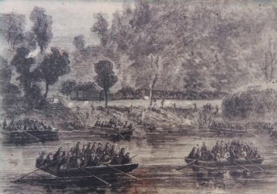
The majority of Confederates guarding the far ferry landing in the pre-dawn darkness of October 27, 1863, slept soundly. Suddenly, more than a thousand blue-clad soldiers seemed to burst forth from the river, exiting their pontoon boats and scattering the Southern soldiers (inset). This act of bravery opened the way for supplies to reach starving Union soldiers in Chattanooga. The life-sustaining supply line would forever be known as "The Cracker Line."
Erected by Friends of Moccasin Bend National Park (through a grant by the Lyndhurst Foundation).
Topics and series. This historical marker is listed in these
this page online
Location. 35° 3.378′ N, 85° 20.4′ W. Marker is in Chattanooga, Tennessee, in Hamilton County. It can be reached from the intersection of Pineville Road and Manufacturers Road, on the right when traveling south. This marker is located inside of the Moccasin Bend National Archaeological District, at the western end of the walking trail, along the east bank of the river. Touch for map. Marker is in this post office area: Chattanooga TN 37405, United States of America. Touch for directions.

Regionally, this marker is in the American South, specifically in the Upper South, in Appalachia, and specifically in Southern Appalachia. Globally, it is in North America, the Western Hemisphere, the Western World, and the Anglosphere. Historically, it finds itself in what was once the original Cherokee Nation, the territory of the Mississippian Culture, one of the Confederate States of America, and the Antebellum South.
Other nearby markers. At
Photographed by Dale K. Benington, August 5, 2014
2. Crossing into History Marker
Close-up view, that is displayed on the marker, of an image from, Harper's Weekly: A Journal of Civilization, showing Union troops moving on the Confederate position at Brown's Ferry using pontoon boats.
More about this marker. This marker is the fourth and final marker, in a series of four (4) markers that mark the footpath, used to walk portions of the old Brown's Ferry Federal Road, from the present day roadway, to the Tennessee River, and then back, a journey of about 1.2 miles, round-trip.

Photographed by Dale K. Benington, August 5, 2014
3. Crossing into History Marker
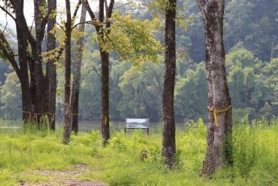
Distant view of the marker, looking west along the walking trail, with the ridge-line on the opposite bank of the Tennessee River in the far background.
Photographed by Dale K. Benington, August 5, 2014
4. Crossing into History Marker
View of the marker, looking west along the walking trail, with the opposite bank of the Tennessee River in the background.
Photographed by Dale K. Benington, August 5, 2014
5. Crossing into History Marker
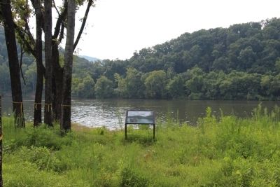
View of the marker, looking southwest, with the marker being situated at the western end of the trail and the Tennessee River in the background.
Photographed by Dale K. Benington, August 5, 2014
6. Crossing into History Marker
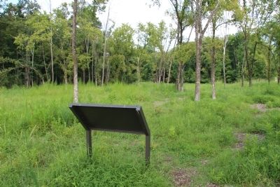
View of the backside of the marker, looking east along the walking trail, back the direction of the starting point for the walking trail.
Photographed by Dale K. Benington, August 5, 2014
7. Crossing into History Marker
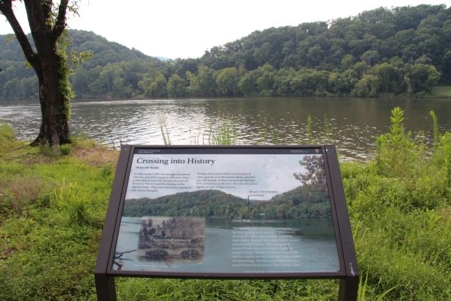
View of the marker, looking southwest, directly across the Tennessee River, towards the west bank side of the historic Brown's Ferry (located at the low point in the far ridge).
Credits. This page was last revised on June 16, 2016. It was originally submitted on June 10, 2015, by Dale K. Benington of Toledo, Ohio. This page has been viewed 920 times since then and 40 times this year. Photos: 1, 2, 3, 4, 5, 6, 7. submitted on June 10, 2015, by Dale K. Benington of Toledo, Ohio.
