
Near Buffalo in Johnson County, Wyoming — The American West (Mountains)
The Legend of Crazy Woman
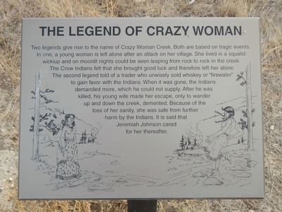
Photographed by Barry Swackhamer, September 16, 2015
1. The Legend of Crazy Woman Marker
Two legends give rise to the name of Crazy Woman Creek. Both are based on tragic events. In one, a young woman is left alone after an attack on her village. She lived in a squalid wickiup and on moonlit nights could be seen leaping from rock to rock in the creek. The Crow Indians felt that she brought good luck and therefore left her alone. The second legend told of a trader who unwisely sold whiskey or "firewater" to gain favor with the Indians. When it was gone, the Indians demanded more, which he could not supply. After he was killed, his young wife made her escape, only to wander up and down the creek, demented. Because of the loss of her sanity, she was safe from further harm by the Indians. It is said that Jeremiah Johnson cared for her thereafter.
Topics. This historical marker is listed in these topic lists: Anthropology & Archaeology • Indigenous Peoples and Communities • Waterways & Vessels • Women.
Location. 44° 5.047′ N, 106° 31.451′ W. Marker is near Buffalo, Wyoming, in Johnson County. It can be reached from Buffalo Sussex Cutoff Road near
this page online

Regionally, this marker is in Wyoming’s Powder River Basin. It is also in the American Mountain West. Globally, it is in North America, the Rocky Mountains, the Western Hemisphere, the Western World, and the Anglosphere.
Other nearby markers. At least 5 other markers are within 14 miles of this marker, measured as the crow flies: Conflict at the Crossing (here, next to this marker); Lieut. N.P. Daniels, U.S.A. (a few steps from this marker); Bozeman's Trail: (a few steps from this marker); TA Ranch (approx. 10.1 miles away); Tisdale Divide (approx. 13.9 miles away).
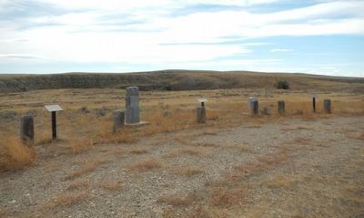
More about this marker. This marker is found at the Crazy Woman Battlefield Monument. From U.S. Highway 87, take Exit 291, Buffalo Sussex Cutoff Road (Trabing Road) to the southeast for 12 to 15 miles. When you reach the Irigaray Road junction, make a U-turn and return northwest about 1 mile. There, take the poorly signed ranch road to the right about 1/4 mile. The marker(s) will be at
Photographed by Barry Swackhamer, September 16, 2015
2. The Legend of Crazy Woman Marker
The marker is on the left.
Credits. This page was last revised on November 15, 2025. It was originally submitted on December 13, 2015, by Barry Swackhamer of Brentwood, California. This page has been viewed 32,082 times since then and 2,056 times this year. Last updated on June 5, 2023, by McGhiever of Minneapolis, Minnesota. Photos: 1, 2. submitted on December 13, 2015, by Barry Swackhamer of Brentwood, California. • J. Makali Bruton was the editor who published this page.
