Downtown in Columbus in Franklin County, Ohio — The American Midwest (Great Lakes)
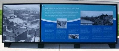
The Urban Face of the Scioto River
The confluence of the Scioto and Olentangy Rivers is just northwest of North Bank Park, and the rivers were the major attraction for both Native American and white settlers. The river and its tributaries were the life-blood to the region providing drinking water, food, and businesses, as well as limited transportation. The floodplains provided fertile ground for growing crops.
Even though the river was a major reason for locating in Central Ohio, it also brought problems. More than a dozen major floods ravaged the region, and along with floods came disease and pests.
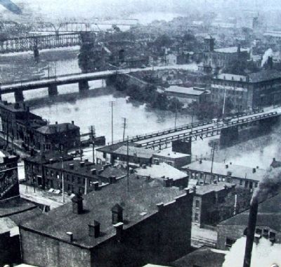
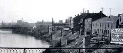
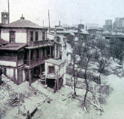
As the community grew, the residents turned their backs to the river and filled it with raw sewage, garbage, and industrial waste. Soon, only the poorest, and those who had to, lived near the river. By the mid to late 1800s, the river was lined with tenement slums, taverns, warehouses, and manufacturing facilities. Huge manufacturing plants such as Union Fork and Hoe and Columbus Buggy Company were located in the area just north of Spring Street.
Civic leaders began to recognize the potential benefits of the river in the early 1900s, and developed a plan to reclaim the area. It called for major waterfront parks, government buildings, and entertainment venues. Before the plan could be implemented, one of the most devastating floods in Columbus history occurred in 1913.
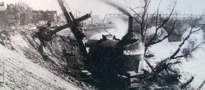
The plan was delayed, but eventually huge sections of abandoned and run-down buildings were demolished. The river was widened and deepened with a series of dams to minimize flooding. Only a portion of the civic center plan was constructed, including major structures such as Central High School (now COSI), the Federal Building, City Hall, and the Ohio Supreme Court Building (formerly the Ohio Departments Building).
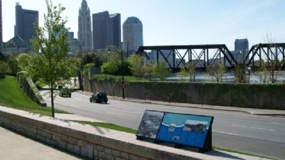
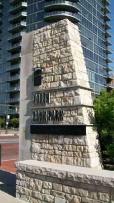
North Bank Park is part of a modern day effort to reclaim the riverfront and make it more available to the public and to promote downtown activities.
Erected by City of Columbus.
Topics. This historical marker is listed in these topic lists: Disasters • Environment • Government & Politics • Industry & Commerce • Man-Made Features • Natural Features • Notable Events • Settlements & Settlers • Waterways & Vessels. A significant historical year for this entry is 1913.
Location. 39° 57.93′ N, 83° 0.539′ W. Marker is in Columbus, Ohio, in Franklin County. It is in Downtown. Marker is on Long Street (U.S. 33), on the left when traveling east. Marker is about 200 feet east of Neil Avenue, in North Bank Park. Touch for map. Marker is in this post office area: Columbus OH 43215, United States of America. Touch for directions.
Other nearby markers. At least 8 other markers are within walking
distance of this marker. Working Class Neighborhoods (a few steps from this marker); William and Hannah Neil (within shouting distance of this marker); Transportation, Growth, and Development (about 300 feet away, measured in a direct line); The Irish in Columbus (about 400 feet away); Native Americans (about 500 feet away); General John Hunt Morgan, CSA / Morgan's Escape (about 600 feet away); The Railroads (about 600 feet away); Soldiers Cross Memorial (approx. 0.2 miles away). Touch for a list and map of all markers in Columbus.
Also see . . .
1. Friends of the Scioto River. (Submitted on April 21, 2010, by William Fischer, Jr. of Scranton, Pennsylvania.)
2. North Bank Park. (Submitted on April 22, 2010, by William Fischer, Jr. of Scranton, Pennsylvania.)
Credits. This page was last revised on February 3, 2023. It was originally submitted on April 21, 2010, by William Fischer, Jr. of Scranton, Pennsylvania. This page has been viewed 1,283 times since then and 51 times this year. Photos: 1, 2, 3, 4, 5, 6. submitted on April 22, 2010, by William Fischer, Jr. of Scranton, Pennsylvania. 7. submitted on April 20, 2010, by William Fischer, Jr. of Scranton, Pennsylvania.
