On Main Street (Leinster Route R405) 0.2 kilometers south of Maynooth Road (Leinster Route R405), on the right when traveling south.
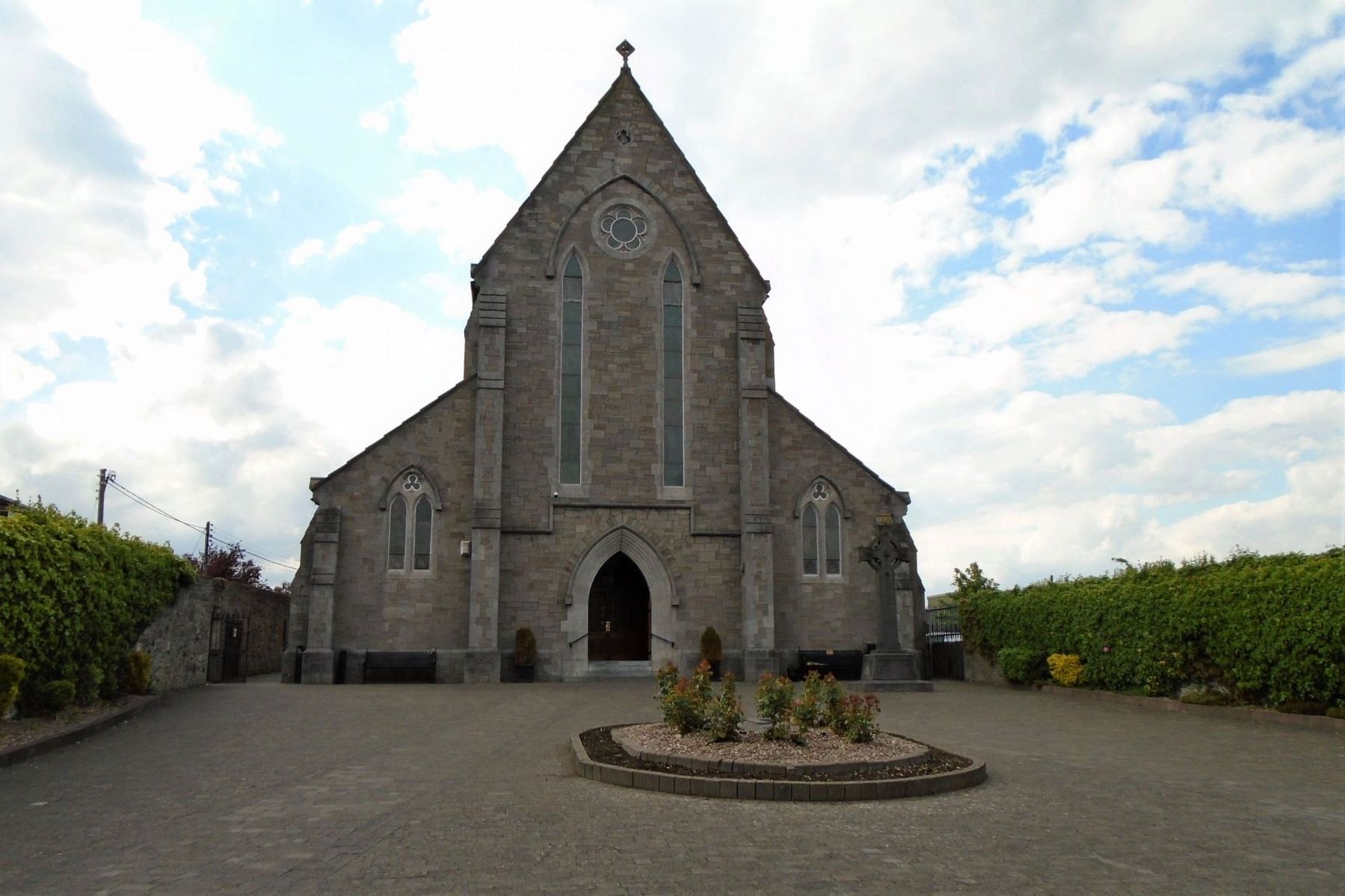
By 1855 the Mass House which had served the people of Celbridge for over one hundred years was in a poor state of repair. It was situated in front of the present church. It was known as a Mass House as Mass was the only service allowed in it. . . . — — Map (db m143176) HM
On Maynooth Road (Leinster Route R405) at Shackleton Road, on the left when traveling south on Maynooth Road.
The Irish Poor Law System
The origins of the Irish Workhouse system lie in the Irish Poor Law Act passed by the parliament of the United Kingdom in 1838.
The Act, entitled an Act for the More Effectual Relief of the Poor in Ireland was . . . — — Map (db m143231) HM
On Main Street (Leinster Route R405) just west of Maynooth Road (Leinster Route R405), on the left when traveling south.
"Along the banks of that river, amid the groves and bowers of Swift and Vanessa, I grow convinced that I was right."
Henry Grattan
INTRODUCTION
Celbridge (Cill Droichid: 'Church by the Bridge' originally angicised to . . . — — Map (db m143210) HM
Tá Eastát Castletown, Cill Droichid i mbaile clúiteach Arthur Guinness agus tailte cúirtéireachta Jonathan Swift, údar Gulliver's Travels.
Lonnaithe sa stair chlúiteach seo, is é Castletown an teach mór ar stíl Phallaidiach is mó clú . . . — — Map (db m143409) HM
On Clane Road (Route R403) just west of Tea Lane, on the left when traveling west.
• The original Celbridge Manor was built at the beginning of the 18th century by Bartholemew Van Homrigh, a wealthy Dutch merchant, who was Purchaser of Provisions and Commissioner of Ordnance for the victorious forces of King William III.
• . . . — — Map (db m143209) HM
On Maynooth Road (Route R405) at Shackleton Road, on the left when traveling south on Maynooth Road.
Pray
for the souls
of all
poor and afflicted
whose bodies
have been laid
in this cemetery
since 1841
R.I.P.
—————————————
This Holy Ground is . . . — — Map (db m143226) HM
On Maynooth Road (Leinster Route R405) at Shackleton Road, on the left when traveling south on Maynooth Road.
Through this gate from 1841 onwards passed the
bodies of deceased inmates of the Celbridge Union
Workhouse on their way to burial in these
grounds. The Workhouse System conducted its
burials in a characteristically efficient manner
and . . . — — Map (db m143227) HM
On Main Street (Leinster Route R405) 0.2 kilometers south of Maynooth Road (Leinster Route R405), on the left when traveling south.
C Company, 1st Battalion,
Dublin Brigade, I.V.
Four Courts & Interned
in Stafford & Frongoch 1916
Unveiled by Cllr. Frank O'Rourke
21st February 2016 — — Map (db m143171) WM
On Main Street (Leinster Route R405) 0.2 kilometers south of Maynooth Road (Leinster Route R405), on the right when traveling south.
Erected by his numerous friends of all classes
and of all creeds in memory of
Sir Gerald Dease, K.C.V.O.
Born 17th July 1831, died 18th October 1903.
A man of stainless honour, who used his high position
and great . . . — — Map (db m143180) HM
On Main Street (Leinster Route R405) close to Maynooth Road (Leinster Route R405), on the left when traveling south.
The origins of our town
In ancient times there were five principal roads in Ireland. One of these roads was known as the "Slí Mhór". It extended from Dublin Bay to Galway Bay and forded the river Liffey in Celbridge just below where the Mill . . . — — Map (db m143545) HM
In 1740-41, famine spread across Europe, following a great frost[,] the so-called 'Black Spring'. Rivers froze, and water-powered mills that ground grain into flour stopped working. This led to a flour scarcity, hoarding by wholesalers, . . . — — Map (db m143165) HM
On Main Street (Leinster Route R408) just west of Mill Street (Leinster Route R148), on the right when traveling west.
Muiris Mac Gearailt a thóg 1176 : rinneadh méadh air ó am go ham ina dhiaidh sin. [?] dtús na 14ú aoise ba é príomháit chónaithe ghearaltach chill dara é, chuir "Tomás an Tsíoda" i dtreo cosanta in aghaidh na sasanach é i . . . — — Map (db m143158) HM
On Parson Street (Leinster Route R408) just west of Mill Street (Leinster Route R148), on the right when traveling south.
The Church of St. Mary's - a living centre of worship today - is also a monument to the Fitzgerald family whose history is permanently linked with the nearby Geraldine Castle. Originally built as a private chapel for the castle, in 1248 St. Mary's . . . — — Map (db m143157) HM
On Parson Street (Leinster Route R408) just west of Mill Street (Leinster Route R148), on the right when traveling south.
This Large East Window is unusual because it is made of wood and set in stone. During the restoration of 1770 this window was taken from the church of Laraghbryan, which had fallen into ruins[.] Note how the stonemason corrected the misspelling in . . . — — Map (db m143155) HM