Tazewell County Va. Area 531 Square Miles. Formed in 1799 from Russell and Wythe, and named for Henry Tazewell, United States Senator, 1794-1799. Beautiful Burk's Garden is in this county.
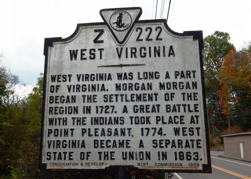
West Virginia. West Virginia . . . — — Map (db m110080) HM
West Virginia
(Mercer County)
"The Mountain State"—western
part of the Commonwealth of
Virginia until June 20, 1863.
Settled by the Germans and
Scotch-Irish. It became a line
of defense between the English
and French . . . — — Map (db m90595) HM
Jordan Nelson, blacksmith, dug coal from bank to fuel forge, and made 1st commercial use by selling for 1 cent a bushel in 1870s. In 1873 I. A. Welch surveyed Pocahontas Coalfield for J. Hotchkiss who induced F. J. Kimball, later President of N&W . . . — — Map (db m130241) HM
First stationed across the highway and on the extreme right of the Confederate line, the 23rd Battalion was later moved to support the 19th Va. Cavalry on the left flank. After an initial charge that temporarily halted the Federal advance, the 23rd . . . — — Map (db m34391) HM
“The Wilderness Road” sums up the iconic meaning of the lives of Daniel Boone and the thousands of settlers who poured after him through the great gap into Kentucky. In its various forms as frontier trail, wagon road, stage route and antebellum . . . — — Map (db m228382) HM
Giles County was formed from Montgomery, Monroe (now in West Virginia), and Tazewell Counties in 1806. It was named for William Branch Giles, United States senator from Virginia and later governor. North of here, the first court of Giles County was . . . — — Map (db m37528) HM
"Coal is known to be in so many places, as to have induced an opinion that the whole tract between the Laurel Mountain and Ohio yields coal." — Thomas Jefferson, 1785
Bluefield is the Southern Gateway to West . . . — — Map (db m305245) HM
Buchanan County Buchanan County is situated in the heart of
Southwest Virginia's coalfields in the Appalachian
Plateau and was formed from Tazewell and
Russell counties in 1858. The county is named
for James Buchanan who served as . . . — — Map (db m228601) HM
Solomon Osborne was born circa 1814 on a Cherokee reservation in North Carolina. Served as guard on the “Trail of Tears,” and fell in love with Seaberry (Martha Arms), daughter of Chief Running Bear (Robert Arms). They escaped and were married in . . . — — Map (db m137986) HM
On February 20, 1858, the General Assembly of Virginia passed legislation creating
McDowell County from the western section of Tazewell County. McDowell County was named in honor of James McDowell, the governor of Virginia between 1843 and 1846, . . . — — Map (db m178627) HM
The Southwest Virginia Improvement Company
opened Pocahontas Mine No. 1, the first to
exploit the rich seams of the Pocahontas Coalfield,
in 1882. An extension of the Norfolk and Western
Railway soon followed, bringing industrial development to . . . — — Map (db m104975) HM
Stretching across western Mercer County through McDowell and southern Wyoming counties is the Pocahontas coalfield, one of the most productive, coal-bearing areas in the world. In this area, 6 seams of high-quality coal can be found close to the . . . — — Map (db m179086) HM
This fertile region was known as Richlands from an early period. In 1782 and later Richlands was a militia station for frontier defense. The town was laid off in 1890, with the coming of the Norfolk and Western Railroad, and was incorporated in . . . — — Map (db m104946) HM
Bluestone River
The Bluestone River begins at an elevation of about 3,500 feet above sea level on East River Mountain, Tazewell County, Virginia. After flowing about 77 miles the river empties into the New River at an elevation of . . . — — Map (db m140101) HM
Bluestone River
The Bluestone River begins at an elevation of about 3,500 feet above sea level on East River Mountain, Tazewell County, Virginia. After flowing about 77 miles the river empties into the New River at an elevation of . . . — — Map (db m140102) HM
This building, erected in 1792, served as the
second courthouse of Russell County and is one
of the earliest public buildings still standing
in Southwest Virginia.
Russell County was
formed in 1786 from Washington County and
originally . . . — — Map (db m91034) HM