Markers highlighting this symbol of the Cold War, where the "Iron Curtain" was made of concrete and physically divided a city. The Berlin Wall was perhaps the most visible result of competing political ideals in a post-WWII bipolar world. At the time, most people could not conceive of its demise and a reunited Berlin.
• Between 1945-1961 2.7 million escaped East Germany
• In 1960, 200,000 East Germans escaped to Freedom
• Order given to build Wall - Sunday, Aug. 13, 1961
Construction began Aug. 16, 1961; completed 2 mos. later
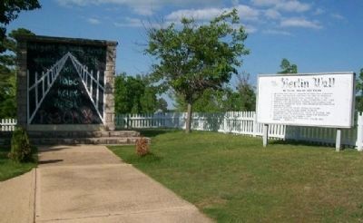
• Initially 6 ft. . . . — — Map (db m80171) HM
On Wilshire Boulevard east of Ogden Drive, on the right when traveling east.
The Wall Along Wilshire is an installation featuring ten sections of the original Berlin Wall. Measuring nearly forty feet wide, it is the world’s longest stretch of the Wall outside of Berlin. The Wende Museum assembled the Wall Along Wilshire . . . — — Map (db m125316) HM
Near Massachusetts Avenue Northwest east of 18th Street Northwest, on the right when traveling east.
This segment of the Berlin Wall was presented to the Nitze School and the American Institute for Contemporary German Studies of the Johns Hopkins University by the Berlin Senate. It symbolizes both the peaceful end of a long international struggle . . . — — Map (db m112638) HM
On East 2nd Street at South Galena Avenue, on the right when traveling west on East 2nd Street.
General Secretary Gorbachev,
if you seek peace--
if you seek prosperity
for the Soviet Union
and Eastern Europe--
if you seek liberalization.
come here, to this gate.
Mr. Gorbachev. Open this gate.
Mr. Gorbachev. Tear down this . . . — — Map (db m78278) HM
Near East 2nd Street (Illinois Route 2) at South Galena Avenue (U.S. 52), on the right when traveling west.
[Plaque 1]
• The flag of the USSR is shown behind Vladimir Lenin, Russian leader of the Bolsheviks in the 1917 Revolution.
• Soviet soldiers stand in Moscow's Red Square near the Kremlin, seat of the Communist government of the USSR.
• . . . — — Map (db m230799) HM
On West 7th Street just west of Westminster Avenue, on the left when traveling east.
Following the defeat of Nazi Germany in 1945, the country was divided into four zones of occupation by the World War II Allies. The United States, Great Britain, France and the Soviet Union. Berlin, located deep within the Soviet zone also was . . . — — Map (db m59080) HM
Near Liberty Street near Battery Park City Esplanade.
In November 2004, the 15th Anniversary of the dismantling of the Berlin Wall, the city of Berlin donated this piece of the Wall to Battery Park City. These segments were originally located in downtown Berlin in the area between Potsdamer Plaza and . . . — — Map (db m132053) HM
On East Freedom Way at Vine Street, on the right when traveling west on East Freedom Way.
The Berlin Wall
On August 13, 1961,
the totalitarian government
of East Germany split Berlin
with a wall of concrete.
Free expression of thought
disappeared, From 1961
to 1989 some 130 people
were killed attempting to
escape through . . . — — Map (db m130350) HM
For 49 years, Berlin, former capital of Adolf Hitler's Nazi Germany, was occupied by the victorious allies of World War II--the United States, Great Britain, France and the Soviet Union. For much of that time an ugly wall divided the city . . . — — Map (db m136630) WM
Berlin Wall Segment A.
This Berlin Wall Segment, located between the Brandenburg Gate and Checkpoint Charlie from 1961 - 1989, is donated in gratitude to all Military Chaplains, who in time of war and peace, faithfully served God and . . . — — Map (db m136418) WM
Panel A.
On November 9, 1989, to stem the flow of refugees, desperate Communist leaders announced amid chaos that they would issue passports to all East Germans, allowing them to come and go as they pleased. That evening hundreds of . . . — — Map (db m136631) HM
Because of the Four-Power Agreements, the Allies had insisted upon free access to Berlin at any time. In 1958, Premier Nikita S. Khrushchev of the Soviet Union demanded that the Allies leave West Berlin and Berlin be made a "demilitarized free . . . — — Map (db m136629) HM
Given to Rapid City by Generous Citizens Mindful of the Price of Freedom
COMMITTEE
Gale Holbrook
Ra Vae Luckhart
Jim Kuehn
Phil Nichols
Carolyn Mollers
Paul Reinke, DDS
Col. Josiah Wallace
Dale Clement, PhD . . . — — Map (db m136399) WM
This piece of the Berlin Wall
arrived in Fremont in 2001 to
commemorate the role of Seattle
and Boeing's C-47 in the Berlin
Airlift of 1948.
Thank you to the Burke Family
and History House for retaining
this piece of history. — — Map (db m234832) WM
Wider das Vergessen
Originalstück der Berliner Mauer, die von 1961 bis zum
Mauerfall 1989 auf einer Länge von 155 Km stand
und etwa 130 Menschen das Leben kostete.
Gestiftet 2008 von Rudi May - Würzburg
-
(English . . . — — Map (db m131276) HM WM
(English text) In July 1990, East German border guards began systematically demolishing the Berlin Wall. The great majority of Berliners were glad to see this much-hated structure disappear from the centre of the city.
Only the initiative of a . . . — — Map (db m94149) HM WM
[Panel 1:] During the time Germany and Berlin were divided by THE WALL, the sign which symbolizes world history was standing here: The victorious powers of World War II and the two Germanies confronted each other here, and the Western powers . . . — — Map (db m56213) HM
On Niederkirchnerstraße east of Stresemannstraße, on the right when traveling east.
German Text: …
English Text:
The Berlin Wall became an international symbol of the division of Germany after the Second World War and also of the Cold War between East and West.
The construction of the Berlin Wall began on . . . — — Map (db m57785) HM
(English) The Berlin Wall was a worldwide symbol for the division of Germany after World War II and for the injustice and inhumanity of the communist system.
Construction began on August 13, 1961, on the orders of the GDR . . . — — Map (db m94136) HM WM
English: Length 43.1 km East-Berlin/West Berlin, 119 km GDR/ West-Berlin Height 3.60 m.
On the 13th of August, 1961 the SED leadership ordered the closure of the border to the sectors of West Berlin. For 28 years this border divided . . . — — Map (db m94130) WM
English translation: The Glienicker Bridge was built between 1904 and 1907 and was destroyed in World War II and reopened in 1949 as Union Bridge. For decades the leaders of East Germany who chose this name fought against unification of . . . — — Map (db m94132) WM
On Lambeth Road at St. George’s Road, on the left when traveling west on Lambeth Road.
Change Your Life by the graffiti artist, Indiano
The Berlin Wall was erected by the East German security forces in August 1961 to seal off the East German sector of Berlin from the West. On 9 November 1989 the East Germans began taking down . . . — — Map (db m118016) HM