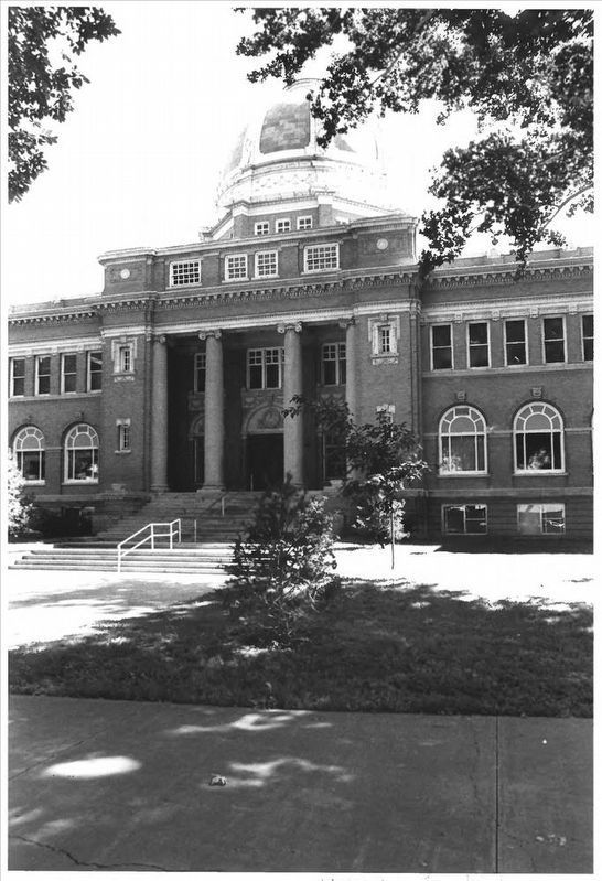
On Main Street near E. 4th Street, on the right when traveling north.
Chaves County
Courthouse
has been placed on the
National Register
of Historic Places
by the United States
Department of the Interior
1985 — — Map (db m102803) HM
Before the construction of the elegant courthouse that stands here today, a smaller courthouse constructed in 1890 was home to Roswell’s judicial system.
In 1889, prior to construction, Captain Joseph C. Lea, Charles Eddy, and Pat Garrett (the . . . — — Map (db m73527) HM
On East Second Street, on the right when traveling west.
Roswell was a watering place for the Pecos Valley cattle drives of the 1870s and 1880s. It was incorporated in 1891 and is seat of Chaves County, named for Col. J. Francisco Chaves, Civil War Soldier and delegate to the U.S. Congress from the . . . — — Map (db m73453) HM
On SE Main Street (U.S. 285) 0.4 miles north of East Brasher Road, on the right when traveling north.
Roswell was a watering place for the Pecos Valley cattle drives of the 1870s and 1880s. It was incorporated in 1891 and is seat of Chaves County, named for Col. J. Francisco Chaves, Civil War Soldier and delegate to the U.S. Congress from the . . . — — Map (db m119935) HM
On North Main Street (U.S. 285) at U.S. 70, on the right when traveling south on North Main Street.
Roswell was a watering place for the Pecos Valley cattle drives of the 1870s and 1880s. It was incorporated in 1891 and is seat of Chaves County, named for Col. J. Francisco Chaves, Civil War soldier and delegate to the U. S. Congress from the . . . — — Map (db m280093) HM
On North Main Street south of West 5th Street, on the right when traveling south.
This location incorporates two of downtown Roswell's most historic buildings. East of this location is the Chaves County Courthouse, built in 1911. It is one of the best surviving examples of courthouses built in the Beaux Arts Revival "monumental . . . — — Map (db m56139) HM
On East Main Street (Business Interstate 25) at North Commercial Street, on the right when traveling west on East Main Street.
Before homesteaders began farming the plains, before barbed wire sliced the prairies into neat squares, and before windmills spiked the horizon, huge open-range ranching operations controlled thousands of square miles of grasslands. Enormous herds . . . — — Map (db m280698) HM
The series of hills immediately to the northeast are the Godfrey Hills. The mountains beyond are part of the Lincoln National Forests White Mountain Wilderness. It provides opportunities for camping, hiking, and backpacking in cool pinyon, juniper, . . . — — Map (db m251042) HM
On Main Street at E. 4th Street, on the right when traveling north on Main Street.
Dedicated to
The Men and Women of Chaves County,
New Mexico Who Served Their Country
During the Persian Gulf War
1990 — 1991
by
Roswell Cares Support Group — — Map (db m102806) WM
This structure is the oldest steel highway bridge in New Mexico, built in 1902 by Chaves County as part of the three-span Pecos River Bridge east of Roswell. There it connected the growing town with the smaller communities and ranches of the . . . — — Map (db m89690) HM
Listed on the National Register of Historical Places, contractor
David Young Tomlinson began construction on this house in 1910
and completed it in 1912, the same year New Mexico became a state.
Taking cues from Frank Lloyd Wright's Prairie-style . . . — — Map (db m235388) HM
Thin black lines indicate changes in relevance. Between each pair of lines entries are ordered geographically but all have the same relevance.
* Inflectional forms of words are their plurals, singulars, and possessives as well as gramatical tenses and similar variations.