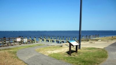
Near Kitty Hawk 0.5 miles east of Caratoke Highway (U.S. 158), in the median. Reported permanently removed.
For many years before the war, Currituck Sound was a busy avenue of commerce sheltered from the Atlantic Ocean by the Outer Banks. Vessels carried produce and goods between North Carolina and Virginia. After hostilities began, the sound became . . . — — Map (db m56980) HM
Near Club Road at Ocean Trail (North Carolina Route 12), on the left when traveling west.
“Currituck” is from the Algonkian word meaning “land of the wild goose.”Currituck Sound is located in Currituck and Dare Counties in Northeast North Carolina.
Currituck Sound, a brackish water estuary separated from the . . . — — Map (db m257087) HM
On Courthouse Road (State Highway 1242) near Caratoke Highway (State Highway 168), on the right when traveling north.
Thursday the 31st December 1767
"On motion the following Bills were ordered to be read ... A Bill to impower the justices of Currituck County to build a prison pillary and stocks in the said county on the lot were the Court House stands for the . . . — — Map (db m9468) HM
On Courthouse Road (Route 615) east of Caratoke Highway (North Carolina Route 168), on the right when traveling west.
The town of Currituck has been the seat of county government since 1723, and the core of the courthouse to your right and jail in front of you were here before the Civil War. By 1860, the county had 7,415 residents, of whom 4,669 were white, . . . — — Map (db m276262) HM
On Caratoke Highway (State Highway 168) at Maple Road, on the right when traveling south on Caratoke Highway. Reported missing.
Currituck County played a vital role in a prisoner-of-war escape in 1863. At 1:30 P.M. on June 10, the troop-transport steamer Maple Leaf sailed from Fort Monroe, Va., for Fort Delaware, carrying 97 captured Confederate officers bound for . . . — — Map (db m56981) HM
On South Indiantown Road 0.4 miles north of Trotman Road, on the left when traveling south.
Indiantown, a commercial center with a shipyard, store, and mill, became a focal point for military activity during the Civil War. On June 10, 1862, U.S. Navy Lt. Charles W. Flusser led several gunboats up the North River to capture a prominent . . . — — Map (db m56814) HM
On Corolla Village Road, on the left when traveling north.
Currituck Outer Bankers depended on the land and the water for their livelihoods. Besides waterfowl hunting and fishing, the Sound provided an important transportation route to and from the Currituck mainland and up and down the Banks. The first . . . — — Map (db m91802) HM
On Shawboro Road (Route 34) at North Indiantown Road, in the median on Shawboro Road.
Member N.C. Assembly and U.S. Congress. Confederate colonel. Killed in attack on New Bern, Feb. 1, 1864. Home & grave about 150 feet West. — — Map (db m9507) HM
Near Watson Road at North Battlefield Boulevard (Virginia Route 168), on the left when traveling south.
(side 1)
This monument honors
Patriots who assembled
at this site in the Cause of
American Freedom in 1775
American Patriots
at the Battle
Second Virginia Regiment
Commanded by
Colonel William Woodford,
of . . . — — Map (db m211239) HM
On Caratoke Highway (Route 168) at Courthouse Road (North Carolina Highway 1242) on Caratoke Highway.
Preached first Methodist sermon in colony, 1772, at Currituck Courthouse. Pilmoor Memorial Methodist Church is near the site. About 300 ft. north. — — Map (db m2763) HM
"The Grand Old Man Of North Carolina"
Captain, 8th North Carolina, CSA
Lt. Governor & Governor of North Carolina
U.S. Ambassador to Brazil
U.S. Senator
The Father of East Carolina University In life he embodied the motto
of the . . . — — Map (db m66885) HM