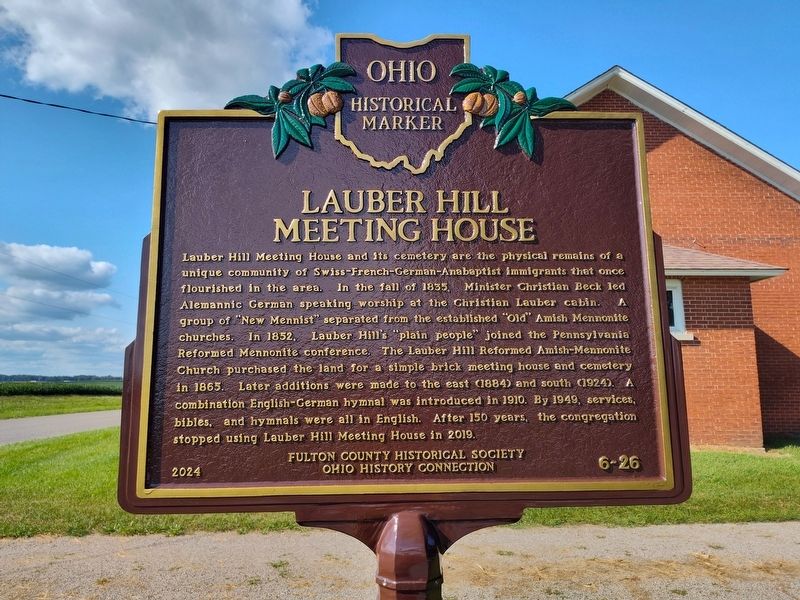
On County Road 21 at U.S. 21A, on the right when traveling north on County Road 21.
Lauber Hill Community. In 1834, immigrant families from the Upper Rhine River Valley villages of Mulhausen (France) and Schaffhausen (Switzerland) first met in Marshallville, Ohio. They decided to travel west by canal boat and purchase . . . — — Map (db m282429) HM
On Ohio Route 109 at Route 120, on the left when traveling north on Ohio Route 109.
The Ohio Michigan Boundary War. The Northwest Ordinance of 1787 defined the boundary of the northern and southern tier of states to be carved out of the Northwest Territory, as a line drawn east from the southernmost tip of Lake Michigan . . . — — Map (db m21009) HM
On Bridge Street at County Route 152, on the right when traveling west on Bridge Street.
1875 - 1930 F J & G R. R.
Northern Terminal Rail Route
To Adirondacks. Sacandaga
Amusement Park 1 Mi. South
Coney Island of The North
— — Map (db m11423) HM
Near Ohio Route 108 north of Interstate 80, on the right when traveling south.
Among the most recognizable product icons in Fulton County, Ohio is Sterlena the Cow. This fourteen foot high fiberglass sculpture was created as a parade float in the mid 1970's for the Sterling Milk Company. Created in the era of the Borden's, . . . — — Map (db m211823) HM
On Ohio Route 109 just south of Route F, on the right when traveling south.
William King, a Presbyterian clergyman, of Scottish and
English ancestry, was born in Londonderry, Northern Ireland
and died in Canada at the age of eighty-two. He is buried
in the Maple Leaf Cemetery at Chatham, Ontario, Canada.
The Old King . . . — — Map (db m171989) HM
On County Road 26 0.2 miles south of County Road F, on the right when traveling north.
Goll Woods In 1836, Peter Goll (1808-1896), Catherine Marguerite Goll (1813-1903), and son Peter Jr. (1834-1915) arrived in German Township, Fulton County from Grand-Charmont, France. The next year, Goll purchased 80 acres along the Anse des . . . — — Map (db m225382) HM
On Ohio Route 2, on the right when traveling east.
This Log School is a reconstruction of a 1840s era
schoolhouse, based upon written accounts of schools
from the time period. Desks, arranged along the walls
near the window openings, took advantage of the
natural light. The windows themselves . . . — — Map (db m171973) HM
On Main Street at East 8th Street, on the right when traveling north on Main Street.
In memory of Fulton County Citizens who harbored fugitive slaves on their way to freedom in Canada. In Indiana, the underground railroad began along the Ohio River in 1850. After the Fugitive Slave Law was passed requiring citizens to help capture . . . — — Map (db m37667) HM
On Ohio Route 108 0.2 miles south of County Road J, on the left when traveling north. Reported permanently removed.
The Fulton County 9/11 Memorial is a tribute of remembrance and to honor the nearly 3,000 people killed in the terror attacks of September 11, 2001 at the World Trade Center site, near Shanksville, Pa., and at the Pentagon, as well as the six . . . — — Map (db m265703) HM WM
On Fulton County Fairgrounds, on the right when traveling north.
The Fulton County 9/11 Memorial is a tribute of remembrance and to honor the nearly 3,000 people killed in the terror attacks of September 11, 2001 at the World Trade Center site, near Shanksville, Pa., and at the Pentagon, as well as the . . . — — Map (db m265702) HM WM
On County Road 102, on the left when traveling north.
Council Oak Of the three things for which the site is historically important, only one survives - the famous Council Oak. Given the power of speech, the great tree could tell a stirring story of council meetings, torture of war prisoners, and . . . — — Map (db m100804) HM
On Pine Street south of East Main Street (County Route 2), on the right when traveling north.
(center panel:)
Called the Illinois Traction System until 1937, the Illinois Terminal System was 550 miles of electrified railroad, linking farm communities of central Illinois to the bigger cities of Peoria, Springfield and St. Louis. . . . — — Map (db m162227) HM
On S. Fulton Street, on the left when traveling north.
Side 1
Fort Donelson, Tenn., Feb. 14 to 16, 1862.
Winghester, Va., March 22, 1862.
Shiloh, Tenn., April 6 & 7, 1862.
Fair Oaks. Va., May 3 & June 7, 1862.
Erected and dedigated
to the me mory of
the
Soldiers and Sailors
of . . . — — Map (db m173808) WM
Thin black lines indicate changes in relevance. Between each pair of lines entries are ordered geographically but all have the same relevance.
* Inflectional forms of words are their plurals, singulars, and possessives as well as gramatical tenses and similar variations.