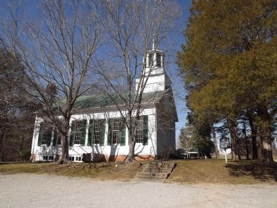
On Dancyville Methodist Church Road 0.2 miles south of Dancyville Road (Tennessee Route 179), on the right when traveling south.
This site was deeded for a church on April 1, 1835. The congregation was organized and a log structure built in 1837. The present church was completed in 1850. It was constructed of hand-sawed timber cut on the grounds. It survives as the oldest . . . — — Map (db m53098) HM
On February 1, 1865, Col. George Kirk, 2nd North Carolina Mounted Infantry (U.S.), left Newport, Tennessee, with 400 cavalry and 200 infantry for a raid into Haywood County. He passed through the mountains at Mount Sterling, following the . . . — — Map (db m12895) HM
On North Bells Street (Tennessee Route 88) at West Main Street, on the right when traveling north on North Bells Street.
In 1861, this place was called Cageville, a small hamlet at an important West Tennessee crossroads. The residents here and at nearby Bells (then called Bells Depot) largely supported the Confederacy. In April 1861, 170 volunteers formed what would . . . — — Map (db m156331) HM
On Dancyville Methodist Church Road 0.2 miles south of Dancyville Road ( Route 179), on the left when traveling south.
Born Oct. 6, 1793, in Sumner Co. Tenn. Married 1819 to Martha McGee, seven children. Private, War of 1812, enlisted Jan 28, 1814 in Capt. Allen Wilkinson's Company, discharged April 2, 1814. Established Bank of Fayette Co., president until death. . . . — — Map (db m53099) HM
On Tennessee Route 88 at Dr Conyers Road, on the right when traveling east on Tennessee Route 88.
One mile due north is the grave of this veteran of the Revolutionary War who enlisted in 1776, wintered at Valley Forge, served in numerous battles, afterwards fought Indians, and was honorably discharged at Pittsburgh. He moved to what is now . . . — — Map (db m56291) HM
On Jackson Street, on the right when traveling east.
Born a slave in Madison County, Samuel McElwee began teaching school in Haywood County at the age of 16. In 1882, he was elected to the Tennessee House of Representatives and one year later was graduated from Fisk University. The only African . . . — — Map (db m81465) HM
On East Main Street at East Main Street when traveling west on East Main Street.
The first brick Haywood County Courthouse was erected in 1844. In 1868, the Tennessee Supreme Court met in the west wing which was added for that purpose. — — Map (db m194105) HM
This is the final resting place of the parents and seven of nine siblings of James Knox Polk. Revolutionary War Major Samuel Polk and Jane Gracey Knox were married on Dec. 25th, 1794 at Hopewell Church, located in Mecklenburg County, North . . . — — Map (db m151180) HM
On 7th Avenue North north of Union Street, on the left when traveling north.
The tallest office building in Nashville was purchased from American General Life and Accident Insurance Company by the State of Tennessee on January 3, 1994.
It was originally built in 1970 as the National Life Center, home of the National Life . . . — — Map (db m166570) HM
On West Main Street (Tennessee Route 54) at North Wilson Avenue, on the right when traveling west on West Main Street.
Built in 1910 with $7500 donated by Scottish-born industrialist and philanthropist Andrew Carnegie, this building served as the county library for 82 years. In 1957 it became the Brownsville-Haywood County Library, part of Tennessee's regional . . . — — Map (db m194129) HM
On Hillview Circle east of South Main Street (Business U.S. 23), on the left when traveling south.
Col. William Holland Thomas (February 5, 1805-May 10, 1893) is among the Confederate officers and soldiers buried here in Greenhill Cemetery. His grave is located about thirty yards in front of you on the right.
Thomas, who began trading with . . . — — Map (db m75487) HM
Near Interstate 40 at Cold Spring Creek Road, on the right when traveling west.
Presented in memory and gratitude by thankful friends and citizens for a task accomplished against tremendous odds, by people who said, "it couldn't be done", "it was done."
His untiring efforts and forceful presentation to the legislators and . . . — — Map (db m256530) HM
Near South Washington Avenue at East Main Street, on the right when traveling north.
Before President Abraham Lincoln issued the Emancipation Proclamation on January 1, 1863, black men were forbidden to serve as U.S. soldiers. Eventually, more than 200,000 African Americans enlisted in U.S. Colored Troops regiments during the last . . . — — Map (db m194093) HM
After going east for college and west for law school, and serving in the Army Air Corps, John came home to New Richmond in 1950 to practice law with his father, brother Tom and cousin Warren.
In July 1960, John left New Richmond to move to . . . — — Map (db m147374) HM
Near South Washington Avenue at East Main Street, on the right when traveling north.
Brownsville's courthouse square resembled a battleground as residents and businesses suffered from repeated raids during the war.
Confederate raiders arrested two cotton brokers and four other Brownsville residents on July 25, 1862. A Memphis . . . — — Map (db m199328) HM