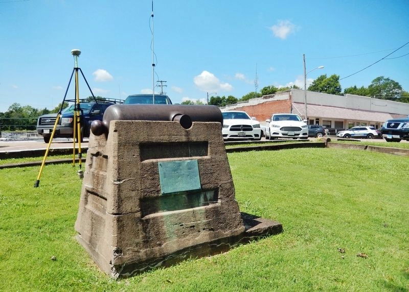
On South 5th Street just south of Court Street, on the left when traveling south.
Dedicated to the memory of Thirteen Hundred and Sixty-four Volunteers enlisted from Johnson County, Illinois, during the rebellion, 1861-65. Erected October 1, 1907, by Vienna Post 221, G.A.R. and Vienna Camp, 9, S. of V. Division . . . — — Map (db m186298) WM
On Main Street just south of West 2nd Street, on the right when traveling south.
From 1870 through the next hundred years, trains reigned in southern Illinois. The presence of natural resources — coal, timber and fertile farmland — led to the establishment of railroad lines to transport goods to distant markets. Communities . . . — — Map (db m312584) HM
On Roosevelt Street just south of Stonefort Road (County Highway 16), on the left when traveling south.
From 1870 through the next hundred years, trains reigned in southern Illinois. The presence of natural resources — coal, timber and fertile farmland — led to the establishment of railroad lines to transport goods to distant markets. Communities . . . — — Map (db m312994) HM
On Poplar Street east of S 5th Street, on the right when traveling east.
Early settlers of Johnson County included patriots of the Revolutionary War. With this Historical Marker we commemorate the following veterans.
Daniel Chapman - Born July 25, 1756 in Westchester County, New York. Daniel Chapman served the . . . — — Map (db m146585) HM WM
On Walnut Street (Illinois Route 149) west of 10th Street, on the right when traveling east.
On January 10, 1816, Jackson County, created from Randolph and Johnson counties, became Illinois' ninth county. It was named for General (later President) Andrew Jackson, hero of the Battle of New Orleans. The county's first seat, Brownsville, . . . — — Map (db m160952) HM
On Asp Avenue at West 1st Street, on the right when traveling south on Asp Avenue.
Walker Tower was constructed in 1966 during the final phase of President George Lynn Cross' plans to expand university housing to accommodate the enormous growth OU's student body had experienced during his tenure. Initially a part of Couch Center, . . . — — Map (db m276898) HM
On Fort Street (U.S. 16) near Adams Avenue, on the left when traveling west.
This marker is in the form of a timeline. The left to right timeline is presented here from top to bottom. Jenkins Family History is in italics text. Homesteading History is in normal text. History Milestones are in bold text.
1862: . . . — — Map (db m92236) HM
On North Main Street (Business U.S. 65) at West Rush Avenue, on the right when traveling south on North Main Street.
In memory of those who were killed in the Mountain Meadows Massacre, in September of 1857. Dedicated in 2020.
Modern historical research has yielded information which was not readily available to those who designed the 1955 monument. . . . — — Map (db m225251) HM
Thin black lines indicate changes in relevance. Between each pair of lines entries are ordered geographically but all have the same relevance.
* Inflectional forms of words are their plurals, singulars, and possessives as well as gramatical tenses and similar variations.