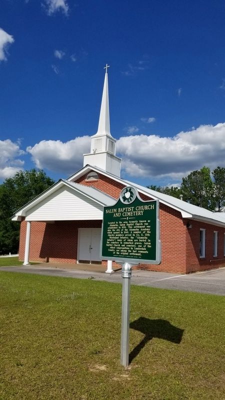
On Kewanee Road at Salem Church Road, on the right when traveling north on Kewanee Road.
Located in the area formerly known as Alamucha, Salem Baptist Church was established in 1838. This settlement was also the site of the Alamucha Academy which opened in 1840. A number of the church's members served in Co. E, 13th Mississippi . . . — — Map (db m173400) HM
On 25th Avenue at 5th Street, on the right when traveling south on 25th Avenue.
Charles Darden was president of the Mississippi
branch of the NAACP from 1955 to 1960 and one of
the founding fathers of the Meridian Freedom
Movement, which had its first headquarters in a
building on this site. Under Darden's leadership, . . . — — Map (db m312327) HM
On U.S. 190 at Oxford Cemetery Road (County Road 429), on the left when traveling east on U.S. 190.
As the primary burial ground for citizens of the Cottonwood community and the family of Garland Walker Ross (1807-1892) and Elizabeth Hodges Ross (1826- 1882), the Oxford Cemetery was in use as early as 1869.
The Ross family came to Texas . . . — — Map (db m245564) HM
On County Route 34 0.1 miles south of County Route 94, on the right when traveling south.
In 1824, settlers from the Carolinas built Old Pleasant Grove Primitive Baptist Church, the first church in the Cowpen Creek area and one of the earliest churches in Lauderdale County. Although the cemetery was likely established before the church . . . — — Map (db m236490) HM
On County Road 568 at County Road 51, on the left when traveling west on County Road 568.
The home-place of Bettie Anne Springer-Thornton lies 1.6 miles north on the east side of Lauderdale County Road 51. This home was originally a one-room log cabin, built between 1892 and 1894 by Levi Patrick Thornton. Two rooms and a dog-trot were . . . — — Map (db m141966) HM
On East Limestone Street at Carroll Ave N, on the right when traveling west on East Limestone Street.
The Alabama Territorial Legislature created Franklin County on
February 6, 1818, from lands ceded two years earlier by the
Chickasaw and Cherokee nations. The county was named in honor
of Benjamin Franklin. The first sheriff was James Frazier. . . . — — Map (db m285558) HM
On Main Street at King Street (Old Alabama Route 20), on the right when traveling north on Main Street.
FrontByler Road
Pioneer's settled path to new lands, agriculture, transport and commerce that began in Northwest Alabama.
140 mile corridor/route designated on December 19th, 1819 by the State Legislature. This was . . . — — Map (db m205287) HM
On Main Avenue at 1st Street, on the right when traveling south on Main Avenue.
Byler Road
Pioneer's settled path to new lands, agriculture, transport and commerce that began in Northwest Alabama.
140 mile corridor/route designated on December 19th, 1819 by the State Legislature. This was Alabama's first . . . — — Map (db m308392) HM
Thin black lines indicate changes in relevance. Between each pair of lines entries are ordered geographically but all have the same relevance.
* Inflectional forms of words are their plurals, singulars, and possessives as well as gramatical tenses and similar variations.