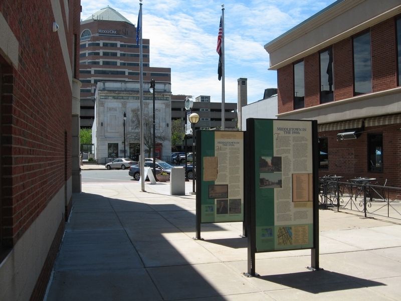
On Main Street at Court Street, on the right when traveling north on Main Street.
Middletown entered its golden era during the 1700s. By 1750, a century after its settlement, Middletown was the most populous and one of the richest towns in Connecticut.
The town owed its size and prosperity primarily to maritime trade. At . . . — — Map (db m98586) HM
On Pleasant Street at Main Street, on the left when traveling east on Pleasant Street.
By the end of the Civil War, one of every nine Middletown men wearing the Union uniform was dead. They included young David Lincoln, who gave his life in the Battle of Fredericksburg on December 13, 1862.
More than 900 soldiers and sailors . . . — — Map (db m98603) HM
On Main Street (Connecticut Route 154) at Sand Creek Drive, on the left when traveling south on Main Street.
General William Hart House, 1767 The General William Hart House, 1767, on the National Register of Historic Places, is a Living Symbol of our American Heritage. This Georgian colonial was built by a young man of means from a prominent family . . . — — Map (db m239187) HM
On Main Street at Pleasant Street, on the right when traveling south on Main Street.
Middletown
The area known as Mattabesett, home of the Wangunk Indian tribe, was settled by English colonists from Hartford and Wethersfield in 1650. Situated at the big bend in the Connecticut River, it was named Middletown because it lay halfway . . . — — Map (db m67814) HM
On Broad Street at William Street, on the left when traveling south on Broad Street.
On this site, on a spring evening in 1834, a violent mob descended on a small group of Middletown residents who had come together to work towards abolishing slavery. The abolitionists, both black and white citizens, were members of the newly . . . — — Map (db m71118) HM
On Main Street at Town Hall Drive, on the right when traveling north on Main Street.
Branford
In 1638 the New Haven Colony traded "eleven coats of trucking cloth and one coat of English cloth made in the English fashion" to the Mattabesec Indians for land known as Totokett (Tidal River). The First permanent settlement was . . . — — Map (db m35588) HM
On St. Johns Square at St. Johns Street, on the right when traveling east on St. Johns Square.
About 1650, a handful of English colonists began settling Middletown – then called by its Native American name, Mattabesseck or Mattabesett. The first colonists did not come directly from England, but from early New England settlements like . . . — — Map (db m98604) HM
On Vine Street at Washington Street, on the right when traveling south on Vine Street.
From the peak of the grassy hill behind these gates, Sowheag, leader of the Wangunks, could see for miles, observing the round-topped wigwams of his people in small settlements on both sides of the Connecticut River. The Wangunks called this area . . . — — Map (db m98684) HM
On Ferry Road, on the left when traveling west on Ferry Road.
(Upper middle photo)
At one time, the town of Chester had three train stations: (from south to north) Chester, North Chester, and Hadlyme-all of which would have been within sight of this location looking south.
This location is the . . . — — Map (db m266484) HM
On Washington Street at deKoven Avenue, on the right when traveling east on Washington Street.
Middletown became of the richest towns in all New England in the 1700s. during that time, thousands of ships loaded with local products like lumber, barrels, horses, pigs, corn, butter, and beef.
The ships sailed down the Connecticut River and . . . — — Map (db m98690) HM
On Broad Street (Alabama Route 28) at Fail Street, on the left when traveling north on Broad Street.
Joseph Morgan Wilcox was born on March 15, 1790 in Killingsworth, Middlesex County, Connecticut. He was the son of Revolutionary War officer, Joseph Wilcox and Phoebe Morgan. On June 15, 1808, Cadet Wilcox entered the U.S. Military Academy where he . . . — — Map (db m68159) HM
On South Main Street at Pleasant Street, on the left when traveling east on South Main Street.
In 1756, this simple structure was the birthplace of one of New England's leading craft dynasties, the Danforth family of pewterers. For nearly a century, three generations of Danforth men fashioned everything from plain plates to graceful . . . — — Map (db m98550) HM
On Main Street at Court Street, on the right when traveling north on Main Street.
The 1800s brought enormous change to Middletown, transforming its economy, its culture, and the very face of its people.
The changes began in 1807, when hostilities between the United States and Great Britain led Thomas Jefferson to ban . . . — — Map (db m98587) HM
On Main Street at Court Street, on the right when traveling north on Main Street.
The 20 century transformed Middletown as completely as the previous one had. The stream of immigrants that began in the mid-1800s now became a flood. Between 1900 and 1910, Middletown's population grew from 17,464 to 21,000 – a 20 percent . . . — — Map (db m98588) HM
On Washington Street at Main Street, on the left when traveling east on Washington Street.
This fine post-and-beam house has been home to numerous prominent Middletown figures since it was originally built in the 1750s. In 1777, Jehosaphat Starr, Jr. left this house, his birthplace, to become a Revolutionary War soldier. Within a few . . . — — Map (db m310861) HM
On Cross Street (Virginia Route 227) just south of Virginia Street ( Route 602), on the right when traveling south.
Welcome to Urbanna, Virginia
Along this walking tour you will find illustrated panels presenting many lively stories and facts about the town, its buildings, its residents and their lives. Urbanna's origin goes back to June 1680, when . . . — — Map (db m186685) HM
On Broad Street at Court Street, on the right when traveling south on Broad Street.
Bbr>Within these brownstone walls, choirs sang hymns, teenagers learned astronomy, and – eventually – Middletown residents of all ages borrowed books.
Although this building has housed the Russell Library for well over a century, it . . . — — Map (db m71116) HM
On Main Street (Connecticut Route 154) at Sand Creek Drive, on the left when traveling south on Main Street.
Dedicated to Preserving, Protecting and Promoting the History of Old Saybrook
Frank Stevenson Archives
Frank Stevenson (1912-1997) Frank Stevenson, a lifelong Saybrook resident, tended the lawns, plants, houses and people of the North . . . — — Map (db m181142) HM
On Massachusetts Avenue (Route 2A) at Garden Street, on the right when traveling south on Massachusetts Avenue.
Newtowne
One of the Neatest and Best Compacted Towns
So wrote William Wood in New England's Prospect in 1633. At this time, sixty families occupied the first planned community in America, in which the houses were required to . . . — — Map (db m215372) HM
On Mount Auburn Street west of John F. Kennedy Street, on the right when traveling east.
The Founding of Newtowne
Massachusetts Bay Colony
The Puritans of Lincolnshire and East Anglia, England, in anticipation of their emigration to New England, organized the Massachusetts Bay Company in 1628, and obtained a grant of the . . . — — Map (db m215331) HM
Thin black lines indicate changes in relevance. Between each pair of lines entries are ordered geographically but all have the same relevance.
* Inflectional forms of words are their plurals, singulars, and possessives as well as gramatical tenses and similar variations.