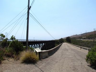
Near U.S. 101 3.5 miles east of Mariposa Reina, on the right when traveling east.
Arroyo Hondo creek has the best habitat on the south coast of Santa Barbara County for the endangered Southern California Steelhead (Oncorhynchus mykiss). This native fish spends part of its life in freshwater streams like this one, and part . . . — — Map (db m71951)
On East 6th Street (Kansas Route 9) at Lincoln Street (U.S. 81), on the right when traveling east on East 6th Street.
Anna was the daughter of William Kinslow and Kitty Doherty of Connecticut. Kitty gave birth to her daughter in Manhattan, New York, and placed her daughter in the New York Foundling Hospital (NYFH). Anna was a part of a company of 40 children sent . . . — — Map (db m185872) HM
The Santa Barbara County Courthouse is one of America's finest representations of
Spanish-Andalusian architecture in a public structure. It stands as the prized jewel
of the county whose people it serves and whose visitors it delights. After . . . — — Map (db m135171) HM
Near San Julian Road 0.5 miles south of California Route 1.
History of ...
Chumash Indian Village—For many centuries prior to the arrival of the Spanish in the late 1700s, Santa Barbara County was home to a large Chumash Indian population. Valleys such as this one were often the . . . — — Map (db m67196) HM
Santa Barbara County Courthouse has been designated a National Historic Landmark. This courthouse complex possesses national
significance in commemorating the history of the
United States Of America
The Santa Barbara County Courthouse . . . — — Map (db m135167) HM
Near South Broadway (State Highway 135) south of West Main Street, on the right when traveling south.
On this site September 28, 1905 representatives of the Masonic Grand Lodge of California convened to place the cornerstone of the first Masonic temple in Santa Barbara County.
Among those famous representatives present were Edward H. Hart, acting . . . — — Map (db m162353) HM
Near Victory Boulevard 0.8 miles west of Valley Circle Boulevard, on the right when traveling west.
The Upper Las Virgenes Canyon Open Space Preserve was part of the 113,000-acre Rancho San Jose de
Gracias de Simi tract granted to Javier, Miguel and Particio Pico by the King of Spain in 1795. The Rancho,
which was later transferred to Jose . . . — — Map (db m196844) HM
On Laguna Street at E. Los Olivos Street, on the right when traveling north on Laguna Street.
This clothes washing basin or lavanderia was built by the Chumash Indians of
Santa Barbara Mission village in 1808. Not all missions built such a structure.
The Chumash particularly valued cleanliness and worked to construct this
lavanderia . . . — — Map (db m135254) HM
On Maricopa Highway at Ojai Avenue, on the right when traveling west on Maricopa Highway.
Pat and her husband Larry moved from Akron, Ohio, to Ojai in 1968.
She soon began her work to shape the future of the Ojai Valley
for the better, including:
Preservation by Act of Congress of 3,500 acres around Lake
Casitas (which had . . . — — Map (db m252812) HM
Near Los Carneros Road 0.3 miles north of U.S. 101, on the right when traveling north.
On this site stands Goleta Depot, an enduring tribute to many who, with generous gifts of love, time, and resources made possible its acquisition, restoration, and maintenance as Santa Barbara County Landmark No. 22.
Built in 1901 near . . . — — Map (db m176316) HM
Thin black lines indicate changes in relevance. Between each pair of lines entries are ordered geographically but all have the same relevance.
* Inflectional forms of words are their plurals, singulars, and possessives as well as gramatical tenses and similar variations.