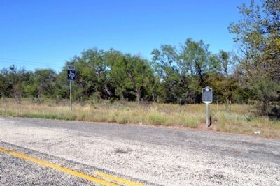
On Farm to Market Road 1086 0.1 miles west of U.S. 277, on the right when traveling west.
Near this site, an important link in the frontier transportation system was an area landmark. The Butterfield Overland Mail maintained a stage stop at the falls and crossing of Valley Creek beginning in 1858. The twice-weekly mail and passenger line . . . — — Map (db m77995) HM
On Main Street at N. 6th Street, on the right when traveling east on Main Street.
Colonel John Griffith
(1831-1889)
Confederate officer in Civil War. Learned at War’s end that women and children of family had fled from Arkansas to Texas in open wagon drawn by a milch cow and a one-eyed mule. The missing were found in 1866, as . . . — — Map (db m102800) HM
On Oak Street at South 4th Street, on the right when traveling north on Oak Street.
Known throughout West Texas as “a city within itself,” Thornton’s Store was one of Abilene’s leading businesses for nearly seven decades. E.L. Thornton (1896-1964) moved to Abilene from Arkansas in 1919, after service in World War I. He opened a . . . — — Map (db m79730) HM
Near Barrow Street 0.1 miles south of S. 7th Street.
Mustered into service during World War I, July 16, 1917, at Abilene with officers, Capt. R.M. Wagstaff; 1st Lt. A.J. McDavid; 2nd Lt. E.B. Sayles; and 1st Sgt. Elmer C. Stearns. Company had 139 enlisted men from the area who trained here at the . . . — — Map (db m78969) HM
On Drummond Cemetery Road (County Road 316) 0.4 miles north of Butterfield School Road (County Road 290), on the right when traveling north.
In 1879, after her husband’s death in Jamaica, Helen Fanny Harris Drummond returned with her children to England. She immigrated with them to the United States in 1885, settling in Brazos County, Texas. In October 1891, she purchased 100 acres in . . . — — Map (db m77654) HM
On South Lamar Street at West Olive Street, on the right when traveling north on South Lamar Street.
First known Eastland area inhabitant was Frank Sanchez (d. 1867), who grazed herds here in the 1850s. The United States in 1853 established Army posts at Fort Phantom Hill, in present Taylor County, and Fort Belknap, in present Young County, giving . . . — — Map (db m105242) HM
On Vinson Road (County Road 114) 0.9 miles east of Farm to Market Road 1750, on the left when traveling east.
Founded in 1881, the city of Abilene became a regional economic center, yet civic boosters believed that the discovery of oil and gas in the area had the potential to advance the area’s economy and population even further. Significant oil . . . — — Map (db m77768) HM
Near Sam Houston Street north of Avenue C, on the right when traveling north.
(Panel One)
Thomas T. Perry
(1853-1943)
Thomas T. Perry was born March 12, 1853 in Murfreesboro, Tennessee. He came to San Antonio, Texas, as a young man, learning the craft of stone while masonry working for the Southern . . . — — Map (db m94577) HM
On North 1st Street at Pine Street, on the right when traveling west on North 1st Street.
When the young railroad town of Abilene incorporated in 1883, the first city officials desired to project a more civilized image to visitors and new settlers, as the new town had already developed a lawless reputation since its 1881 founding. . . . — — Map (db m85803) HM
President Franklin D. Roosevelt and the U.S. Congress created the Civilian Conservation Corps (CCC) in 1933 to provide jobs on public lands for unemployed workers, specifically young men and World War I veterans. Quick to recognize the benefits of . . . — — Map (db m79332) HM
On Farm to Market Road 604 2.4 miles east of U.S. 84, on the left when traveling east.
At the height of Cold War tensions between the United States and the Soviet Union, development of intercontinental ballistic missiles (ICBMs) with nuclear warheads embodied military might. Convair's Atlas missile program, selected by the U.S. Air . . . — — Map (db m239792) HM
Thin black lines indicate changes in relevance. Between each pair of lines entries are ordered geographically but all have the same relevance.
* Inflectional forms of words are their plurals, singulars, and possessives as well as gramatical tenses and similar variations.