16 entries match your criteria.
Grant’s March Through Louisiana Historical Markers
This series of markers were erected in 1962 by the Louisiana Civil War Centennial Commission in Madison and Tensas Parishes.
By Duane Hall, May 26, 2015
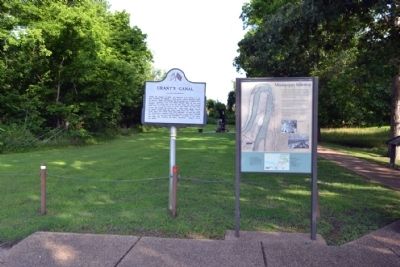
Grant's Canal and Mississippi Sidestep Markers
| Near Old Highway 80 East at Stafford Drive, on the left when traveling south. |
| On Thomastown Road at Ashley Plantation Road, on the left when traveling north on Thomastown Road. Reported missing. |
| On Old U.S. Highway 65 (State Highway 603) 1.2 miles south of Lee Street, on the left when traveling south. |
| On State Highway 602 at Crescent Plantation Drive, on the right when traveling east on State Highway 602. |
| On Thomastown Road at Ashley Plantation Road, on the left when traveling north on Thomastown Road. |
| On Old U.S. Highway 65 (State Highway 603) 1.2 miles south of Lee Street, on the left when traveling south. |
| On North Cedar Street (U.S. 65) at Depot Street, on the right when traveling south on North Cedar Street. |
| On Highway 605 at Highway 608, on the left when traveling south on Highway 605. |
| On Highway 605 at Highway 608 on Highway 605. |
| On State Highway 605, 0.5 miles south of State Highway 888, on the right when traveling south. |
| On State Highway 605, 0.6 miles south of State Highway 608. |
| On U.S. 65 at State Highway 898, on the right when traveling south on U.S. 65. |
| On State Highway 608, 3 miles east of State Highway 605, on the right when traveling east. |
| On Second Street near Hancock Street. |
| On Second Street near Hancock Street. |
| On State Highway 605 north of Arceneaux Road, on the left when traveling north. |
Jun. 16, 2024