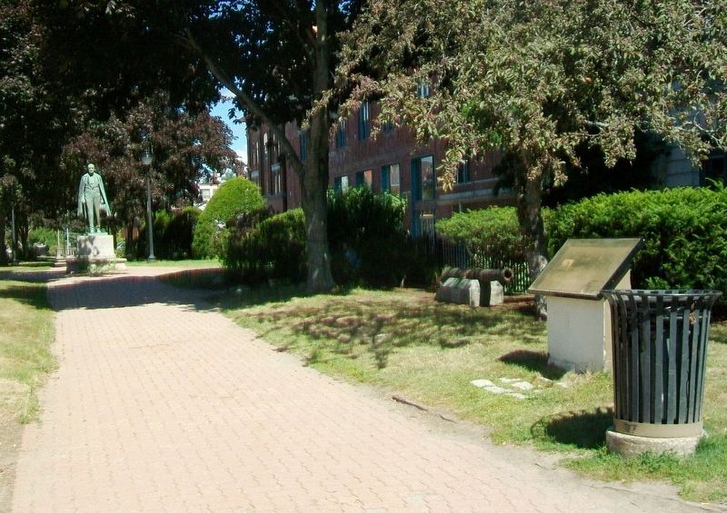
On Hammond Street/State Street (U.S. 2) at Kenduskeag Stream, on the left when traveling east on Hammond Street/State Street.
Long before the arrival of the first settlers, this area of the Kenduskeag served as a travel route and encampment site for Native Americans, hunters, trappers and explorers, and the young village of Condeskeag grew in the late 18th century . . . — — Map (db m110593) HM
On Main Street (U.S. 202) at Cedar Street, on the left when traveling north on Main Street.
Here, on August 22, 1943, fifty six 17 year old volunteers
enlisted in the U.S. Navy. They were the largest group from Maine
to enlist in the Navy during World War II
Gilbert T. Soucy · Killed in Action
[Victory Platoon Members and . . . — — Map (db m110563) HM WM
On Thomas Hill Road 0.1 miles south of Ohio St., on the right when traveling south.
The Thomas Hill standpipe was designed by Ashley B. Tower of Tower and Wallace of New York and Holyoke, Mass. and built in 1897 by Major James M. Davis on land once owned by the Thomas brothers. Using a portable sawmill and blacksmith shop erected . . . — — Map (db m175789) HM
On Harlow Street at Franklin Street, on the right when traveling west on Harlow Street.
Mabel Derrick, Edith Johnson & Blanche Dymond supported suffrage & their community through the Mothers Clubs
& The Household of Ruth — — Map (db m288452) HM
On Western Avenue north of Lake Avenue, on the right when traveling north.
Killed near the mouth of the
Red River, Louisiana, while
in the service of his country,
commanding U.S. Gunboat Gazelle
Nov. 26, 1864,
Aged 27 Years. — — Map (db m110698) WM
On Riverside Avenue at Monument Avenue, on the left when traveling north on Riverside Avenue.
In memory of
our citizen soldiers
who died for
their country.
Consecrated 1864.
[Roll of Honored Dead]
Rev. Chs. D. Jameson • Wm. J. Deane • Edward F. Orff
Lewis L. Marsh • Jas. L. Rowe • Wm. P. Holden
Wm. Jordan • Ransom Wharton . . . — — Map (db m110678) WM
On North Avenue at Cedar Avenue, on the right when traveling north on North Avenue.
This fort was built by patriotic donors in 1907 to honor veterans of the Grand Army of the Republic. It was rebuilt in 1985 with funds bequeathed by Luther H. Peirce, a member of the Second Maine Regiment of Volunteers in the Civil War. . . . — — Map (db m110720) WM
On Hammond Street/State Street at Kenduskeag Stream (U.S. 2), on the left when traveling east on Hammond Street/State Street.
Speaker - of - Maine - House
Member - of - Congress
United - States - Senator
Governor - of - Maine
Vice President with Lincoln
Minister - to - Spain
Erected 1927 by Public Contribution — — Map (db m110584) HM
On Harlow Street (U.S. 2) north of State Street (U.S. 2), on the right when traveling north.
This 1800 pound bell was cast by the Clinton H. Meneely Bell Co., Troy, New York for installation in the Hersey Memorial Building (Old Bangor City Hall) where it was dedicated on July 4, 1894.
At the dedication each councilman pulled the bell . . . — — Map (db m110570) HM
On Perry Road west of Webster Avenue, on the left when traveling east.
This memorial is to honor
All Korean War Veterans
with special tribute
to Maine Congressional
Medal of Honor recipients
Cpl. David B. Champagne
Cpl. Clair Goodblood
Sgt. George D. Libby
Maj. Charles J. Loring, Jr.
Col. Lewis L. . . . — — Map (db m106944) WM
On Eastern Avenue south of Mount Hope Avenue, on the left when traveling south.
(Front)
They Gave Their Lives Fighting For Freedom
Medal of Honor Recipients
Cpl Clair Goodblood Army
Cpl David B Champagne USMC
Sgt George D Libby Army
Maj Charles J Loring Jr USAF
[Remaining Roll of Honored . . . — — Map (db m110728) WM
Born in
Shrewsbury Mass.
Nov. 19, 1752,
Died in
Bangor Me.
May 21, 1844.
He served in the War of the Revolution as
Lieutenant in the 5th Regiment of Massachusetts;
and in grateful memory of that service the . . . — — Map (db m110692) HM WM
On Main Street (U.S. 1A/202) near Emerson Street, on the left when traveling north.
This statue, reputed to be the largest of Paul Bunyon in the world, stands facing the Penobscot River. The legendary giant woodsman is a symbol of the great era in the late 1800's when Bangor, Maine was acclaimed to be "The Lumber Capitol of the . . . — — Map (db m4938) HM
On Main Street (U.S. 1A) north of Bass Park Boulevard, on the right when traveling south. Reported permanently removed.
• This permament statue of Paul Bunyon, 31 feet tall and weighing 3700 pounds is made of reinforced fiberglass and internally braced with steel. It stands on a solid concrete foundation the top of which is 6 feet above ground level. Built into the . . . — — Map (db m242468) HM
On Hammond Street/State Street (U.S. 2) at Kenduskeag Stream, on the left when traveling east on Hammond Street/State Street.
Near this spot
in the year 1604
Samuel de Champlain
Gallant pioneer
and intrepid explorer
made a landing on his voyage
up the Penobscot River — — Map (db m110599) HM
Not painlessly doth God recast
and mould anew the nation
Second Maine Regiment
of Volunteers
Battle Record • July 1861 - May 1863
Bull Run · Yorktown · Hanover Court House
Gaines' Mill · Malvern Hill · Manassas-2nd Bull Run . . . — — Map (db m110628) WM
On Hammond Street/State Street (U.S. 2) at Kenduskeag Stream, on the left when traveling east on Hammond Street/State Street.
Cast at Seville, February 9, 1787.
Dismounted from Fort Toro, Guantanamo Bay, Cuba.
— in bombardment by —
U.S. Navy, June 15th, 1898.
Recovered June 7th, 1899, by
Lieut. Commander Frank E. Fletcher,
commanding U.S.S. Eagle . . . — — Map (db m110600) HM WM
On Main Street (U.S. 202) at Cedar Street, on the left when traveling north on Main Street.
To the memory of
the Soldiers and Sailors
of
the Spanish-American War
1898
—————————
Shield and Scrolls
recovered from wreckage
of U.S.S. Maine
Blown up Havana Harbor, Cuba . . . — — Map (db m110559) WM
On Franklin Street 0.1 miles north of Hammond Street (U.S. 2), on the right when traveling north.
Dedicated to all who have made
the supreme sacrifice
for their country
Sponsored by and erected
through the efforts of
Norman N. Dow Post
Veterans of Foreign Wars
of the United States
and the generosity of
the Citizens of . . . — — Map (db m110601) WM
On Perry Road west of Webster Avenue, on the left when traveling east.
(Front)
World War II Memorial
1941-1945
Dedicated to the more that 112,000
Mainers who served in that war
2,551 gave their lives for our freedom
The jeep was a vehicle universal to all
branches of the U.S. Armed Services
(Side) . . . — — Map (db m62466) WM
Near North Main Street (Maine Route 178) at State Street, on the right when traveling south.
Chamberlain - Freedom Park commemorates Major General Joshua Lawrence Chamberlain. General Chamberlain won the Congressional Medal of Honor for his heroic Civil War defense of Little Round Top Hill at Gettysburg. He was chosen to accept the . . . — — Map (db m208131) HM
Near North Main Street (Maine Route 178) at State Street ( Route 15B), on the right when traveling south.
Site of the
John Holyoke House
Built 1811, Dismantled 1997
Dedicated 1997
Brewer Historical Society's
Chamberlain Freedom Park
In honor of
General Joshua L. Chamberlain
Maine's Official Memorial to the . . . — — Map (db m208092) HM
Near Western Avenue (New York State Route 9) (U.S. 202) near Old Highway, on the right when traveling east.
Previously called the Luce Cemetery, and later the Mount Harris Cemetery, the current Dixmont Corner Cemetery is the original public burial ground for the town of Dixmont. The Luce Cemetery was reportedly used for re-interments from the Methodist . . . — — Map (db m148384) HM
On Western Avenue (U.S. 202) east of Lillians Lane, on the right when traveling east.
The Dixmont Town House was built in 1836, probably by Rowland Tyler (1780-1872), one of Dixmont's original settlers. Mr. Tyler is the documented builder of the Dixmont Corner Methodist Church, formerly known as the Union Church, built in 1834-1835, . . . — — Map (db m136999) HM