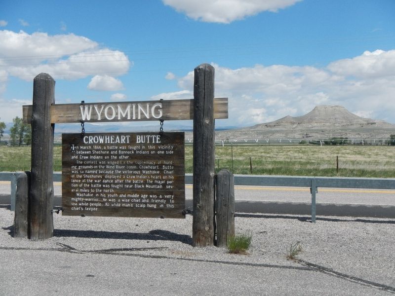
On U.S. 287 near Sand Draw Road, on the left. Reported permanently removed.
In March, 1866, a battle was fought in this vicinity between Shoshone and Bannock Indians on one side and Crow Indians on the other.
The contest was waged for the supremacy of hunting grounds in the Wind River basin. Crowheart Butte was so . . . — — Map (db m305429) HM
On U.S. 287 near U.S. 26, on the left when traveling west.
Portions of the High Plains were not settled until the early 20th century because water was needed for irrigation. Responding to pressure for Western settlement, Congress created the Reclamation Service in 1902. Its purpose was to develop water . . . — — Map (db m96242) HM
On U.S. 287 near U.S. 26, on the left when traveling west.
On the wind-blown mountain slopes south and west of Dubois winters the world’s largest herd of Rocky Mountain bighorn sheep. The bighorn once was found throughout all mountain habitats of the Rockies: today its range is but a remnant. The . . . — — Map (db m96241) HM
On 2nd Street at Washakie Street, on the left when traveling west on 2nd Street.
In Memory of Those Who Made the Supreme Sacrifice in World War II
Sherman Redman • Lee Wadda • Gordon E. Burt • Elwin Elmer • George W. Antelope • Claude Goggles • William Trosper • Loren McC. Frank • Richard Pogue • Louis Bishop • John L. Brown . . . — — Map (db m96240) WM
On Cemetery Lane near Trout Creek Road, on the left when traveling north.
Sacred to the Memory of
Mrs. Maggie Richards
and
Mrs. Hall
Pioneer White Settlers
Killed July 23rd, A.D. 1873
by a raiding band of hostile Sioux Indians
in their ranch home
on the site of
the present city of . . . — — Map (db m96197) HM
On Cemetery Lane 0.5 miles north of Trout Creek Road, on the left when traveling north.
Sacajawea Died April 9, 1894
A guide with the Lewis and Clark Expedition
1805-1806
Identified, 1907 by Rev. J. Roberts who officiated at her burial
Dedicated in the memory of
Baptiste Charbonneau Papoose of the . . . — — Map (db m96168) HM
Near Cemetery Lane near Trout Creek Road, on the left when traveling north.
Burial Register on File at Roberts Mission Pages 114-115 Day: 1884 • Date: April 9 • No.: 10 • Names: Bazil's Mother (Shoshone) • Age BCC: 100 • Residence: Shoshone Agency • Cause of Death: Old Age • Place of Burial: Burial ground Shoshone Agency • . . . — — Map (db m96203) HM
Near Cemetery Lane near Trout Creek Road, on the left when traveling north.
This cemetery is named for the Shoshone woman who became an invaluable guide, interpreter and translator to the Lewis and Clark Expedition.
Fifteen year old Sacajawea accompanied her husband, fur trader Charbonneau, when he joined the Corps of . . . — — Map (db m96202) HM
On Cemetery Lane near Trout Creek Road, on the left when traveling north.
This tablet is erected to the memory of
The Right Rev. George Maxwell Randall, D.D.
Bishop of Colorado, Wyoming, and New Mexico. Born Nov. 23, 1810. Died Sept. 28, 1873. Who held his last service in this building on its former site at . . . — — Map (db m96201) HM
On Trout Creek Road near Cemetery Lane, on the left when traveling west.
This school was founded by the Reverend John Roberts. Born in Wales, in 1853, Roberts was for 66 years a missionary to the Shoshones.
"Our hope is in the children and the young people, the old people can't hear!" So spoke Washakie, Chief of . . . — — Map (db m96167) HM
On North Fork Road near Black Coal Drive, on the right when traveling west.
The Great Shoshone Chief, a skilled hunter, strategist, and warrior against his tribal enemies was noted for his friendship towards the white man. He united his people. He was born about 1804 and died February 20, 1900. Shoshone Indian Reservation . . . — — Map (db m96204) HM