On South Church Street (Maryland Route 17) 0 miles south of Washington Street, on the left when traveling south.
Eight thousand Confederates under Gen. Lafayette McLaws marched by this church on September 10-11, 1862, heading south to Harper’s Ferry. Since no Federals were in the area, McLaws expected no encounters with the enemy. Unknown to him, however, . . . — — Map (db m166869) HM
On West Main Street (Alternate U.S. 40) at Elm Street, on the left when traveling west on West Main Street.
When Gen. Robert E. Lee and part of the Army of Northern Virginia passes through Middletown on September 10–11, 1862, they encountered a chilly reception. The inhabitants of this single-street hamlet on the National Road loved the Union, and . . . — — Map (db m21911) HM
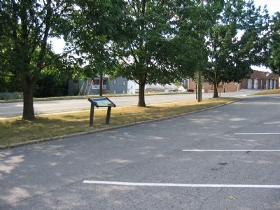
On Old National Pike (Alternate U.S. 40), on the right when traveling west.
Civil War Hospital Site
The Henry Shoemaker House was used as a hospital site during the Maryland Campaign 1862.
Private Property courtesy of S.H.A.F — — Map (db m4953) HM
On Old National Pike (Alternate U.S. 40) at Washington Monument Road, on the right when traveling east on Old National Pike.
Fresh from victory at the Second Battle of Manassas, Gen. Robert E. Lee's Army of Northern Virginia crossed the Potomac River on September 4-6, 1862, to bring the Civil War to Northern soil and to recruit sympathetic Marylanders. Union Gen. . . . — — Map (db m1520) HM
On Old National Pike (Alternate U.S. 40) at Washington Monument Road, on the right when traveling east on Old National Pike.
The Battle of South Mountain erupted on September 14, 1862, when elements of the Union army tried to drive the Confederate rear guard from Crampton’s, Fox’s, and Turner’s Gaps and break through to the western side of the mountain to attack . . . — — Map (db m1519) HM
On Old National Pike (Alternate U.S. 40) at Washington Monument Road, on the right when traveling east on Old National Pike. Reported permanently removed.
An unnamed citizen of Frederick City said the following of the Confederates he had beheld marching through his hometown: “I have never seen a mass of such filthy strong-smelling men. Three in a room would make it unbearable, and when marching in . . . — — Map (db m1521) HM
On Old National Road (Alternate U.S. 40) at Washington Monument Road, on the right when traveling west on Old National Road.
Between September 4th and 7th, 1862, the Army of Northern Virginia, General Robert E. Lee, commanding, crossed the Potomac near Leesburg and occupied Frederick, Maryland. On the 10th a movement was made to surround and capture the Union forces at . . . — — Map (db m1594) HM
On Old National Road (Alternate U.S. 40) at Washington Monument Road on Old National Road.
In the advance of the Union forces to repel the invasion of Maryland by the Confederates, the Army of the Potomac commanded by Major General Geo. B. McClellan, moved northward from Washington with its front extending from near the Baltimore and Ohio . . . — — Map (db m1595) HM
On Old National Road (Alternate U.S. 40) at Washington Monument Road, on the right when traveling west on Old National Road.
Hill's five brigades were encamped at and around Boonsboro to prevent the escape of the Union forces at Harper's Ferry, through Pleasant Valley. Informed that two Union brigades were approaching Turner's Pass, Hill, on the evening of September 13, . . . — — Map (db m1596) HM
On Old National Road (Alternate U.S. 40) at Washington Monument Road, on the right when traveling west on Old National Road.
Cox’s Division of the Ninth Corps moved from Middletown at 6 A. M., September 14, by the Frederick and Hagerstown Pike, turned to the left at Koogle’s Mill, on the Catoctin, nearly four miles southeast of this, and, marching on the old Sharpsburg . . . — — Map (db m1597) HM
On Old National Road (Alternate U.S. 40) at Washington Monument Road, on the right when traveling west on Old National Road.
During the contest at Fox's Gap, Hooker's (First) Corps was operating east and northeast of this point. The First Corps left the Monocacy at daybreak, passed through Frederick and Middletown and between 3 and 4 P. M., leaving Gibbon's Brigade on the . . . — — Map (db m1598) HM
On Old National Pike (Alternate U.S. 40) at Washington Monument Road, on the right when traveling west on Old National Pike.
When Hooker moved to the right at Bolivar by way of the Hagerstown road, Gibbon continued on the main road and attacked Colquitt, in position about 700 yards southeast of this point. He drove Colquitt's skirmishers and reached the bend in the road . . . — — Map (db m1599) HM
On Old National Pike (Alternate U.S. 40) near Washington Monument Road, on the right when traveling west.
On September 4, 1862, General Robert E. Lee, hoping to shorten the war by winning a decisive victory on Northern soil, crossed the Potomac River into Maryland. Lee planned to draw the Army of the Potomac through South Mountain into Pennsylvania and . . . — — Map (db m2040) HM
On Reno Monument Road at the Appalachian Trail, on the left when traveling west on Reno Monument Road.
On September 4, 1862, General Robert E. Lee, hoping to shorten the war by winning a decisive victory on Northern soil, crossed the Potomac River into Maryland. Lee planned to draw the Army of the Potomac through South Mountain into Pennsylvania and . . . — — Map (db m2041) HM
On Reno Monument Road at the Appalachian Trail, on the left when traveling west on Reno Monument Road.
No other document of the Civil War has generated so much controversy as Lee's Special Orders No. 191. These “Lost Orders” detailed the movements of Lee's army for the operation against Harpers Ferry. On September 9 Lee sent copies of the order to . . . — — Map (db m2042) HM
On Reno Monument Road near the Appalachian Trail, on the left when traveling west.
The fight for Fox’s Gap on September 14, 1862, claimed the lives of two generals, one from each side. Confederate Gen. Samuel Garland, a Lynchburg, Virginia native, attended the Virginia Military Institute at Lexington and later obtained his law . . . — — Map (db m455) HM
On Reno Monument Road at the Appalachian Trail, on the right when traveling west on Reno Monument Road.
More than 90,000 Michigan men served in the Union Army and Navy during the Civil War. The 17th Michigan Volunteer Infantry Regiment was mustered at the Detroit Barracks in August 1862 under the command of Colonel William H. Withington. The . . . — — Map (db m158389) HM
On Reno Monument Road at the Appalachian Trail, on the left when traveling west on Reno Monument Road.
(front)
9th Army Corps.
September 14, 1862.
Reno.
(west side)
This monument marks the
spot where Major Gen. Jesse Lee Reno,
commanding 9th Army Corps U.S. Vol’s,
was killed in battle Sept. 14, 1862.
(south . . . — — Map (db m158614) WM
On Reno Monument Road at the Appalachian Trail, on the left when traveling west on Reno Monument Road.
As Confederate Gen. D.H. Hill’s division struggled to hold the gaps of South Mountain on September 14, 1862, the fighting here at Fox’s Gap raged throughout the day. About 9 a.m., Gen. Jesse L. Reno’s corps attacked Confederate Gen. Samuel . . . — — Map (db m454) HM
On Reno Monument Road at the Appalachian Trail, on the left when traveling west on Reno Monument Road.
Near here in Wise's field on the morning of Sept. 14, 1862, Brigadier General Samuel Garland, Jr. C.S.A. of Lynchburg, Virginia fell mortally wounded while leading his men. — — Map (db m429) HM
Near South Mountain Natural Environmental Area Service, on the right when traveling south.
(Front Side): In Memory of the North Carolinians who fought at or near here September 14, 1862. The 1st, 2nd, 3rd, 4th, 5th, 6th, 12th, 13th, 14th, 15th, 20th, 23rd, 30th Infantry and Manly's and Reilly's Battery, 1st NC Artillery. . . . — — Map (db m4325) HM WM
Fresh from victory at the Second Battle of Manassas, Gen. Robert E. Lee’s Army of Northern Virginia crossed the Potomac River on September 4-6, 1862, to bring the Civil War to Northern soil and to recruit sympathetic Marylanders. Union Gen. George . . . — — Map (db m5923) HM
On the West Welcome Center and Rest Area (Interstate 70) near Exit 42 (Maryland Route 17), on the right when traveling west. Reported permanently removed.
Fresh from victory at the Second Battle of Manassas, Gen. Robert E. Lee’s Army of Northern Virginia
crossed the Potomac River on September 4-6, 1862,
to bring the Civil War to Northern soil and to recruit
sympathetic Marylanders. Union Gen. . . . — — Map (db m167359) HM