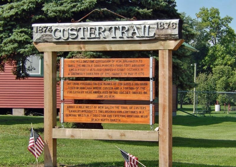
Near 8th Street North 0.7 miles south of Interstate 94, on the right when traveling south.
The Yellowstone Expedition of 1876, organized to quell the hostile Sioux, marched from Fort Abraham Lincoln May 17, 1876, and camped a short distance in a southerly direction of this marker on May 19, 1876. The trail extends to the banks of the . . . — — Map (db m234874) HM
On Main Street West at Dagnault Avenue, on the left when traveling west on Main Street West.
The Yellowstone Expedition of 1876, organized to quell the hostile Sioux, marched from Fort Abraham Lincoln May 17, 1876, and camped about eight miles west of this marker on May 24, 1876. Custer’s Calvary route passes three miles south of Taylor, . . . — — Map (db m234897) HM
On Main Street North at 4th Avenue Northwest, on the left when traveling north on Main Street North.
The Yellowstone Expedition of 1876, organized to quell the hostile Sioux, marched from Fort Abraham Lincoln May 17, 1876, and camped about three miles south of Belfield on May 26, 1876. From this campsite Custer’s route extends south to the . . . — — Map (db m234870) HM
On Pacific Avenue at 3rd Street, on the left when traveling west on Pacific Avenue.
The Yellowstone Expedition of 1876, organized to suppress the hostile Sioux, marched from Fort Abraham Lincoln May 17, 1876.
The Expedition camped at the junction of Davis Creek and the Little Missouri River, four miles south of Medora on May . . . — — Map (db m154256) HM
On 4th Street Northeast (State Highway 16) just east of North Central Avenue, on the left when traveling east.
The Yellowstone Expedition of 1876 organized to quell the hostile Sioux marched from Fort Abraham Lincoln May 17, 1876 and passed within three fourths of a mile to the south of this marker on June 3, 1876. Between Sentinel Butte and Beach . . . — — Map (db m202891) HM