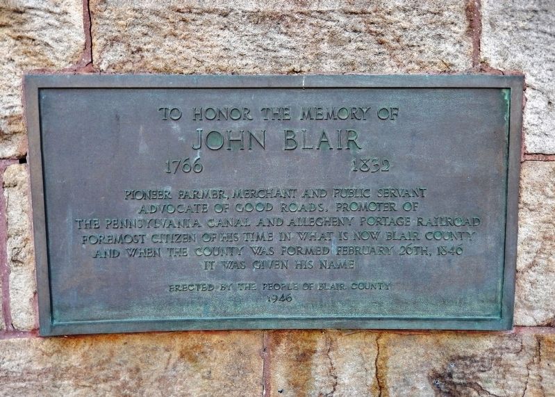
Near Union Street north of Allegheny Street, on the left when traveling north.
To honor the memory of John Blair 1766-1832 Pioneer farmer, merchant and public servant advocate of good roads, promoter of the Pennsylvania Canal and Allegheny Portage Railroad foremost citizen of his time in what is now Blair County and when . . . — — Map (db m162042) HM
On Allegheny Street at Union Street, on the right when traveling west on Allegheny Street.
Formed on February 26, 1846 from Bedford and Huntingdon counties. Named for the Honorable John Blair, a prominent citizen who died in 1832. Hollidaysburg, county seat, was incorporated 1836. City of Altoona, founded 1849, became a major railroad . . . — — Map (db m52348) HM
No man has contributed more to the preservation of Huntingdon County history than J. Simpson Africa, who resided here while compiling his monumental History of Huntingdon & Blair Counties in 1888. Lot#16, on which this building stands, was . . . — — Map (db m95204) HM
On William Penn Highway at Reservoir Road, on the right when traveling north on William Penn Highway.
The canal in the Lewistown Narrows was part of the Pennsylvania Main Line Canal's Juniata Division, which stretched 127.3 miles along the Juniata River from Duncan's Island, Perry County, to Hollidaysburg, Blair County. The 6.5 miles of canal which . . . — — Map (db m292499) HM
Near South Tecumseh Road (Ohio Route 69). Reported permanently removed.
You are standing on the site of a cabin built by John Keifer in 1824. John Keifer (1802- 1863) and his wife Elizabeth Donnel (1805- 1865), daughter of surveyor Jonathan Donnel, resided here until 1830. That year the family moved to another farm . . . — — Map (db m299338) HM
This Comfort Inn stands on the site once occupied by Fort Fetter.
Michael Fetter's barn was fortified and named Fort Fetter circa 1777. It served throughout the American Revolutionary War as a fortified structure for the defense of the local . . . — — Map (db m75206) HM
(side 1)
This Monument
Was erected to celebrate the 100th anniversary of the opening of
The Old Portage Rail Road
March 18, 1834
A scale model of one of the inclined planes is in the Blair County Historical Museum, Altoona, . . . — — Map (db m52478) HM
On Curtin Road (Pennsylvania Route 1003) 0.1 miles south of Eagle Valley Road ( Route 150), on the left when traveling south.
IN APRIL 1834, ROLAND CURTIN joined a dozen other
Centre County businessmen-including fellow
ironmasters James Irvin, Joseph Miles, William
Thomas, and Bond Valentine-in organizing the
Bald Eagle and Spring Creek Navigation Company
(BE&SCN). . . . — — Map (db m275276) HM
Near 18th Avenue at 8th Street, on the left when traveling south.
Died For Their Country
(South face)
(Top Center Column) Capt. Henry Wayne • Capt. T. L. McGlathery • Capt. P. T. Keys
(Left Column) Lieut. Geo. W. Burley • Lieut. P. Morris • J. Kelly • G. R. Everson • Jr. • G. M. Loudon • J. . . . — — Map (db m95886) WM
Thin black lines indicate changes in relevance. Between each pair of lines entries are ordered geographically but all have the same relevance.
* Inflectional forms of words are their plurals, singulars, and possessives as well as gramatical tenses and similar variations.