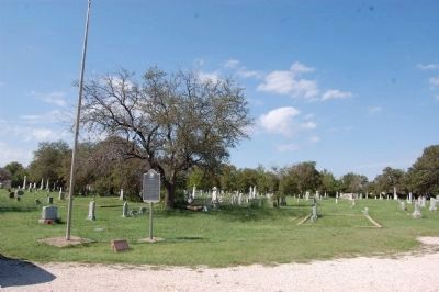
Near CR175 (Sam Bass Rd) 0.1 miles east of Clark St.
Established in the early 1850s in what is now known as Old Round Rock; this cemetery is the burial ground of many area pioneers and outstanding Round Rock citizens. The oldest legible tombstone, which marks the burial site of 11-year-old Angeline . . . — — Map (db m25174) HM
On U.S. 59 0.2 miles south of County Highway 1641-A, on the right when traveling north.
Alabama physician. Came to Texas, 1847. Served Cass County in Texas House and Senate for 24 years. Was called the Ablest Parliamentarian of his time.
Served as one of the Speakers of Texas House of Representatives in critical Civil War years, . . . — — Map (db m160772) HM
On West Front Street (State Highway 1) north of Main Street (State Highway 168), on the left when traveling north.
United Gas Public Service Company, discovered the Rodessa Oil Field one mile west of this historical marker on July 7, 1935. Rodessa was a “Boom Town” a few weeks later.
United’s L.L. Young No. 1, Lease 6875, Sec.21-23N-16W Rodessa Field Caddo . . . — — Map (db m128263) HM
Dr. Samuel H. Gilbert (1828-1890) came to Texas about 1850. He settled first in Cass County, and in 1852 married Julia Ann Ritchie (d. 1881). Gilbert purchased 275 acres of land at this site about 1855 and by 1857 had this native limestone house . . . — — Map (db m149539) HM
On North State Line Avenue at West 5th Street, on the right when traveling south on North State Line Avenue.
The United States doubled in size with the 1803 Louisiana Purchase from France under President Jefferson. The Purchase was based on an 1800 treaty land transfer from Spain to France. Jefferson determined that the SW boundary of the Louisiana . . . — — Map (db m308393) HM
On West Houston Street (State Highway 11) at Legion Street, on the right when traveling west on West Houston Street.
As part of the New Deal's efforts to offer unemployed workers jobs on public projects, President Franklin D. Roosevelt and the United States Congress created the Civilian Conservation Corps (CCC) in March 1933. Three months later, Company 1814 was . . . — — Map (db m266690) HM
On Farm to Market Road 2328 0.5 miles north of U.S. 59, on the left when traveling north.
Originally a family cemetery, this burial ground began upon the death of Henry G. Law (1813-1854), son of George and Martha McDonald Law, who died shortly after the family moved here from Georgia. The site eventually became a community cemetery . . . — — Map (db m160774) HM
On U.S. 59 at Farm to Market Road 2208, on the right when traveling north on U.S. 59.
Home to the Caddo Indians for centuries, this area of Texas attracted Anglo-American colonists to settle here in the early 1800s. Founded in 1839, Jefferson developed along a double-grid pattern. Daniel Nelson Alley platted the townsite in a true . . . — — Map (db m110954) HM
On West Front Street (State Highway 1) 0.2 miles north of Main Street (State Highway 168), on the right when traveling north.
Frog Level and Rodessa
A town meeting was called in the 1800’s by Noah Tyson Sr., store owner, police juror and post master, to name their town. The frogs were hollering in a nearby pond. A man from Alabama jumped up and said, “Let’s name . . . — — Map (db m128259) HM
On Riverside Drive east of Race Street, on the left when traveling west.
Logansport was founded in 1838, the same year the Dentzel name first became associated with carousel manufacturing in Germany. A circuitous series of events. eventually brought what is perhaps the most famous name in carousel carving to . . . — — Map (db m224663) HM
On Gulf Street at 11th Street West, on the right when traveling north on Gulf Street.
Side A
Lamar is distinguished as the birthplace of Harry S. Truman, the 33rd President of the United States. The son of John Anderson Truman and Martha Ellen (Young) Truman, he was born May 8, 1884. The family moved to Harrisonville in Cass . . . — — Map (db m42286) HM
Thin black lines indicate changes in relevance. Between each pair of lines entries are ordered geographically but all have the same relevance.
* Inflectional forms of words are their plurals, singulars, and possessives as well as gramatical tenses and similar variations.