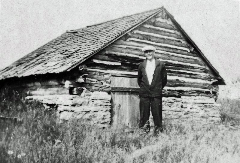
Near North Mechanic Street at West Day Spring Lane, on the left when traveling north.
Overview Many buildings on farms in Norway were designed to serve one purpose. This building was probably used to dry grain for brewing beer. While many Norwegians and Norwegian Americans brewed their own beer, others fought for temperance. . . . — — Map (db m236672) HM
On U.S. 8 at Linden Street, on the left when traveling east on U.S. 8.
"...All of them left home hoping for a better life: enough land to raise food for their children, a country where there were no rigid classes – America...seeking new homes, good land, in a wide, strange, frightening, rich, wonderful . . . — — Map (db m247745) HM
Near Nymphara Lane 0.2 miles east of East Seventh Street.
William Colvill was born in New York state on April 5, 1830. As a young lawyer he moved to Red Wing in 1854, becoming the town's first city attorney.
On April 19, 1861 — one week after the Confederates fired on Fort Sumter — a . . . — — Map (db m48890) HM
Near North Mill Street just north of West Water Street, on the right when traveling north.
Overview Nineteenth century Norwegian farmers grew food for their families instead of for income. Many farms in Norway used small water-powered mills to grind grain, press apples and process cloth. These mills were usually only big enough to . . . — — Map (db m236295) HM
On West Avenue 0.1 miles north of West 2nd Street, on the right when traveling north.
This bridge spans the time from
the 19th to the 21st century
This authentic 116 foot long covered bridge is the last in Minnesota. It was moved to this location in the city of Zumbrota on March 4, 1997.
The restoration and relocation of . . . — — Map (db m203008) HM
Minnesota has lost 99 percent of its native prairies and 92 percent of its old-growth forests. This 13-acre parcel seeks to recover part of that original landscape.
Susan Windgrow - Prairie Island resident. . . . — — Map (db m239615) HM
On 580th Avenue 0.5 miles north of County Highway 23, on the right when traveling north.
The first pioneers to settle in this area arrived by July, 1856, three months after their oxen-drawn prairie schooners left Rock County, Wisconsin. They were the families of Henrik H. Thoen, Ole H. Ness, Nels H. Colberg and bachelors Ole H. . . . — — Map (db m92468) HM
Near Old Allatoona Road Southeast 1.5 miles east of Interstate 75, on the left when traveling east.
(front)
In tribute to the officers and men of the Fourth Regiment Minnesota Volunteer Infantry, Lt. Col. John E. Tourtellotte, commanding. Who held their ground on October 5, 1864. 11 killed. 33 wounded.
(back)
4th Regiment . . . — — Map (db m277715) HM WM
On West Avenue 0.1 miles north of West 2nd Street, on the right when traveling north.
A vital river crossing for 63 years
1869
The new bridge was designed to be "high enough and strong enough", because spring floods had destroyed earlier river crossings.
1871
A roof and sidewalls were added to protect the . . . — — Map (db m203016) HM
On Cannon Bottom Road at the Cannon Valley Trail, on the right when traveling north on Cannon Bottom Road.
Military Roads
Thousands of immigrants and adventurers traveled to Minnesota Territory in the 1840s. They traveled by steamboat and humble wagon roads. Journeys could be difficult due to seasonal river conditions and the rough dirt trails. . . . — — Map (db m224746) HM
Near East State Street (State Highway 19 at milepost 192), 0.1 miles east of North Almond Street, on the right when traveling east.
William Colvill,
Col. 1st Regt. Minn. Vols.
Born April 5, 1830.
Died June 12, 1905.
In Memory Of
Colonel William Colvill and the 1st Reg. Minn. Vols. which he commanded at the Battle of Gettysburg on July . . . — — Map (db m46813) HM
On July 13, 1890 the steamer Sea Wing, heavily loaded with 215 passengers and crew, left the steamboat landing here for a Sunday excursion down the Mississippi River to Lake City.
The Sea Wing, based in Diamond Bluff, Wisconsin, . . . — — Map (db m49445) HM
Thin black lines indicate changes in relevance. Between each pair of lines entries are ordered geographically but all have the same relevance.
* Inflectional forms of words are their plurals, singulars, and possessives as well as gramatical tenses and similar variations.