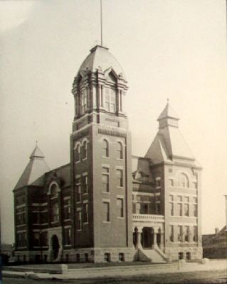
On Virginia Avenue south of 7th Street (Missouri Route 66), on the left when traveling south.
Jasper County, Missouri boasts two county courthouses -- one in Joplin and one in Carthage, the county seat. Actually, there could have been three county courthouses; Webb City also insisted upon having one. Bitter rivals in the 1890s, the three . . . — — Map (db m57767) HM
On Northwest Murphy Boulevard just south of East Pool Street, on the right when traveling north.
Osage Nation in the Joplin Region More than a thousand years ago, the Osage people migrated from the Ohio Valley up the Mississippi River and onto the tributaries of the Mississippi and Missouri rivers. They occupied this diverse landmass that . . . — — Map (db m230200) HM
Near Navasota Street north of East 7th Street, on the right when traveling north.
Born in Virginia, June 4, 1778. Died in Jasper County, March 2, 1850. A delegate to the Constitutional Convention of Missouri, 1821. Senator in Legislature of Missouri. Second in command in the Fredonian War in Texas, 1826. Member of the . . . — — Map (db m26205) HM
On Kafir Road west of Loop County Road 122 when traveling west.
In the log cabin of George Hornback the first sessions of the county court and the circuit court of Jasper County, Missouri were held February 25, 1841. — — Map (db m244868) HM
On J.H. Williamson Drive at Business Interstate 44, on the right when traveling north on J.H. Williamson Drive.
In 1933, Bonnie and Clyde travelled along Route 66 through Missouri while they were on the run. They used this route to move around, conceal themselves, and commit various crimes. The couple hid out in the Carthage/Joplin, MO area for 12 days . . . — — Map (db m311720) HM
On Northwest Murphy Boulevard south of East Pool Street, on the right when traveling north.
The initial settlers in the Joplin region were primarily farmers and trappers due to the plentiful resources the land offered. Abundant wildlife furnished a dependable food supply and from the heavily timbered hillsides, building material for . . . — — Map (db m230273) HM
On State Highway Z at Pea Vine Road (State Highway 103), on the right when traveling north on State Highway Z.
"Company 1710 was organized at Fort Leavenworth, Kansas, June 3, 1933...The company was made up of approximately 200 Missouri boys, 96 from three north Missouri counties (Putnam, Caldwell, Lynn) and the remainder from Jasper County.... On June . . . — — Map (db m36195) HM
On Esterly Drive 0.2 miles west of Missouri Route 96, on the right when traveling east.
The beautiful city of Carthage was laid out, 1842, as the seat of Jasper County, organized, 1841, and named for Sgt. William Jasper, Revolutionary hero. Centered in a county of great mineral wealth and good farm land, Carthage grew into a . . . — — Map (db m24311) HM
On Georgia Route 11 0.1 miles south of Plum Street, on the right when traveling south.
Late on Nov. 17, 1864, the 29th Missouri Mounted Infantry [US] seized the ferry at Planters’ Factory (Ocmulgee Mills) on the Ocmulgee River at Seven Islands (12 miles NW) to secure it for the crossing of the Right Wing of General Sherman’s army into . . . — — Map (db m24637) HM
On East 4th Street, on the left when traveling east.
In memory of Charles Pollard Wood, who died July 11, 1898 while training at Camp George H. Thomas, Chickamauga, Georgia. A Sergeant in Company A, 2nd Missiouri Infantry (Carthage). Only person to "lay in state" in the Jasper County Courthouse. . . . — — Map (db m52065) HM
On Keys Ferry Road at Winding Way (County Route 293), on the right when traveling east on Keys Ferry Road.
On Nov. 17th, the Right Wing of Gen. Sherman’s army [US] marched from McDonough to Jackson, enroute to Planters’ Factory on Ocmulgee River where it was to cross next day. To relieve congestion on the Jackson road, Smith’s division, 17th Corps with . . . — — Map (db m21327) HM
On Bull Street near Macon Street, on the right when traveling south.
Sergeant William Jasper, the famed Revolutionary hero, was mortally wounded a few hundred yards northwest of this spot on October 9, 1779, in the ill-fated attack of the American and French forces on the British defenses around Savannah. The . . . — — Map (db m5455) HM
On Georgia Route 16 at Buggy Road (County Route 170), on the right when traveling east on Georgia Route 16.
On Nov. 15, 1864, after destroying Atlanta and cutting his communications with the North, Maj. Gen. W. T. Sherman, USA, began his destructive campaign for Savannah -– the March to the Sea. He divided his army [US] into two wings. The Left Wing . . . — — Map (db m35435) HM
In Memory of the Soldiers of the
1st Regiment Kansas Colored Volunteers
who gave their lives in battle May 18, 1863 near Sherwood, Missouri
Henry Aggleson Pvt Co F •
Greene Allen Pvt Co H •
John Booth Pvt Co H •
Edward Cockerell Pvt . . . — — Map (db m116815) WM
On County Loop 122 0.1 miles south of Kafir Road, on the left when traveling south.
In 1838, Lemuel McIntire (1820-1909)
built a small one room cabin of hand-hewn split logs with the flat side out on a
high bluff overlooking the Spring River
in Jasper Village west of the city of
Carthage, Missouri. McIntire left the
cabin in . . . — — Map (db m251648) HM
Thin black lines indicate changes in relevance. Between each pair of lines entries are ordered geographically but all have the same relevance.
* Inflectional forms of words are their plurals, singulars, and possessives as well as gramatical tenses and similar variations.