On West 4th Avenue east of South Oak Street, on the right when traveling east.
Boone-Murphy House
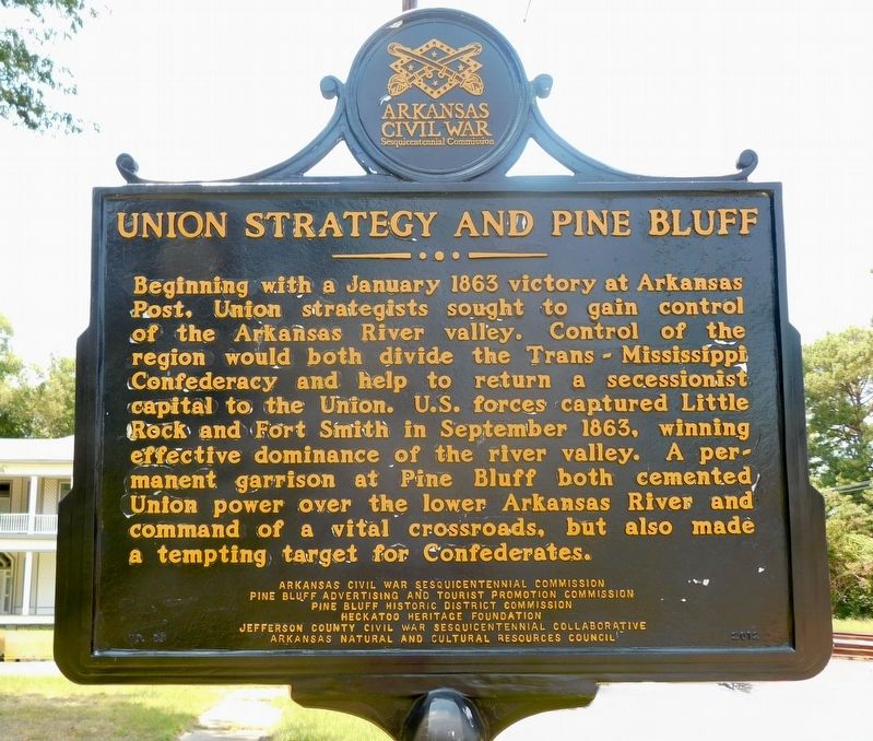
Following the Union capture of Little Rock on Sept. 10, 1863, citizens of Pine Bluff asked that a Union garrison be stationed there for their protection. Gen. Frederick Steele sent the veteran 5th Kansas Cavalry and 1st . . . — — Map (db m170444) HM
On West Barraque Street at North Chestnut Street, on the right when traveling west on West Barraque Street.
In 1818 a French trapper, Joseph Bonne landed on the south bank of the Arkansas River with his dog and gun near the location of the original Jefferson County Courthouse. Driven to this high bluff after flood waters had threatened his homesite at . . . — — Map (db m30576) HM
On South Drew Street at West Bradley Street, on the right when traveling south on South Drew Street.
Star City was laid off in 1871 as the County Seat of the newly created Lincoln County which was named in honor of President Abraham Lincoln. It was the center of many Indian trails and early roads which ran from Mississippi River landings back into . . . — — Map (db m229496) HM
On Sardis Road (County Road 61) at Puddin Drive, on the right when traveling west on Sardis Road.
Conway County in the Civil War
Conway County men served in both the Union and Confederate armies in the Civil War. Co. I, 1st Arkansas Mounted Rifles, Co. B, Carroll’s Cavalry, Co. I, 36th Arkansas Infantry, and several companies of the 10th . . . — — Map (db m96451) HM
On Lake Saracen Drive 0.1 miles west of Regional Park Drive, on the right when traveling west.
On November 15, 1824, not far from here, near what is now the Lincoln/Jefferson County line, Quapaw leaders, including Chief Heckaton and Saracen, signed a treaty ceding the Quapaw Nation’s remaining land in the Arkansas Territory to the United . . . — — Map (db m313154) HM
In 1912, Secretary of State Earle Hodges (1911-1917) and the Pine Bluff chapter of the Daughters of the American Revolution sponsored a competition to produce a design for Arkansas’s first state flag. Since 1819, Arkansans had lived, fought, played . . . — — Map (db m168987) HM
On West Barraque Street just east of North Main Street, on the right when traveling west.
The first court house in Jefferson County created in 1829 and named for President Thomas Jefferson was erected on this site at (Pine Bluff) in 1833. Meanwhile, sessions of the county court had been held first at the house of Joseph Bonne and second . . . — — Map (db m30580) HM
On North Main Street (U.S. 63/79) near Garnett Road, on the right when traveling south.
Miss Willie Kavanaugh Hocker of Wabbaseka
was the designer of the Arkansas state flag. Miss
Hocker, a member of the Pine Bluff Chapter of
the Daughters of the American Revolution, submitted
her flag design to the Arkansas General
Assembly in . . . — — Map (db m167532) HM
On South Main Street at South Olive Street (Business U.S. 63), on the right when traveling north on South Main Street.
Beginning 10 miles northwest of Pine Bluff, this storied bayou flows 300 miles through 6 Arkansas counties and 2 Louisiana parishes before emptying into the Ouachita River in north Louisiana. Indian mounds dotted its banks. Immigrants travelled it . . . — — Map (db m30581) HM
On U.S. 63/79 0.1 miles north of Myrtle Street, on the right when traveling north.
The Arkansas Flag/Wabbaseka Memorial was founded by Jason Irby in 2013. Jason is an author and humanitarian who grew up in Wabbaseka and attended the public schools around the city. Jason attended Willie K. Hocker Elementary/Jr. High schools, . . . — — Map (db m169051) HM
On East Briggs Avenue just west of North Court Street, on the right when traveling west.
[south side] Major Mehitable Woods Pioneer Jefferson Co. & Civil War hero [west side] De Oppresso Liber [north side] 224th Engineers — That They May Fight 34th Infantry Division . . . — — Map (db m286893) HM
On North Broadway at West 3rd Street, on the right when traveling north on North Broadway.
Architects Shryock
"Best known surname in Kentucky architecture is Shryock." Family home, erected by Matthias Shryock (1774-1833), here. Designed first Episcopal church in city, 1814, and Mary Todd Lincoln home on W. Main. Son, . . . — — Map (db m136935) HM
On Turkey Creek Road at Raymond Stotzer Frontage, on the left when traveling north on Turkey Creek Road.
The Brazos Valley was first settled and formed by people from all over America and other foreign lands. The earliest Anglo settlers arrived in this Mexican province from nearby southern states, lured by large Mexican land grants. After the Texas . . . — — Map (db m283311) HM
On 7th Avenue North west of 24th Street North, on the right when traveling west.
National Register of Historic Places
In many ways, the 1954 Brown v. Board of Education decision fueled the modern Civil Rights Movement. The NAACP's legal team strategically chipped away at the “separate but equal" doctrine to end . . . — — Map (db m188205) HM
Thin black lines indicate changes in relevance. Between each pair of lines entries are ordered geographically but all have the same relevance.
* Inflectional forms of words are their plurals, singulars, and possessives as well as gramatical tenses and similar variations.