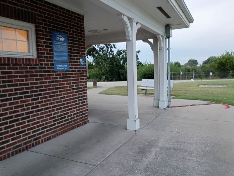
On Dwight D. Eisenhower Highway (Interstate 70) at Missouri Route 23, on the right when traveling west on Dwight D. Eisenhower Highway.
Extended employment sheltered workshop programs in America began in the state of Missouri, in the city of Sedalia in 1965, when a parent campaigned for a vocational program to better the life of his disabled child; who was finished with school . . . — — Map (db m314897) HM
At the onset of the Civil War Missouri was of particular importance as the westernmost border state, gateway to the western territories and bordered by the Mississippi River. Militarily the situation was grave. On Aug. 10, 1861 Union forces suffered . . . — — Map (db m46115) HM
Near Sand Hollow Road near Lytle Boulevard, on the right when traveling north.
John D. Henderson was the third child of twelve born to Perman D. and Sarah (Trapp) Henderson, both originally of Tennessee. John was born December 30, 1828, in what is now part of downtown Kansas City, then farmland, where his parents had . . . — — Map (db m107039) HM
On 1st Street 0.4 miles north of Business Missouri Route 13, in the median. Reported permanently removed.
Cottage Row
Among the first buildings to be constructed at the Confederate Home of Missouri were small frame houses making up Cottage Row. These three room cottages were located along both sides of the road and served as independent living for . . . — — Map (db m278559) HM
On College Street north of Main Street (State Highway 10), on the right when traveling north.
[Side A]
Richmond was founded, 1827, as the seat of Ray County on land donated by John Wollard, W.B. Martin, and Isaac and William Thornton. The county, organized 1820, had its first seat at Bluffton, where Camden, an early Missouri . . . — — Map (db m157138) HM
On West 70th Street 0.4 miles west of Shiloh Avenue, on the right when traveling west.
Susan C. Haile was born December 20, 1817, in Cape Girardeau, Missouri. She was the youngest child of Joseph and Prudence (Bledsoe) Seawell, natives of Sumner County, Tennessee. Upon the death of Joseph in 1819, Prudence Seawell returned to Sumner . . . — — Map (db m123807) HM
On Delaware Street at 4th Street (U.S. 73), on the right when traveling east on Delaware Street.
Land for the building was purchased from the U.S. Government in 1857 by William H. Russell of Lafayette County, Missouri. The building was built in 1878 by James A. McGonigle for Francis Fitzwilliam. It was financed through the German Bank of . . . — — Map (db m46717) HM
In March 1872 Harvey Higgins deeded this two block strip of land to the Lexington and St. Louis Railroad stipulating that a depot be built here. The railroad was the first in the county and its depot was the nucleus of Higginsville. In 1880 the . . . — — Map (db m140277) HM
On Main Street at West Commercial Street, on the left when traveling north on Main Street.
Waverly, noted for fine apples & rich farmlands was settled in 1818, chartered in 1850 with William Smith Thomas as Mayor. In 1804 Lewis & Clark Expedition made oars near Port of Waverly which served Missouri River steamboats and now barge lines for . . . — — Map (db m90359) HM
Near Wood Street 0.1 miles north of 13th Street and Wood Street.
This area saw action between the Missouri Home Guard units and the Missouri State Guard. The Home Guard were composed of pro-Union German immigrants from Lafayette county. They were commanded by Maj. F.W. Becker. Sharpshooters kept many of the . . . — — Map (db m46167) HM
On 44 Road north of West 70th Street, on the right.
To overland emigrants the rigors of the trail
began with the "Coast of Nebraska," the ridge of sandhills separating the Platte Valley from the open
prairie behind it. Thousands of emigrants passed
this way during the peak emigration years of . . . — — Map (db m257803) HM
On East Main (County Road 9) just west of Snell Street, on the right when traveling west.
1541 - When Desoto brought his Spanish conquistadores to this area in 1541, he found an industrious Caddo Indian tribe who inhabited and enjoyed the area that was later to become Miller County, Arkansas. Along the Red River the Caddo farmed, . . . — — Map (db m173500) HM
Thin black lines indicate changes in relevance. Between each pair of lines entries are ordered geographically but all have the same relevance.
* Inflectional forms of words are their plurals, singulars, and possessives as well as gramatical tenses and similar variations.