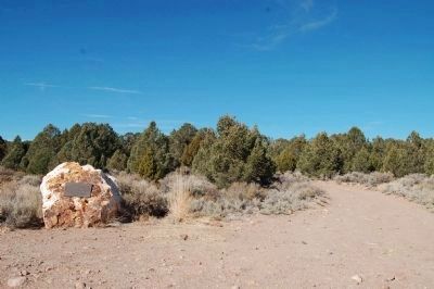
Aurora, founded in 1860, was claimed by both California and Nevada. In 1861, the California legislature created Mono County and fixed the county seat here. In 1863 a border survey showed the camp was in Nevada and the Mono County seat was moved to . . . — — Map (db m49891) HM
On Bypass Road 0.2 miles California Route 270, on the right when traveling west.
Gold was discovered here in 1859 by W.S. Bodey after whom the town was named. Once the most thriving metropolis of the Mono Country, Bodie’s mines produced gold valued at more than 100 million dollars. Tough as nails, the “Bad Man from Bodie” still . . . — — Map (db m8437) HM
[Main Marker]:
Site of the first major gold rush to California’s eastern slope of the Sierra Nevada, Dog Town derived its name from a popular miners’ term for camps with huts or hovels. Ruins, lying close to the cliff bordering Dog Town . . . — — Map (db m11586) HM
On Crowley Lake Drive at Hilton Creek Trail, on the left when traveling north on Crowley Lake Drive.
West of here, near the summit of McGee Mountain, the Hilton Creek tungsten mines (Nicoll Hilton Creek Mine, Phelps Hilton Creek Mine, and Filipelli Prospect) were discovered in June 1940 by Cecil Thorington, Morris Harlan, and Raymond W. Phelps. . . . — — Map (db m314418) HM
On Three Flags Highway (U.S. 395), on the right when traveling south.
On January 27th, a cold winter day in 1844, Captain John C. Fremont and his guide Kit Carson led a small band of half-starved men west past this point. They were in search of the fabled Buena Ventura River, which they believed would give them easy . . . — — Map (db m49887) HM
On Topaz Lane 1.4 miles east of Three Flags Highway (California Highway 395).
Near this location, records show establishment of a post office at Topaz, Mono County, California, February 20, 1885. Discontinued in 1922, it was re-established in June, 1926. Nearby could also be found a school, way-station, blacksmith shop, and . . . — — Map (db m50086) HM
Near Bryant Street at School Street, on the right when traveling west.
Since the formation of Mono County in 1861, six facilities have served as the county jail. This stone building was placed into service by Sheriff C.F. McKinney, Dec. 5, 1883, and became the 5th Mono County Jail. It replaced the wooden jail facility . . . — — Map (db m10364) HM
These plaques featuring little known and forgotten facts about Mono Lake. Dedicated September 13, 2013, E Clampus Vitus Bodie Chapter No. 64.
Mono Lake - Land of Many Uses
Except for fishing, this "inland sea" has been a lake of many . . . — — Map (db m72569) HM
On U.S. 395 north of Church Street, on the left when traveling north.
The members of the Minden Town Board selected this site, on the Minden-Gardnerville boundary and adjacent to the telephone company offices, as a particularly appropriate location for what they have named "Sunset Park".
In the early 1900's, . . . — — Map (db m55510) HM
On Court Street 0.1 miles California Route 182, on the right when traveling west.
Located near this site was the first courthouse in the town of Bridgeport. Previously, the county courthouse was in Aurora (the county seat established in 1861) However, a state boundary survey completed in 1863 determined that town was actually in . . . — — Map (db m8545) HM
Founded in 1860 by A. Horteshorne, Coleville played a major roll in the development of Mono County. It was once known as Centerville, Double Town (due to the high prices charged for supplies) and Amonia. It was finally named as Coleville after . . . — — Map (db m11342) HM
On Airport Road 0.7 miles north of East Line Street.
Mining has played a vital role in the local economies of
the Eastern Sierra beginning in the 1860s. Historically
significant mines include:
The Mine in the Sky
Twenty miles west of here lies the Pine Creek Tungsten . . . — — Map (db m288225) HM
On South Tufa Entrance Road just north of State Road 120, on the right when traveling north.
During the Cold War, Mono County was home to one of many remote facilities used by the US Military to test new weapons and weapons systems. A "secret military installation" operated by the US Navy was located along the south shoreline of Mono . . . — — Map (db m20739) HM
On National Forest Development Road 26 0.5 miles National Forest Development Road 28, on the left.
Formerly known as Six Mile Station, this stage stop and way station provided service between some of the smaller mining camps and Aurora and Bodie, CA during the late 1860's. The area became of greater importance with the arrival of the Carson . . . — — Map (db m37630) HM
On Lundy Lake Road 7 miles west of U.S. 395, on the right when traveling west.
Home of the May Lundy Mine. Site of W. J. Lundy sawmill supplying lumber to Bodie in 1878. Organized as the Homer Mining District in 1879 by Wasson, Nye and Homer. Plagued by snowslides and partially destroyed by fire in 1886, Lundy's page of Mono . . . — — Map (db m37583) HM
Thin black lines indicate changes in relevance. Between each pair of lines entries are ordered geographically but all have the same relevance.
* Inflectional forms of words are their plurals, singulars, and possessives as well as gramatical tenses and similar variations.