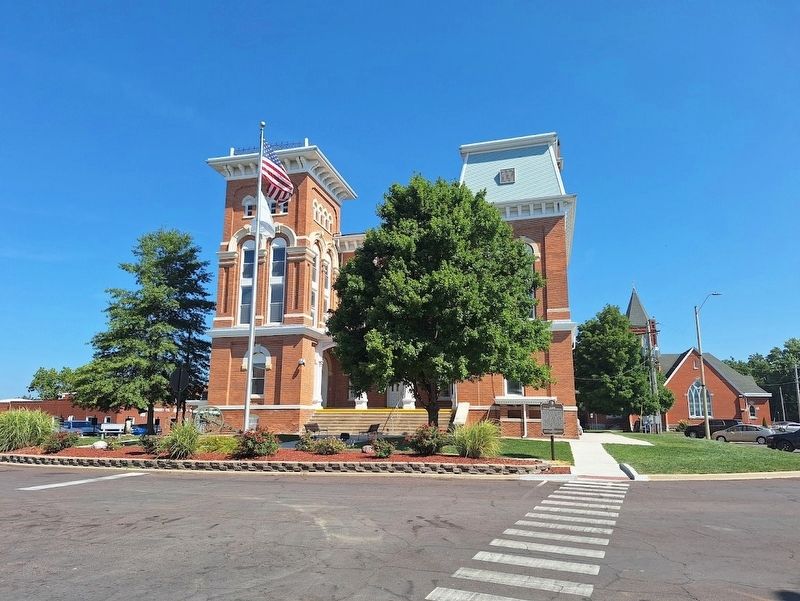
On South Main Street at West Seward Street, on the right when traveling north on South Main Street.
Hillsboro was founded in 1823. Abundant natural resources shaped its economic landscape, such as the eight-foot vein of coal underlying the town. Coal from Hillsboro and nearby Taylor Springs and Kortkamp was primarily used locally rather than . . . — — Map (db m281209) HM
On North Applegate Street (U.S. 51) north of Summit Street, on the right when traveling north.
On June 9, 1963, at this location, the site of
Staley's Café, six civil rights activists were
arrested on their return from a voter education
workshop. The activists were taken to the
Montgomery County Jail at the corner of Oak
Drive and . . . — — Map (db m314956) HM
A) Grand Gulf, Mississippi
Mile 407.0 AHP
A bluff jutting into the river at the old mouth of the Big Black River created perilous whirlpools that made Grand Gulf notorious among early flatboatmen. The town of Grand Gulf was established . . . — — Map (db m115164) HM
On Summit Street at Fairground Street, on the left when traveling east on Summit Street.
Established in 1873 as a mission of All Saints Parish of Grenada, Mississippi. The first sanctuary was built in 1875 and the church was formally organized the following year with Reverend V.N. Shields serving as rector. In 1909 this Gothic Revival . . . — — Map (db m219770) HM
On East McElroy Road 0.3 miles State Highway 18, on the left when traveling west.
Here between the landmark known as Round Mountains to the south and a camp on Salt Creek three miles to the northwest was fought the first battle of the Civil War in Oklahoma.
When the five civilized tribes of the Indian Territory joined the . . . — — Map (db m209523) HM
On North Hull Street at East Jefferson Street, on the right when traveling north on North Hull Street.
Located on the Federal Road near Line Creek (present Waugh) in eastern Montgomery County, this wayside hotel was built prior to 1818 and was owned by a least two other families before coming into the possession of Walter and Eliza Lucas around . . . — — Map (db m98557) HM
On Missouri Route 87 west of U.S. 40, on the right when traveling north.
Beyond the Mississippi
The Boone's Lick Road was the first to bring settlers deep into the heart of the great Louisiana Purchase from early settlements west of the Mississippi River. It bore the nation's constant westward push, extending by . . . — — Map (db m247698) HM
On Alumni Mall (Business U.S. 460) west of North Main Street, on the right when traveling west.
People and Place – Virginia Tech's Blacksburg campus is situated on land long the domain of Monacan-Tutelo peoples. The university's other sites across Virginia, like schools everywhere in the US, are also on land once held by Native nations.
. . . — — Map (db m228128) HM
On Kentucky Route 191 0.8 miles east of Route 203, on the left when traveling east.
Traditionally, healing properties
of mineral water of a spring here
discovered by owner when treating
her pet dog for mange. Its use by
humans spread and by 1895 three
hotels and many boarding houses
were hosts to people from all . . . — — Map (db m146572) HM
Near Jesup Blair Drive east of Georgia Avenue (U.S. 29), on the right when traveling east.
6 August 1863: “Our weather continues intensely hot, so far Blair endures it well — cheerful as a bird — out under the trees all day about the Spring where it is cool from the dense shade & the cool waters, he makes mill dams, mud cakes & runs . . . — — Map (db m82236) HM
Front
Roebuck “Pops” Staples, one of the foremost figures in American gospel music as a singer, guitarist, and patriarch of the Staple Singers family group, was born on a farm near Winona on December 28, 1914. Staples began playing . . . — — Map (db m90019) HM
On Sam Houston Avenue (State Highway 75) north of 12th Street, on the right when traveling north.
Formed from Montgomery County
Created April 6, 1846 --- Organized July 13, 1846
Named in honor of
Robert James Walker, 1801-1869
a distinguished citizen of
Mississippi and advocate of the
annexation of Texas
Renamed Walker County . . . — — Map (db m111861) HM
On West Vandalia Street (Illinois Route 157) at St. Louis Street, on the right when traveling west on West Vandalia Street.
Early Political Career
Born in 1775 in Montgomery County, Maryland, Ninian Edwards moved to Kentucky in 1794 and was elected to the Kentucky legislature in 1795. He was appointed to serve as Chief Justice in the Kentucky Court of Appeals . . . — — Map (db m263411) HM
On Brookeville Road 0.2 miles east of Grayheaven Manor Road, on the right when traveling east.
With the shackles of slavery removed following the end of the Civil War, freed blacks in Montgomery County made strides to achieve successful lives for their families. During Reconstruction (1865 - 1877), African Americans established churches, . . . — — Map (db m305918) HM
On Main Street at Front Street, on the right when traveling north on Main Street.
Choctaw County’s blues history is distinguished by the accomplishments of two artists in particular, both of them singers, songwriters, and guitarists; Levester “Big Lucky” Carter, who was born in Weir and raised on his family’s farm in French Camp, . . . — — Map (db m205436) HM
Old Auxvasse Presbyterian is one of the oldest congregations west of the Mississippi. But this hill on which the congregation first met in 1828 in a log church earlier hosted travelers along the Trial, some of whom likely were buried here before . . . — — Map (db m216974) HM
"But never, never, 10,000 times never, do we find as white Southerners, any guilt complex concerning our belief in and the practice of separation of the races because it is the edict of God in the Holy Bible."
Dr. Henry L. Lyon, . . . — — Map (db m304143) HM
(West face)
[Confederate States of America Emblem]
Dedicated to the glory and
honor of the Montgomery
County soldiers of the
Confederate States of America
for their unparalleled courage
and gallantry in defense of their
homeland and . . . — — Map (db m22220) WM
On Avenue of the Republic at Lansdowne Drive, on the right when traveling west on Avenue of the Republic.
The South Arch
This memorial honors Pennsylvania's military heroes of the Civil War (1861-1865). A pair of arches topped by tall pillars, the project involved 12 noted sculptors over a 15-year period. It is considered one of most ambitious . . . — — Map (db m191697) HM
Thin black lines indicate changes in relevance. Between each pair of lines entries are ordered geographically but all have the same relevance.
* Inflectional forms of words are their plurals, singulars, and possessives as well as gramatical tenses and similar variations.