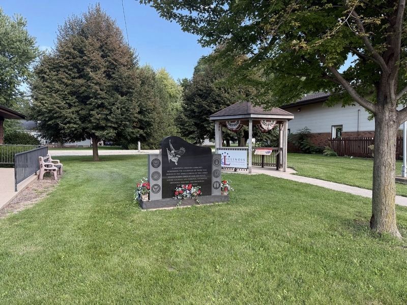
On South Wesley Avenue at East Front Street, on the right when traveling south on South Wesley Avenue.
Rock River Seminary, the first institution of higher education in Northern Illinois, was established by the Methodist Church in 1839. Because of financial difficulties it was forced to close in 1879. The Church of the Brethren then purchased the . . . — — Map (db m308295) HM
On North Franklin Avenue at West Locust Street, on the left when traveling north on North Franklin Avenue.
Abraham Lincoln was a guest in this house, August 15-17, 1856. His host was Zenas Aplington, founder of Polo. On Saturday, August 16, John D. Campbell and James W. Carpenter, who were law partners in Polo, joined Lincoln and Aplington in a drive by . . . — — Map (db m55803) HM
On Chambers Road (U.S. 52) 0.2 miles south of Willow Road, on the left when traveling north.
The Stone Arch Bridge that stands to the east of the present highway was on the Galena Road, once the most important trail in northern Illinois. Along this route innumerable people streamed northward to the lead mines near Galena every spring and . . . — — Map (db m55806) HM
On Illinois Route 2 0.2 miles south of East Camling Road, on the right when traveling north. Reported permanently removed.
In the 1830's and 1840's an organized criminal gang known as the Banditti of the Prairie was active on the Midwestern frontier. In 1841 six members were arrested and held for trial in Oregon, Illinois. On March 21, the day before the trial, the . . . — — Map (db m308296) HM
On West Washington Street (Illinois Route 64) just east of South 5th Street, on the left when traveling west.
The Lincoln Highway is an example of the 1900s American cultural awakening. The end of the Victorian era brought progress and independence as people set out in their automobiles to venture across the country. The vision of the first . . . — — Map (db m209416) HM
Near River Road 2 miles north of Washington Street ( Route 56).
This log cabin, which dates back to the 1830's, originally stood on the Glenn Borneman farm west of Leaf River. It was initially a one-room lofted structure with hand-hewn logs that were notched at the ends for joining at the corners. The timbers . . . — — Map (db m257917) HM
On Illinois Route 2 at Ridge Road, on the right when traveling north on Illinois Route 2.
Erected to the memory of Leonard Andrus founder of the village of Grand Detour Illinois 1835. Adjudicator of land claims, ferry operator, carrier of mail and travelers, first commissioner of schools in Ogle County, manufacturer, vestryman, . . . — — Map (db m131733) HM
Near North River Road 1.7 miles north of Washington Street ( Route 56), on the left when traveling north.
Governor of Illinois 1917-1921
President, the Holstein-Friesian Association of America 1921-1930
Sensitive to the best in men and animals, devoted to the refinement, productivity and integrity of both, conscious of the contribution of the . . . — — Map (db m257929) HM
On West Eagle Point Road 0.3 miles east of Brookville Road, on the left when traveling east.
In the pioneer village of Eagle Point, named because of an eagle's nest on a point of timber near here, Naaman Spencer, inventor of the gang plow, started manufacturing it here, 1868. Spencer, also was the first to use a steam engine, a Gates, . . . — — Map (db m131732) HM
Near State Street (Illinois Route 64) west of Main Street ( Route 23), on the right.
To the men from DeKalb County who died in Vietnam during the Vietnam Conflict
Francis A. Anderson • Dale C. Brewer • Eatterson Byrd, Jr. • David Donnelly • Rodney G. Drake • Jimmy R. Harrison • Richard A. Henke • Richard L. Jossendal • George . . . — — Map (db m257965) WM
Thin black lines indicate changes in relevance. Between each pair of lines entries are ordered geographically but all have the same relevance.
* Inflectional forms of words are their plurals, singulars, and possessives as well as gramatical tenses and similar variations.